Mountains
If day two was my longest day in the saddle, day three was scheduled to be the toughest: Mountain Day! It also happened to be my birthday. What a sucker for punishment.
Over an excellent breakfast I wrote up my diary for the previous day and read through some nice birthday greetings that were waiting for me on text messages and Facebook. I walked into the town to get some supplies from the local Spar and then back to the Horseshoe ready to depart. What is it with Wales and Spar shops? Certainly in the South East corner of England where I live I can’t remember the last time I saw a Spar shop; Happy Shopper, One Stop, Co-op etc yes but not a Spar. Here in Wales there seems to be nothing else.

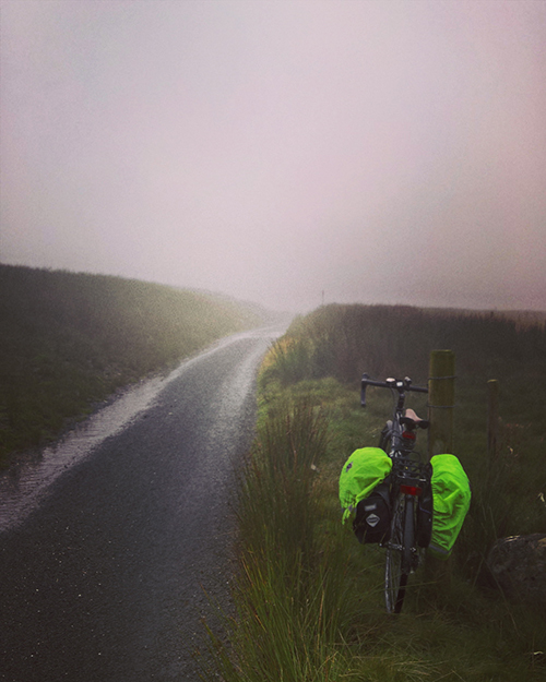
Right on cue the rain started. It didn’t look like it was going to be too short a shower and I didn’t want to hang around so I dug out the wet weather gear and pulled out of town up the hill for the first leg of the journey along some gorgeous lanes above the upper Wye Valley.

The rain came and went but the clouds never left. Things were good though and I was happy in my riding. I got held up for a bit by a farmer leading a lame bull along the track. I had a bit of a chat and he eventually got me to a place where I could go past and onwards; though before long I came across the rest of the herd of cows headed back in the other direction.


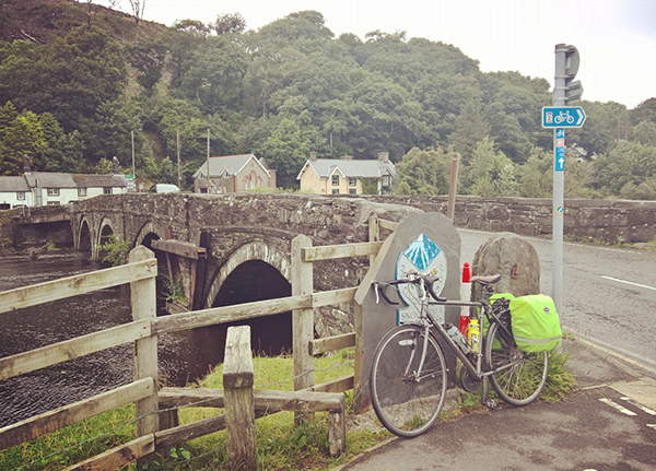
After a short stop to get water at the village shop in Llangurig I readied myself for what on the maps looked to be a tough climb towards Llanidloes. This fairly short stretch marks the swap from the Wye to the Severn valley and I had heard that the ride up to the watershed could be tough going but it was actually fine and I was soon by the, at this point in its journey, small Upper Severn river. As well as crossing into the next valley, the junction where the route turns to follow the Severn also marks the join between the Sustrans North and South maps – so surely this must be half way!?
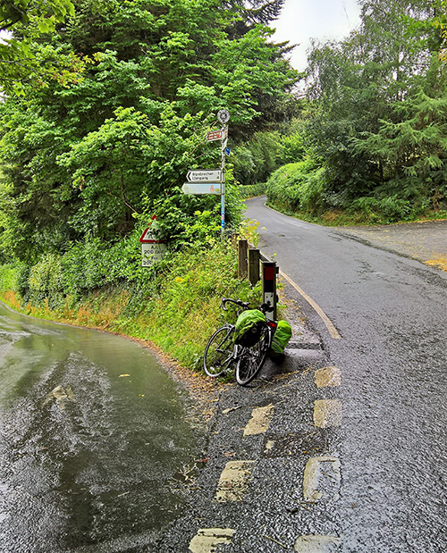
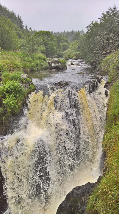
The next few miles was a fairly long slog in some strong drizzle climbing ever up alongside the river. The weather was poor but I was enjoying the ride. I took a break to look at the ‘Severn Break-Its-Neck’ waterfall and then stopped again at a picnic stop in the Hafren forest near the top of that particular climb. A wet lunch chatting to some visiting Americans (an older couple having a whale of a time and their children who were most definitely unimpressed with the weather) was refreshing and soon I was gliding back down towards the hamlet of Staylittle.
With the Machynlleth mountain pass next up I used the opportunity to dive into the village post office to top up the water levels. They also had a coffee machine and chocolate. Which was nice. The shop keeper was very friendly so chatted with him for a bit (I don’t imagine that he gets kept very busy).
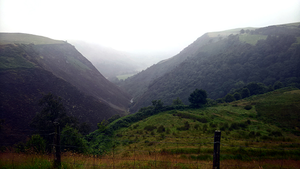
The climb up on the pass was fairly tough but steady. I stopped for a breather a couple of times but made good progress. I would like to claim that the stops were to admire the views but almost as soon as I turned onto the pass road I was in the clouds. I imagine the views are breath taking. I however have no way of confirming this.
After a quick celebratory stop at the summit came the descent. I would have loved to have just let myself go but I don’t know the road and the visibility was poor. Not fancying coming off or into an oncoming truck I rode down fairly heavy on the brakes. Even so there were a couple of hairy moments on corners before the road levelled out on the more sedate drop for the final five miles into Machynlleth.
Another brief fuel stop (and a check on the state of my brakes) went quickly and soon I was over the lovely Millennium Bridge crossing the Dovey. Being on the North bank of the Dovey signals that you are now entering Snowdonia National Park. Naturally, so started the toughest climb of the tour.
The first few miles is one of those sections which looks easy enough on the profile in the Sustrans maps. They show only the average though. Not all the short sharp ups and downs that make the ride like going along sharks teeth. From Corris the road is more even for a couple of miles into the old slate mining village of Aberlefenni where the climb proper begins.
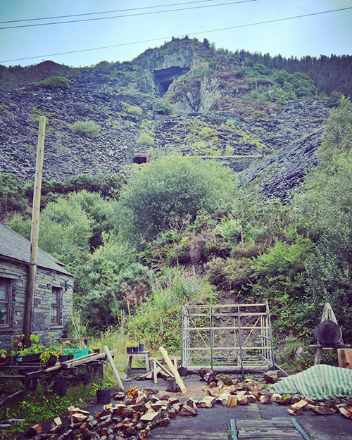
The hills here are riddled with holes into the slate mines that must be fun to explore. An OS map printed on a board in the village shows a number of attractive looking walks here. It would be a grand place to stop for a day to explore if you have the time. The Sustrans map does not really show where the summit of the climb is so i used the OS map to get an idea. It didn’t show the whole road up but i did get the impression that the top would be by the end of a treeline marked towards the edge of the map.
At the end of the village a 90 degree turn indicates the start of the climb. The first few hundred yards weren’t too bad along a slate fence lined section but i could see what was coming. The main climb was hard. It’s a relentless slog. I had to stop for a few breathers and walked a couple of the toughest sections.
Eventually i saw the tree line that would mark the summit. Exhausted I pushed on delighted to be almost there. I would like to think my swearing upon reaching the tree line only to see the hill continuing up even steeper than before as far as I could see into the clouds could be heard back in Machynlleth. The reality is much more likely that with exhausted lungs there was no audible noise at all.


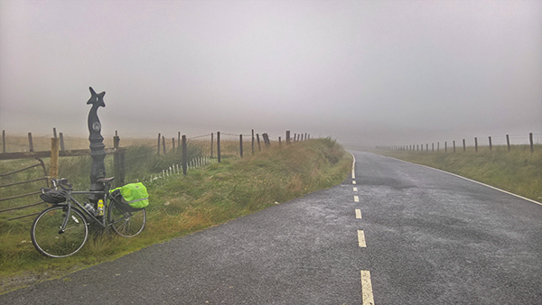
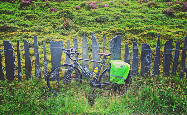
On the open hill out of the trees the cloud was thick and wet. The road had become a rough track; still tarmac but badly worn. Sheep came out of the clouds to stand on the road and mock like some nightmare Welsh version of a Tour de France mountain crowd. Fortunately though, however awful this was and however close to broken the false summit had left me, it was less than a mile to the actual, real, genuine summit.
Still encased firmly in thick clouds. Sweaty; legs burning; head down i barely paused to celebrate. The ride down to start was even not bringing much cheer at first. I could still not enjoy the view; the track was rough with loose gravel, and the sheep were still insistent on standing in the way of my progress.
After crossing the A487 the route is back into a mix of dedicated cycle paths and country lanes. Back down out of the clouds and with easier going I started to get my cheer back just in time to drop down into the centre of Dolgellau. I stopped on another town centre bench for food and rest before the final, flat, ten miles into Barmouth.

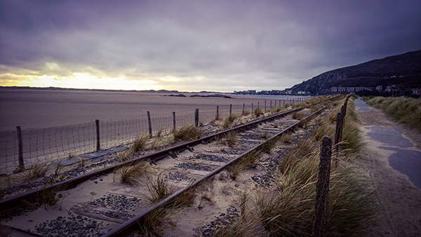
There is quite a marked difference in the ten miles either side of Dolgellau. From rough mountain tracks the next section is on an old rail bed. A moderate headwind wasn’t enough to make the Mawddach trail feel anything but glorious. From the old station and picture post card bridge at Penmaenpool the route follows the south side of the wide open valley with lots of remains of the old train line to entertain a certain type of geek (i.e. Me).

Tired and into the wind this was slow going for such an easy trail but I was happy again and getting ready for food and a beer.
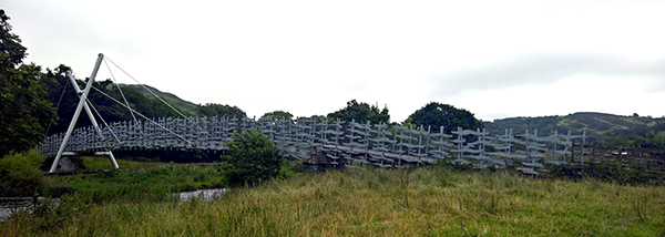
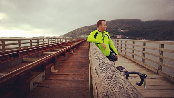
Stopping for a celebratory selfie I crossed the famous Barmouth Bridge and soon found myself parking up at the Tal Y Don Hotel. An immediate shower and pint later I was freshened up and waiting in the bar for the arrival of a couple of friends.
Rick and Tam happened to be vaguely in the area on a long camping weekend and insisted, rather marvellously, on driving out to take me for a birthday meal and drink. Apart from one incident where Rick instead on squeezing my thigh to see how tight my legs were (beyond very, apparently, as my scream indicated) it was a fantastic end to a long and tough but ultimately satisfying day. Rick. Tam. Cheers x
Day Three Stats:
- Distance: 63.2 Miles
- Ride Time: 6 Hours, 37 minutes and 47 seconds
- Maximum Speed: 39.4 mph
- Average Speed: 9.5 mph
- Ascent: 5,396 feet
- Strava: https://www.strava.com/activities/656646070