In the summer of 2021 we made a rather big change to our lives and left the South Coast for Teesdale in County Durham. Since moving here I’ve made a few explorations up some of the bigger cycling hill climbs that I have ever done. I’ll write about some of those trips later, but with a day off work on Friday 13th August 2021, and some reasonable weather (though quite a breeze blowing over the hills) I decided to try my hand at the biggest cycle climb that England has to offer.
I started by loading the car onto the roof bars and driving the short distance to the Tan Hill Inn; the highest pub in England, which I had chosen a start and finish point for the day’s ride (hopefully there would be time for a quick drink at the end of the ride).
The last few miles driving across the hill tops to the pub had got very windy to the point to my being a little concerned about the bike on the roof. Fortunately, I made it in one piece but was happy to get the bike down to ground level as quickly as possible.
Ready to ride but wary of heading into the wind I climbed onto the saddle and headed west. It was quite tough going but not too awful. The first few miles were glorious weaving up and down across the top of the Pennines. The open hills are lovely and there are some fantastic views from the top of the hills to the west across the Eden Valley and over to the Lakes.

Before too long though the road started to descend as I came to the edge of the hills and dropped down towards Kaber and Winton and onto the relative flat lying Eden valley. It was fairly easy going riding into Warcop where I had a quick stop to stretch out my legs before heading back towards the edge of the North Pennines.
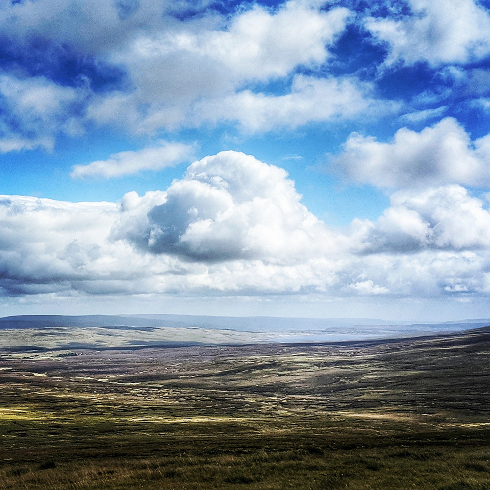
First I had to cross the A66, which involved riding along it for about a mile. Not a pleasant experience but I was soon turning off and onto a quiet road heading next to the army ranges. The road was peaceful and empty as it followed the edge of the ranges and followed the base of the hills. Normally I might enjoy powering through the ups and downs but today I was saving myself for something bigger so took it nice and steady, stopping off on the way at the cafe in Dufton for fortifying coffee and cake.

Refreshed and energised I had a short distance left on the road to get myself back into a rhythm before turning right onto a smaller lane just through the village of Knock.

And now the fun starts.
I was now at the start of the climb up to Great Dun Fell. The track is a well paved service road to the national air traffic radar station at the top and whilst closed to the public in cars, is open for walkers and cyclists. Reaching the summit at 2,740 feet, this is the highest paved road in the UK and one of the toughest and most notorious climbs in the country.
I’d been getting used to some of the climbs that the North Pennines have to offer; long and steady hills on wide open, windswept roads. Great Dun Fell is a whole extra level of hill. Simon Warren describes this as “the greatest climb in England” and scores it as an 11/10 climb!
You don’t have to go far from the turnoff at Knock before the climbing really starts. The low-level fields soon open up into the more familiar open landscape of the North Pennines as you pass the signs that tell motorists that they are not allowed any further up. The next mile or so is a chance to get into the rhythm of the ride and to realise that you still have a hell of a long way to climb.
The sight of snow poles by the side of the road common in these parts, but having each one numbered was new to me. The road surface is great – after all the road needs to be used throughout the year by vehicles servicing the air traffic control radar at the top, but the climbing is relentless.
A short section of flatter road (even with a hint of descent) is a false opportunity to relax. Before long the climb starts again and from here on it just gets more and more intense. Roadside barriers serve to remind you that there is a long drop off the side of the road as it sweeps around a ravine. As that narrows the climb get steeper again. My legs here were burning but I somehow managed to keep going; albeit at a crawl. Scree and rocks line both sides of the valley here making it feel even more foreign and inhospitable. The barriers stop as the valley gets tighter; but the road gets steeper.
Eventually the climb slightly eases off; but at only by opening out onto more exposed landscape at over 2,500 feet altitude. The wind was completely different than the breeze I’d experienced earlier. The road snakes around the back of the hill allowing the wind to hit you at all angles. A gate across the road stops progress whilst you work your way around it (I guess you might be supposed to stop here; but having made it this far I don’t imagine many cyclists stop at this small obstacle).
On the final push beyond the gate, heading into ferocious winds, I passed a couple of riders on their way down (the gate had not stopped them). I recognised them having seen them at the cafe in Dufton. I tried to puff a greeting at them and they roared me on up the final stretch. Another corner into the wind and another increase in gradient had me in trouble but I could see the top and I wasn’t being beaten here. A few more pedal strokes and I was at the top and parked the bike next to the radar station.

Want to see what the climb looks like? Well here’s a video for you.
At the top I got off and walked around the site to take in the views. In the wind this was almost as hard as the climb itself. Staying upright on the north facing side was incredibly tough but what views and what a thing to have done.

I got ready for the descent. As I was about to head downhill I spotted another rider making his approach to the summit so I stopped to grab some pics of him as he made the top. We had a quick chat at the top and, as one might, we swapped Strava details. Hello Ted!

We set off downhill together. Although Ted had made the climb at a fair pace faster than me, I was pleased that even on my old tourer, I was quicker on the descent. The way down was much easier, and the good road surface and lack of traffic made for a fun ride back to Knock.

From here the plan was to head back via Appleby-in-Westmorland. However I had failed to realise quite how busy the famous Horse Fair, which was occurring this week, would make the town. As I approached the number of people camping by the roadside kept increasing and the numbers of people on foot and horse grew and grew. Before long I was in a full scale crowd and realised I had no choice but to turn back. Following my trail back a few miles towards Dufton again wasn’t fun on tired legs.
I ended up having to retrace my route along the base of the hills through Warcop, but eventually deviating from my original path by heading on towards Kirkby Stephen. Passing through the town it was time to hang a left and head for the hills again.
The next climb, Lamp Moss, would be tough enough at the best of times but by now I was tired and my legs were struggling. I had to stop on a couple of occasions to let the legs rest. I got to admire the views better though and was rewarded with another lovely sweeping downhill towards Keld and into Swaledale.

One last climb to make. From Keld I headed north. A couple of sharp hairpins whilst climbing out of the valley was a sharp start to the hill back up to the Tan Hill Inn.

Despite my earlier problems on Lamp Moss I made it up without stopping though, and though the last few miles were all uphill and into the wind, I managed to keep making slow progress back to the pub and the car.
Stats:
- Distance: 66.07 Miles
- Ride Time: 5 Hours 31 minutes and 28 seconds
- Average Speed: 12.0 mph
- Ascent: 7,913 feet
- Strava: https://www.strava.com/activities/5786499278/