After the persistent rain of the previous day, it was a pleasant surprise to open the curtains of my 8th floor bedroom in the Radisson in York to be greeted by a bright and cheery day.
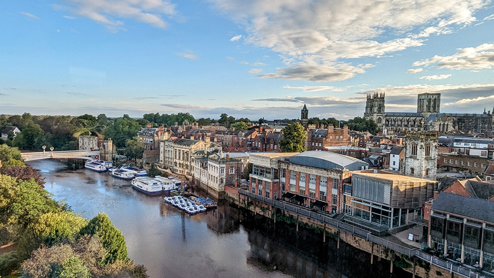
The same view as yesterday evening looked even more stunning with a blue sky. I started to get myself ready. My cycling gear from yesterday was still wet. Fortunately I had two sets with me; and though I was putting back on the clothes from Day One, they were dry (and only a little bit stinky – day one was a shorter day’s riding after all). The wet gear got double bagged (I’d picked up some bin bags the previous morning in Settle. Past experience of a wet day riding between the Somme and Agincourt had taught me the value of double bagging). With most of my kit ready, I headed downstairs for another excellent breakfast – admiring the even more stunning view across the Minster from the elevator lobby.
View over York from the Radisson Hotel
Breakfast was good; though apparently not as good as the one from the Golden Lion in Settle as I didn’t photograph it. Either that or I was so hungry I just wolfed it down.
After a quick retreat to the room to finally gather everything up I headed downstairs to check out and collect my bike from the secure staff parking area, then loaded it up and got ready to set off.
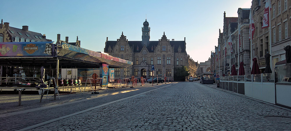
There are few better places to start a cycle ride than going through the heart of medieval York. I headed past the Minster and up through Goodramgate and out of Monkgate Bar. I was so happy to be cycling through the city gates that I was 100 yards through them when I realised my cycle computer was flashing to warn me that I was off route. I wasn’t actually supposed to have ridden through the bar so I had to double back and ride through it a second time!
York Minster Selfie
Back on the correct route I left the City by crossing over the Fosse and found my way onto the former York to Beverley railway line.
Route 66
A mix of railway path and quiet roads and farm tracks would take me through Dunnington and into Stamford Bridge.
Stamford Bridge Station
More flat country lanes led me nice and steadily on towards Pocklington. I was taking it easy but the riding was easy and lovely. It was so much nicer to be out and about in clear blue skies.
Low Slung Finger Posts – Not that Bolton
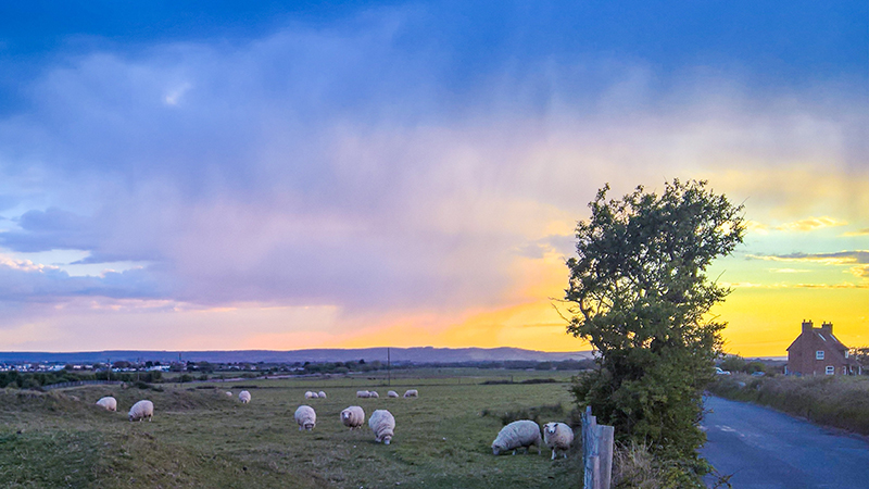
Pocklington would mark the start of riding into the Yorkshire Wolds. It was also going to be biggest settlement I’d be in for a while so I decided to stop for a second breakfast. I pulled over at the first place I came across, Swirlz Gelato. I parked up, ordered a smoothie and a sweet crepe and settled down at an outside table. It was a good break and though barely two hours on since breakfast it was certainly a good choice.
Second Breakfast in Pocklington
A short way after leaving Pocklington on one its busier roads, a turning to the left and onto country lanes marked the start of the Yorkshire Wolds. The fields started to open up and the road rolled up and down (mostly up) into Millington and slowly and gradually onward and upwards. Around a corner the views opened up further to reveal a lovely valley ahead and the road dropped down to meet its floor.
Hills of the Wolds
From the valley bottom I now started to follow it back uphill. The climbing was largely gentle and never beyond mildly steep; although the valley on either side rose up steeply; reminding me of the chalk hills of Wilshire and Sussex I’ve spent so many years riding up.
Into the WoldsClimbing up a Valley in the Yorkshire Wolds
I was briefly distracted by some fine looking highland cattle but got on my way and climbed up and out of the back of Millington Dale.
A Yorkshire Highland Cow
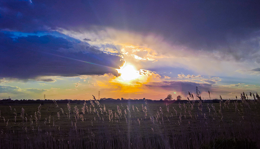
At the top, the landscape flattened back out into wide rolling views as I headed through Huggate and onwards towards Tibthorpe. Somewhere along this stretch a small but threatening looking cloud lived up to expectation as it opened up right above me with a sharp but short shower. I stopped to put my rain jacket on; and stopped again only another mile or two further on to take it back off again as the cloud passed over and the sun came back out.
I passed through Tibthorpe and into Kirkburn, and that was the Yorkshire Weald done and dusted. There was one last set of small hills before the coast, but the Weald had been the last proper set of hills of the whole trip and they had been steady going, but tackled without incident.
From Kirkburn its only about 4 miles into the centre of Driffield by the most direct route. However that route is along the busy A614 and so the Way of the Roses takes a detour along some country lanes in a loop to the south of the town, adding an additional 6 miles riding. These miles were pretty close to pan flat across some open arable land and pretty easy going, albeit with a fair breeze from the north west which the twisty turning route did head into for a fair part of the way.
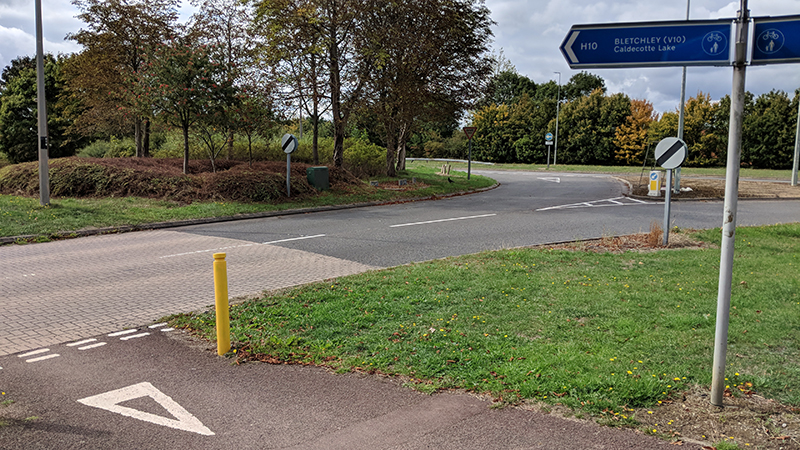
At a junction before Hutton Cranswick the Way of the Roses joins with cycle route NCN1. NCN1 was a regular part of my riding in Kent when living in Sussex as it starts at the Port of Dover and heads around the Kent North and then northwards up the country. I’ve encountered it in a few other places, most notably in the North of Scotland and Orkney. I’d love to complete the full distance of the route all the way to the very top of Shetland; even if done in stages over many years. Adding a few miles of the route in Yorkshire was therefore something of a bonus.
On National Cycle Route 1
At Hutton Cranswick, and again on entering Driffield, I’d also cross the Bridlington to Hull line on level crossings for the first two times. The last few miles from Skerne into Driffield were a bit tougher on account of being almost fully into the wind, but I kept pedalling and soon found myself turning into the Driffield main drag on a lively market day.
Lunch Break in Driffield
I found a bench at the top end of the high street, got a sandwich and some pop from a bakers and had a pleasant rest watching the world go by whilst sitting under some colourful, ornamental, umbrellas.
Driffield Umbrellas
I enjoyed the rest but chivvied myself along into getting back onto the bike. I still had another 20 miles or thereabouts before I’d see the sea including one last final set of hills (even if they were the lowest on the route).
The route leaves Driffield heading east on a fairly busy road so I made the most of a shared footpath/cycleway alongside the route towards the pretty village of Nafferton at which point the route heads south again and over a third level crossing. Before too long a couple of left hand turns put me back northwards on an even quieter road bearing signs that the (fourth) level crossing ahead was closed to traffic. It is, but not to pedestrians or cyclists.
Once across the railway line again a couple of right hand turns around Harpham had me heading on another even more forlorn road to the fifth level crossing (cyclists and walkers only again) before almost immediately turning left onto a more open road and over the sixth (and final) level crossing; the last four of which had been crossed within 6 miles.
The final level crossing brought me into Burton Agnes and the start of the final set of hills. Some brown tourist signs at Burton Agnes suggested a couple of historic attractions in the form of a Hall and a Manor House. I stopped to look them up online and was pleased to see that the Manor House was a free to enter English Heritage property so I diverted into the car park to take a look. The advertising was a bit misleading. It is a ‘free’ EH property, but only if you pay to go into the hall in the grounds of which it sits. I didn’t have the time to properly get value for money on such a visit so I sadly headed back on my way and up into the final set of hills before the coast.
The climbing wasn’t difficult but I was quite tired now so it was also far from easy but I steadily made my way up the short climb to the ridge and onto the Roman Road heading towards Bridlington and Flamborough Head. The map shows a lot of potentially interesting historical and archaeological sites in this small area so I will have to come back another time and explore the area.
Heading East along the ridge I got my first look at the North Sea and the East Coast. The end was visible but I still had a few miles to go. Those are the hard miles when you know you’re almost there but not quite close enough. They passed slowly but pleasantly until the final descent to Bridlington.
First Sighting of the North Sea
Within Bridlington itself the route takes as long as possible to find a way to get you to the sea front. It is actually less than 2 miles from the Old Town around residential streets before suddenly arriving at the sea front. It felt longer.
Bridlington Priory Church – Almost there!
Once on the prom, the sign marking the end of the ride appeared and I was happy to pull up and mark the ride from Morecambe as complete.
Way of the Roses. Done
Well, almost complete. There was the small matter of riding back across town, this time along the prom and past all the seafront rock and tat stalls, arcades, and chip shops back to the rather pretty station. I had made it back a couple of hours before my booked train so I decided to pay for an earlier alternative and was soon settled onto the train, passing over the same six level crossings and through Hull to York, and then on to Darlington to the car and back home.
Despite a very comfortable bed in a lovely room, the sound of the rain outside the window of the Golden Lion had been creeping into my sleep throughout the night. It was still sounding heavy when my alarm went off.
I got dressed into my cycling gear, half loaded the bags and headed downstairs for an excellent full breakfast. It was probably too much to have just before heading out into the hills that were going to be immediately in front of me. It was very good though.
A Golden Lion Breakfast
I went back upstairs, finished getting myself ready, listened to the rain a bit more, and braced myself to head out into the wet and onto the hills.
As anticipated, it wasn’t long before I started climbing. I had pulled out of the Golden Lion, taken a couple of right turns around the town square, and was on the edge of the hills within about 1/4 mile. There was no gentle start. The gradient quickly headed into double figures and to add to the fun there is a nice stretch of cobbles as the road rises.
The cobbles soon gave way, but the hill just got steeper. There would be about 750 feet of climbing ahead of me in around two miles. That would be tough in any situation but add in
A heavy bike
Laden panniers
A massive breakfast
Unrelenting rain
A strong headwind
and it wasn’t going to be easy. When touring I try not to beat myself up too much if I have to get off and walk at any point, but it would have been nice for that to happen a little bit further into the day. The first 2.5 miles would end up taking me 35 minutes – not much faster than walking pace. I was in the saddle more often than I was pushing, but probably not by much.
Climbing out of Settle
Eventually the road levelled out and I knew that the next 5 or 6 miles would be largely downhill. It was a huge relief but it was still wet and windy and the views from the tops were not as stunning today as I imagine they can often be. Coming down was lovely riding to start with, but as things levelled off again, the roads got wetter and wetter with puddles crossing ever further across the width of the carriageway.
Made it to the topThe view from Thorpe
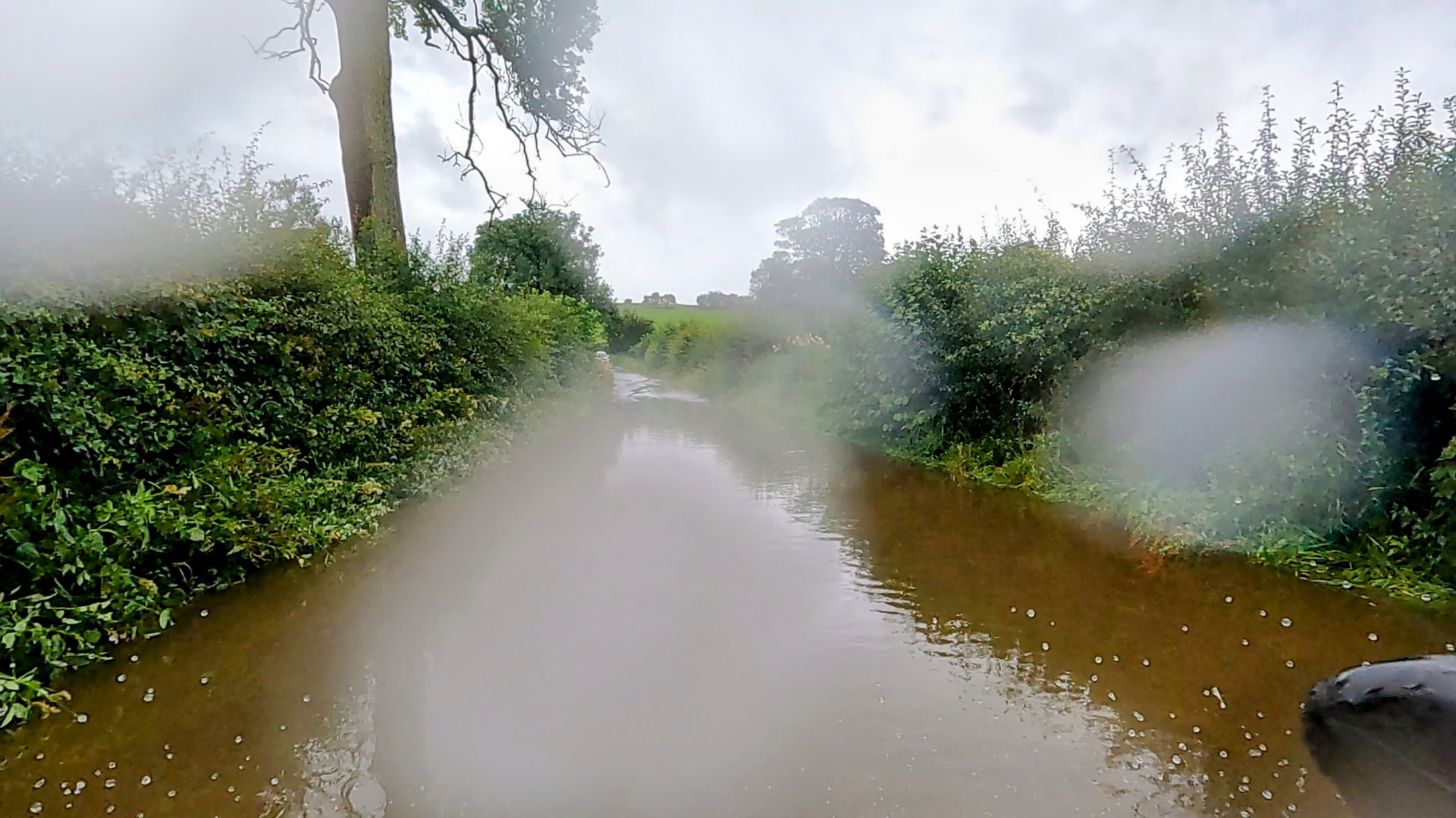
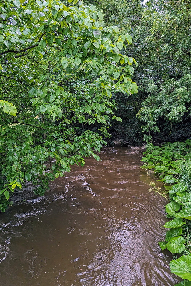
Not long past the small village of Calton things got wetter still. A short downhill section led me with little warning to a completely flooded section of road. With a long enough days riding ahead of me; not wanting to have to double back to add even more miles to the ride; having already got to the point of wet that a little more probably wouldn’t hurt; and with just a little bit of gung ho/sod it in me, I powered on and kept pedalling through, hoping that there wouldn’t be any hidden rocks or potholes, and praying I could keep going to avoid having to get off and wade. I made it. A car at the other end of the flooding had watched my progress and elected to make a u-turn.
River or Road?
Shortly afterwards I came to the hamlet of Winterburn. That’s Winterburn. Presumably named for the river that normally only shows itself in the winter months. Yet here it was in early August and the burn was not merely visible, but close to bursting its banks.
A Winterburn in August
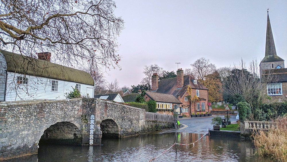
The way continued through Hetton and Cracoe, into ever narrowing lanes and into Thorpe before heading down towards Burnsall and a beautiful bridge crossing the River Wharfe.
Crossing the WharfeThe bridge at Burnsall
Crossing one of the major rivers of the Yorkshire Dales could only mean one thing. Time to start climbing hills again.
The climb from Burnsall up to Greenhow Hill takes you to the highest point on the Way of the Roses route. The difference in elevation between summit and river valley is greater than the climb out of Settle; however it occurs over almost twice the distance.
It’s not without some very steep sections but it was nothing like as brutal and has plenty of easier stretches of road allowing for recovery between the sharpest sections.
It was a long slog though, and for the last mile or thereabouts the route joins the B6265. It’s not a particularly busy road, but much more so than any point in the ride up to this point.
The final drag up takes you past Stump Cross Caverns. It might have been nice to be able to stop and go caving, but I was still only a fraction of the day done and quite well behind where I would have liked to have been by this time so I carried on. The hill continues, albeit it a much reduced gradient, a short way further to the watershed between Wharfdale and Nidderdale.
The view from Greenhow
I bet there are some lovely views from here. But for me all I could see was the cloud I was riding in. It was a relief to see the start of the downhill, although that soon tempered as the descent gets steeper and steeper. I was having to balance between keeping the brakes on to slow the descent, whilst preventing the blocks from overheating.
At the bottom of the hill, on the western edge of Pately Bridge I pulled over by a bakery and a garage for a short break. I climbed off the bike, squelching as I did so. I looked back up the hill. I was glad not be heading up it. I dragged my soggy carcass into the bakery for a decent slab of flapjack, and then filled up my water bottles at the garage next door. I didn’t fancy starting to get cold, and the garage forecourt was not the prettiest so I pulled my right leg back over the crossbar and headed back on my way.
The Climb/Descent at Pately Bridge
The main part of Pately Bridge looked to be a rather pretty market town. However it was also busy with traffic, narrow, and climbed up away from the river valley with enough of a gradient to allow me such that I could feel the growl of the impatient cars behind me. I kept on as quickly as I could manage.
It was nice therefore, approximately a mile beyond the town centre, to see the signs pointing me back onto some quiet country lanes.
There was more climbing to do, but other than one short stretch at Smelthouses where the legs complained and forced a short walk, it was routine enough riding up the hill, then hang a left, and head towards the next (and final) summit by Brimham Rocks.
Brimham Rocks is a beautiful and wonderful (National Trust) site of stunning natural rock formations. I’ve been on a few occasions but not for over 20 years. On a better day I would have risked adding a further delay to proceedings but the weather was grim again and the low clouds would only have damaged my fond memories of the site. On. On.
At least I had now all but completed the climbing for the day and I had a largely downhill run in to Ripon where I was planning to stop for lunch.
Fountains Abbey is another fantastic National Trust property and in this instance the route passes straight through the estate. I had been here a few weeks earlier and had revelled in the beautiful landscapes. Today it was all just grey.
A herd of deer were sitting, disconsolately but appropriately, by the road in the Deer Park. I pulled over to take a picture, but on taking my phone out of my pocket it was so wet I couldn’t persuade the touchscreen to work to take a picture. I had to rely on using the GoPro instead.
Fountains Abbey Deer
The phone situation made me realise just how wet I had now become so pressed on through the final few miles into Ripon.
Arriving in the town centre I forsook looking around for a nice local coffee shop but headed straight for the Caffe Nero I could see in front of me.
Stopped for lunch in Ripon
I found a table (and a leather sofa which would be comfortable but probably wouldn’t appreciate how wet I was) and got a hot sandwich, a massive coffee, and a big slab of something cakeish.
It was good to get warm and be out of the increasingly hard rain for a bit. I wasn’t going to get dry, but I wasn’t getting any wetter. Though eventually I knew I’d have to get moving again.
From here though I was onto the edge of the Vale of York and it would be all level riding for the rest of the day.
First I had to get out of Ripon. Navigation was easy enough, but at one point the route follows an older, largely abandoned road which has been cut in two by a more recent bypass.
As well as dividing the houses either side of the main road, it’s other purpose was apparently to cause flooding on the old way.
Much like the earlier section, I came upon the flood water with no notice and decided to push on. This time though something underwater did knock me off stride enough for me to lose balance and put one foot down straight into the water.
Leaving Ripon
It did demonstrate that I was right in thinking I couldn’t get any wetter though as there didn’t really appear to be any difference between my fully submerged right foot and the rest of me.
Despite the extra watering I was still enjoying the riding and though the rain was still a constant, the wind had eased off by now and with the flatter roads of the Vale the miles started finally to tick off at a decent pace.
On the way to Boroughbridge there were two points of note:
1. The route passed a couple of times underneath bridges of a disused railway line. Unlike the majority of closed lines which tended to be smaller services, the Leeds to Thirsk line was clearly a much more major route with big old solid bridges remaining.
2. I had now got so wet that every time I shifted in the saddle there was not only an unpleasant squelching noise but a channel of water would run off the Lycra and down my leg.
Old Railway Bridge
Crossing the A1 and passing through Boroughbridge would see a change in direction toward York which lay to the South East. In the pretty village of Aldborough I initially rode past the signs to the site of the Roman Town. After a hundred yards or so of passing the sign however I thought that I should probably actually get off the bike and go and see something as so far I had just kept riding. I turned around, doubled back, and rode up the hill on the west of the village to the English Heritage site. It was shut. Despite the opening hours sign which suggested otherwise. I guess the custodian had decided that nobody was coming out to see it in that weather. I can’t really blame them if that was the case, but it was a bit of a shame. I shall just crack on then.
Alborough May Pole
Although the change in direction, and coming off the Dales and into the Vale had made it feel like I was almost done, I still had 20 miles to go.
The next few miles I was also taking a bit of a gamble. I was aware that the toll bridge at Aldwark was closed for major repairs. The semi official diversion would add an extra five miles which I could do without. I had spotted an alternative foot bridge not far upstream from the toll bridge which could be reached by a path along the side of a golf course. If it didn’t work out however, the five mile diversion would become 10 or more.
Fortunately as I squelched my way towards the closed bridge, I found the path and followed it along the river. It is on the grounds of the golf course and cycling was probably frowned on. However I confess that I made an equation:
Too wet and wanting to just keep moving + (evidence that the path had been used by golf buggies x nobody foolish enough to be outside playing golf to stop me) = I cycled to the bridge
Crossing the Ouse felt like I was getting close to York at last and was on a (long) homeward straight.
Crossing the Ouse
The remaining miles were quite uneventful and went quickly. Through Beninbrough Park (another National Trust site), past the Edinburgh 200 Miles sign on the East Coast Mainline, and finally onto the riverside cycle/footpath that would lead me the final few miles into the City of York.
Beninbrough HallFingerpostsEdinburgh 200 MilesEntering YorkA Classic (and favourite) York view
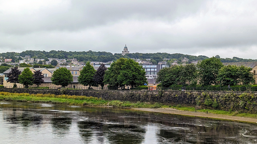
It was great to be on familiar territory and to be so close to done for the day. To see the Museum Gardens to my left and then be crossing Lendal Bridge and onto Tanners Moat. I was done. The 75 wettest miles I’ve ever ridden.
Home for the night was to the place that to me will always be The Viking Hotel. Nowadays it’s the Radisson, but for my three university years in the city my local pub was across the road so it was a familiar site that I never went into. Something I could finally put right.
View from the Radisson
The staff guided me to the staff car park where I could lock the bike up, and then I checked in and made my way to my room. I had a splendid room on the 8th floor overlooking the south side of the city across the part of the town that I had known so well for those years. I had a shower and used the hangers to hang up my cycling gear in the large shower cubicle. I doubted that they would be dry in the morning, but they had a fighting chance at least.
Drip Dry
Warm and dry and in dry clothing I made my way into the City to meet up with one of best and loveliest friends Nicky, who had remained living in York after we graduated in 1994. We had a lovely evening having some great food in Marzano’s Grill, sandwiched with a couple of visits (and probably one pint too many) in the Blue Bell Inn.
Cheers
At the end of the evening, with the world put to rights and a liberal dosing of reminiscing I said farewell to Nicky and headed back to the hotel and a good night’s sleep.
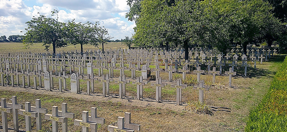
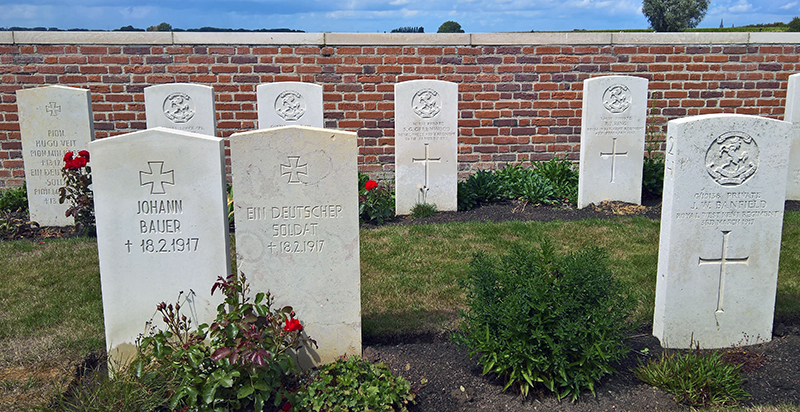
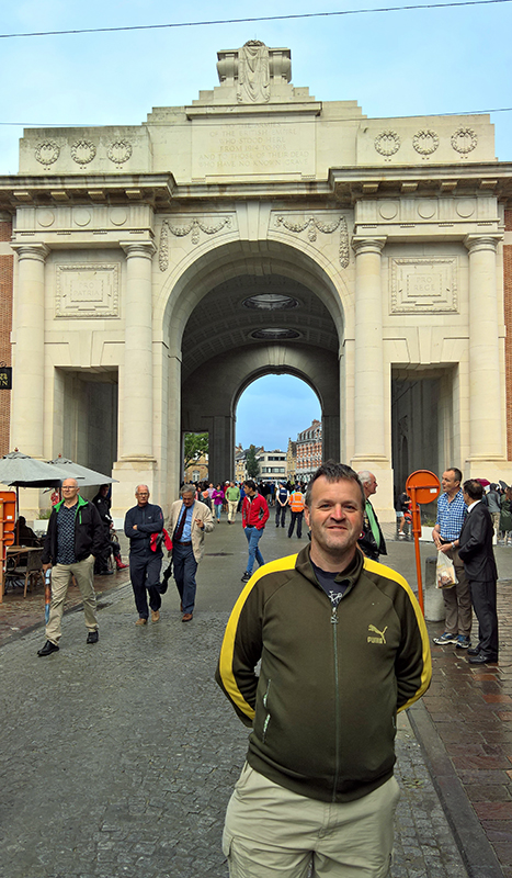
It’s been a while since I’ve sat down to start one of my posts about a multi day cycle ride. My last such trip was in 2018 when I cycled around some of the many battlefields of Belgium and France. In 2019 I went for a walk instead of a cycle, along Hadrians Wall. Covid curtailed any tentative touring plans early in 2020, and 2021 saw me move from the South Coast at Hastings to Teesdale in the North Pennines.
I hadn’t made any firm plans to get out and about again in 2022 before I managed to lose control of my bike downhill and around a corner onto some loose gravel on a short ride after work on my birthday. That left me spending five days in Darlington Memorial Hospital with a broken collarbone, ten broken ribs, and a small fracture on my left hip. All in all not the best birthday ride.
I started riding again in the new year, on the indoor trainer at first but eventually back outdoors. I added a mountain bike to the garage which has been a real boon for getting out and about in bad weather. Its an awful lot slower that being on the carbon fibre road bike, but much safer on the fatter tyres. I also enjoyed the recuperation period by increasing my bike maintenance skills. My touring bike was in major need of an overall so I spent the downtime replacing the chain, front and rear casettes and derauillerurs, the cranks and bottom bracket, brake arms and pads, the shifters and all associated cables. With the touring bike all refreshed, it only seemed right to think of venturing out on an, albeit slightly shorter than previous trips, multi day tour.
A few possible routes came to mind but I settled on the coast to coast “Way of the Roses” route between Morecambe and Bridlington. I already had the guidebook and the travel should be fairly easy from my new base in the north. I planned a route starting with the longer train journey to Morecambe on day one with a shorter ride to Settle in the afternoon that day. And that’s the day that this post is all about.
Having packed the night before (using the same basics as my previous multi day trips, but taking things a bit lighter having learned lessons from over packing in the past) I was up early on the Tuesday morning. I took the dog for a walk and then put everything into/onto the car and drove across to Darlington station.
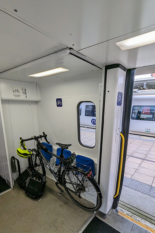
Fortunately everything train related ran smoothly. First up was a train to Leeds. The Cross Country train didn’t have the best bike storage but there was a space. I sat on the luggage racks rather than my booked seat to ensure that the bike didn’t come loose from its less than ideal strapping, but all was ok. I only had ten minutes in Leeds to make my connection (though there was a backup later train if I missed it) but we arrvied into Leeds on time and I was easily able to make it up and over onto the next platform where the Northern rail direct service to Morecambe was already waiting. This time I was able to strap the bike in a bit better and settle into a seat where I could relax whilst keeping an eye on the bike. It was then a steady and uneventful journey across the country arriving on time into Morecambe.
On the Train 1On the Train 2On the Train 3On the Train 4
Before I got going properly I rode out to the seafront, found the Eric Morecambe statue where I took my turn to pose in the traditional style (another group of people doing the same kindly took the lovely picture you see here of Eric and I), and then along the front to the Stone Jetty and pulled into the Stone Jetty cafe for a bit of lunch before starting off.
Sunshine will not be brought
Morecambe Bay
Ready to go, I double checked everything on the bike and rode to the far end of the pier. There was nowhere to easily dip the wheel into the water so I just started off from the end of the Jetty, pointed my front wheel eastwards, and set off.
Let’s Go That A’Way
The first few miles were the flattest of the whole route, following an old railway line towards Lancaster. Having made into that city, and across the Lune on the Millenium Bridge, I took a short detour off the route. I had spent some time in the second half of the 1990s occassionally working for the then Lancaster University Archaeological Unit. I took a short detour up towards the castle (which was still an operational prison back then) to find the old office building and a few other landmarks (mostly pubs) in that part of town. I did remember where things were, but the distraction quickly wore off and I headed back down to the river and picked the route back up where I had left it.
View across LancasterLancaster CastleWay of the Roses
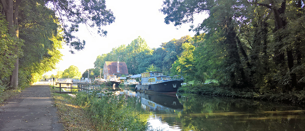
The route continued following the South bank of the Lune as it headed inland and upstream although the river remained largely hidden by the trees lining both sides of the former Lancaster to Wennington railway line. The railway path was quite popular with walkers and cyclists so I continued to take it nice and steady until, having passed the former station at Halton, we came to the Crook O’Lune. After crossing the river once, but before the second bridge cutting across the Crook, the Way of the Roses route leaves the railway line and transfers onto quiet roads for the next few miles.
Crook o’Lune
After 8 miles of largely flat riding it was time to start climbing for the first time on the ride. A quiet lane through Halton Park has a 350 foot climb over three miles; nothing too strenous but certainly noticable after the previously flat riverside riding.
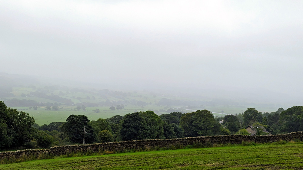
Fog on the Lune
Once on top of the hill, with the Lune valley opening up down to the right of me, the rain started. It was fairly light at this point but threatened getting heavier. A few easy miles got easier as the road headed back down towards the river; crossing the Lune again on a lovely old stone bridge just before entering Hornby.
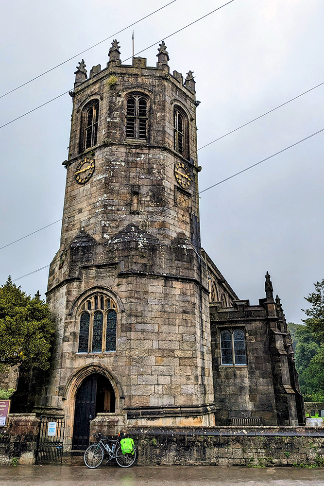
With the rain increasing, and an interesting looking church to step into, I pulled over in Hornby for a quick break. The church was nice, though writing this a month or two after the event I don’t recall anythign particularly exciting inside it. So I had an energy gel, put my coat on, and headed back on my way.
Hornby Church
For the next 18 miles the road continued to slowly climb back up along some pretty, open roads.
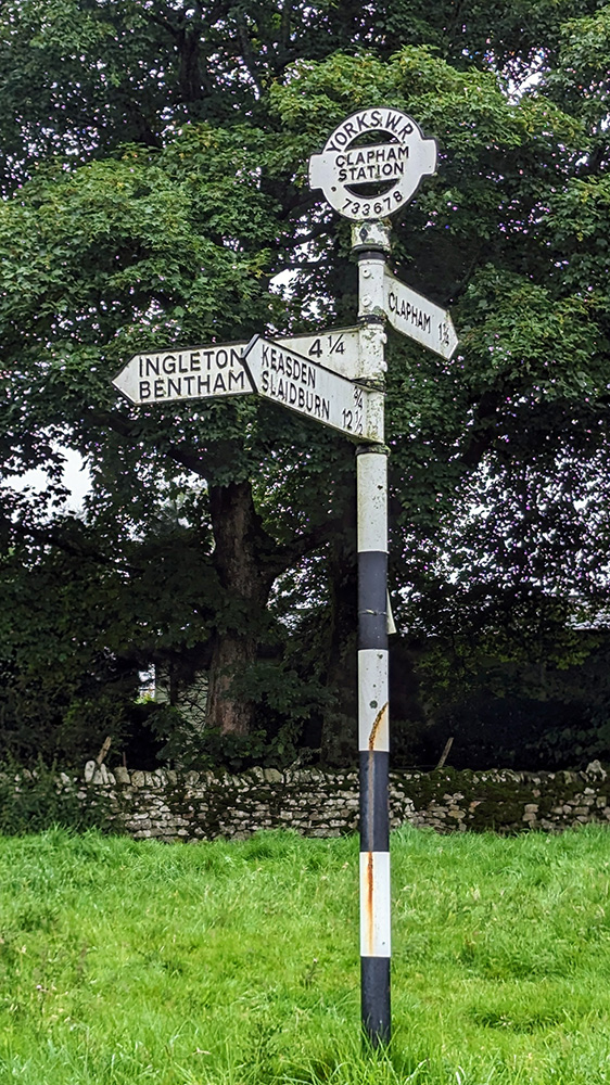
Signpost 1Signpost 2
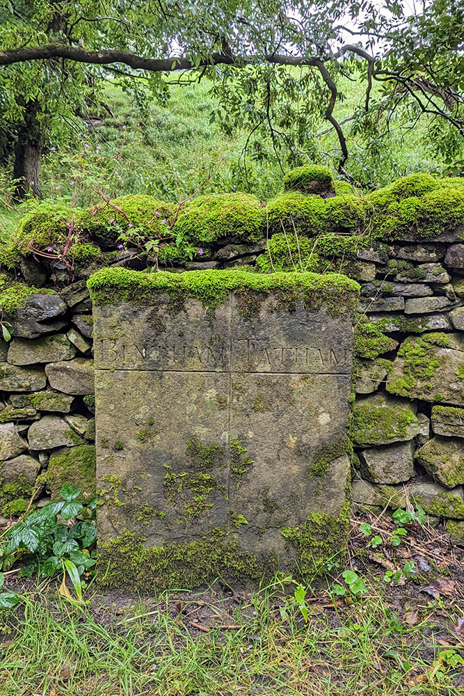
Not too much further on and a big roadside stone marked the boundary of the parishes of Bentham and Tatham, and with it the boundary between Lancashire and Yorkshire. At only 21 miles into a 170 miles tour I was leaving the Red Rose behind and it would all be White Rose from this point on.
County Boundary
As we moved into Yorkshire and continued to climb, the roads seemed to get gradually narrower but also more open as thick hedgerows gave way to dry stone walls and open moorland. Between Clapham and Austwick a sign welcomed me to the Yorkshire Dales National Park.
Welcome to the Dales
Into the Dales and past Austwick the climb got a lot steeper on single track roads for another couple of miles, eventually reaching the high point of the day (c900 feet) after almost 34 miles riding.
At the top of Day One
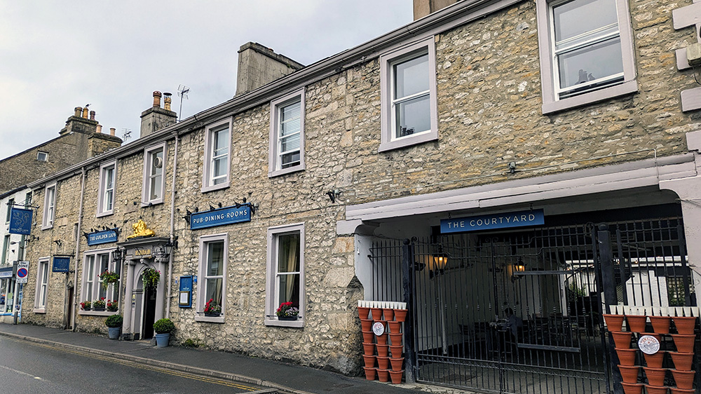
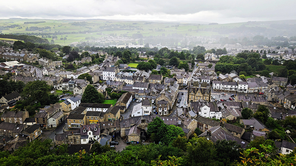
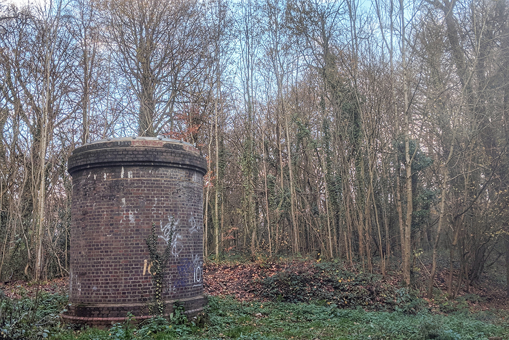
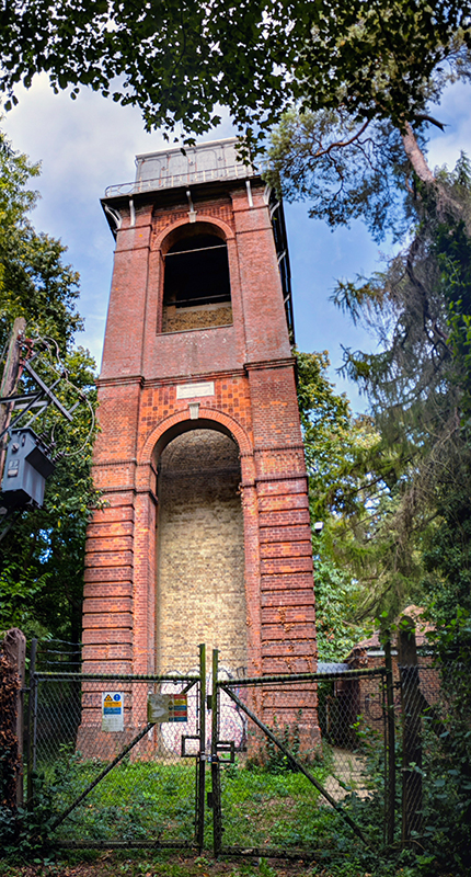
The final three and a bit miles gave a nice chance to relax on the way down into Settle. I rode into the town centre and parked up at The Golden Lion pub; my base for the night. I was shown to the secure bike store and then up to my room. I showered and put on my off bike clothes and went to explore Settle; wandering around the town and down to the famous railway station, and up to to Castleberg Crag to get a look at the town from on high.
The Golden LionThe Lion’s Door Settle Water TowerSettle StationView over Settle
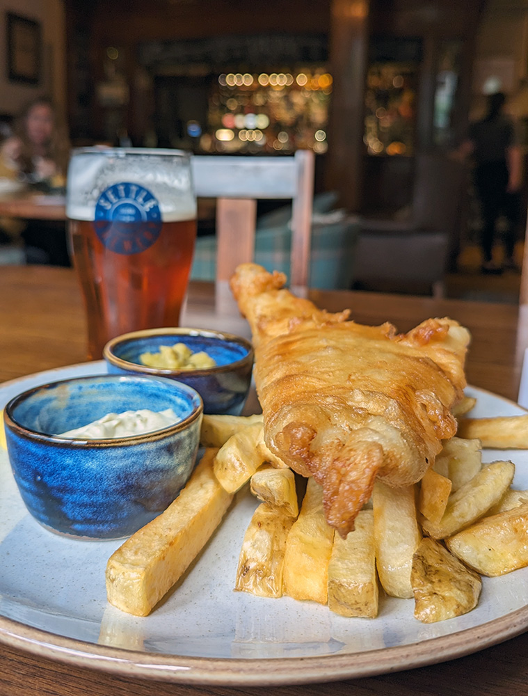
With the legs properly cooled down I headed back to the pub for a few pints of Settle Bitter and a glorious plate of Fish and Chips before heading to a very comfortable bed.
Fish and Chips and a pint of Settle BestJust Deserts
In the summer of 2021 we made a rather big change to our lives and left the South Coast for Teesdale in County Durham. Since moving here I’ve made a few explorations up some of the bigger cycling hill climbs that I have ever done. I’ll write about some of those trips later, but with a day off work on Friday 13th August 2021, and some reasonable weather (though quite a breeze blowing over the hills) I decided to try my hand at the biggest cycle climb that England has to offer.
I started by loading the car onto the roof bars and driving the short distance to the Tan Hill Inn; the highest pub in England, which I had chosen a start and finish point for the day’s ride (hopefully there would be time for a quick drink at the end of the ride).
The last few miles driving across the hill tops to the pub had got very windy to the point to my being a little concerned about the bike on the roof. Fortunately, I made it in one piece but was happy to get the bike down to ground level as quickly as possible.
Ready to ride but wary of heading into the wind I climbed onto the saddle and headed west. It was quite tough going but not too awful. The first few miles were glorious weaving up and down across the top of the Pennines. The open hills are lovely and there are some fantastic views from the top of the hills to the west across the Eden Valley and over to the Lakes.
Good work, sign defacers
Before too long though the road started to descend as I came to the edge of the hills and dropped down towards Kaber and Winton and onto the relative flat lying Eden valley. It was fairly easy going riding into Warcop where I had a quick stop to stretch out my legs before heading back towards the edge of the North Pennines.
First I had to cross the A66, which involved riding along it for about a mile. Not a pleasant experience but I was soon turning off and onto a quiet road heading next to the army ranges. The road was peaceful and empty as it followed the edge of the ranges and followed the base of the hills. Normally I might enjoy powering through the ups and downs but today I was saving myself for something bigger so took it nice and steady, stopping off on the way at the cafe in Dufton for fortifying coffee and cake.
Post Box Pantry, Dufton
Refreshed and energised I had a short distance left on the road to get myself back into a rhythm before turning right onto a smaller lane just through the village of Knock.
Dufton Green
And now the fun starts.
I was now at the start of the climb up to Great Dun Fell. The track is a well paved service road to the national air traffic radar station at the top and whilst closed to the public in cars, is open for walkers and cyclists. Reaching the summit at 2,740 feet, this is the highest paved road in the UK and one of the toughest and most notorious climbs in the country.
I’d been getting used to some of the climbs that the North Pennines have to offer; long and steady hills on wide open, windswept roads. Great Dun Fell is a whole extra level of hill. Simon Warren describes this as “the greatest climb in England” and scores it as an 11/10 climb!
You don’t have to go far from the turnoff at Knock before the climbing really starts. The low-level fields soon open up into the more familiar open landscape of the North Pennines as you pass the signs that tell motorists that they are not allowed any further up. The next mile or so is a chance to get into the rhythm of the ride and to realise that you still have a hell of a long way to climb.
The sight of snow poles by the side of the road common in these parts, but having each one numbered was new to me. The road surface is great – after all the road needs to be used throughout the year by vehicles servicing the air traffic control radar at the top, but the climbing is relentless.
A short section of flatter road (even with a hint of descent) is a false opportunity to relax. Before long the climb starts again and from here on it just gets more and more intense. Roadside barriers serve to remind you that there is a long drop off the side of the road as it sweeps around a ravine. As that narrows the climb get steeper again. My legs here were burning but I somehow managed to keep going; albeit at a crawl. Scree and rocks line both sides of the valley here making it feel even more foreign and inhospitable. The barriers stop as the valley gets tighter; but the road gets steeper.
Eventually the climb slightly eases off; but at only by opening out onto more exposed landscape at over 2,500 feet altitude. The wind was completely different than the breeze I’d experienced earlier. The road snakes around the back of the hill allowing the wind to hit you at all angles. A gate across the road stops progress whilst you work your way around it (I guess you might be supposed to stop here; but having made it this far I don’t imagine many cyclists stop at this small obstacle).
On the final push beyond the gate, heading into ferocious winds, I passed a couple of riders on their way down (the gate had not stopped them). I recognised them having seen them at the cafe in Dufton. I tried to puff a greeting at them and they roared me on up the final stretch. Another corner into the wind and another increase in gradient had me in trouble but I could see the top and I wasn’t being beaten here. A few more pedal strokes and I was at the top and parked the bike next to the radar station.
Made it to the Golf Ball
Want to see what the climb looks like? Well here’s a video for you.
At the top I got off and walked around the site to take in the views. In the wind this was almost as hard as the climb itself. Staying upright on the north facing side was incredibly tough but what views and what a thing to have done.
Moody ViewsView Towards Teesdale
I got ready for the descent. As I was about to head downhill I spotted another rider making his approach to the summit so I stopped to grab some pics of him as he made the top. We had a quick chat at the top and, as one might, we swapped Strava details. Hello Ted!
Ted at the Top
We set off downhill together. Although Ted had made the climb at a fair pace faster than me, I was pleased that even on my old tourer, I was quicker on the descent. The way down was much easier, and the good road surface and lack of traffic made for a fun ride back to Knock.
Eden Valley and the Lakes from Great Dun Fell
From here the plan was to head back via Appleby-in-Westmorland. However I had failed to realise quite how busy the famous Horse Fair, which was occurring this week, would make the town. As I approached the number of people camping by the roadside kept increasing and the numbers of people on foot and horse grew and grew. Before long I was in a full scale crowd and realised I had no choice but to turn back. Following my trail back a few miles towards Dufton again wasn’t fun on tired legs.
I ended up having to retrace my route along the base of the hills through Warcop, but eventually deviating from my original path by heading on towards Kirkby Stephen. Passing through the town it was time to hang a left and head for the hills again.
The next climb, Lamp Moss, would be tough enough at the best of times but by now I was tired and my legs were struggling. I had to stop on a couple of occasions to let the legs rest. I got to admire the views better though and was rewarded with another lovely sweeping downhill towards Keld and into Swaledale.
Struggling up Lamp Moss
One last climb to make. From Keld I headed north. A couple of sharp hairpins whilst climbing out of the valley was a sharp start to the hill back up to the Tan Hill Inn.
On the way back to Tan Hill
Despite my earlier problems on Lamp Moss I made it up without stopping though, and though the last few miles were all uphill and into the wind, I managed to keep making slow progress back to the pub and the car.
I’ve ridden 100km a
number of times now; and even ridden 100 miles on a small handful of occasions
in the past. However I’d never extended the distance to the mystical 200km
(124.27 miles). As Spring started
turning towards the Summer of 2019 I was feeling inspired to put this
“right”.
The blame/credit for
this inspiration came in two forms.
The first form was
in the super human shape of Mark Beaumont.
I had been to see him talking about his ‘Around the World in 80 Days‘ cycle
challenge and then read his book. If he
could do 80 days riding on average around 240 miles a day, then I’m sure that I
could surely manage one day of 125 miles. No?
My second
inspiration was my old University friend Jill.
Jill has long been astounding me with her amazing long distance fell
running efforts but more recently I had looked on in awe as she rode the C2C route in one
day – a truly amazing feat with the hills involved in that ride.
So, suitably
inspired, I planned a route. I wanted to ride a circuit that I already knew so
that I had an idea of what was ahead of me. I wanted the route to be a circuit
rather than linear. I often like riding A to B in order to see a bit more
countryside (and yes, to keep the wind at an advantageous angle). However for
this adventure I didn’t want to do a long ride and then have to spend a few
more hours on a train getting home. I
also wanted a known route so that I could put my head down and turn the peddles
without feeling inclined to stop and take lots of pictures every mile or two.
You will notice that
there are photos in this blog post. I chose to use this as a ‘Greatest Hits’
post using photos I had taken on previous rides that I’ve (mostly) not used on
these pages before.
I settled on a trip
that I had undertaken around Kent and Sussex a year or two earlier, but with
the addition of a section of old railway line cycle path which would get me to
the required distance, without any steep hills.
All planned I set off on a good early Summer’s day in the first week of
June.
I had taken a day
off work for the trip but I was up earlier than I would have been had I been
going to the office. I was saddled up and on my way, heading East out of
Hastings before 6am.
I followed my usual
route East, heading through Pett village rather than following NCN2 through
Fairlight; the road surface down Battery Hill is still too dangerous for the
angle of descent.
Pett – Dec 2016
Instead I joined
NCN2 at Pett Level and followed it’s alternative (and better) route along the
coast through the Rye Harbour Nature Reserve and then up into Rye itself.
Mary Stanford – June 2013Mary Stanford – Nov 2015Rye Harbour – Aug 2018
From Rye I headed
off the National Cycle Network for a few miles; following the straight line
(with defensive dog legs) of the Royal Military Canal for a few easy miles to
Appledore.
Military Canal – Jan 2015
From here I headed
slowly up into the green low hills on the edge of the Weald, passing through
Woodchurch (it has a church; made of stone) before finding the turning onto
NCN18 just before entering the excellently named Shadoxhurst.
From here on the
route is onto the Weald proper with the near constant rises and falls one
expects from this part of the world. The hills aren’t big here but they are
punchy with lots of short sharp climbs.
Whilst these are naturally followed by a similar series of descents,
they aren’t of sufficient duration so as to allow any recovery. With very few sections of relatively flat
riding, the Weald acts like a form of very pretty but enforced high impact
training. Just to make sure that the
riding is never easy the next thirty miles also saw a gradual rise up further
onto the Weald. If it felt like every hill was that little bit higher than the
last, they were.
I was planning on
mainly sticking on Route 18 for this part of the ride, however a closed road
diverted me to High Halden and a few miles cycling on the main A28 road. Normally at the sight of a Road Closed sign I
might try ploughing on regardless in the hope that, whilst blocked for cars, I
might be able to get my bike through any obstructions. With the length of ride I already had planned
though, I didn’t fancy the risk of having to make a U-turn and follow my
breadcrumbs back. The A28 wasn’t what I
had in mind but I got a decent speed and rhythm going and knew I’d soon be back
on the quiet lanes.
As St Michaels I
re-joined route 18 towards Benenden where I took my first break at the village
stores and coffee shop. Although I had
already covered about 40 miles it was still only just about 9am so I was happy
with progress and enjoyed a coffee and pastry.
The next few miles
continued with more of the same Wealden riding until broken up upon entering
Bedgebury Pinetum. The woods here still
have the same hills as the previous 20 miles; but the change from the open hills
to deep woodland makes it feel quite different.
Back out of the other side of the woods I knew there were some more
steep climbs up to and around the hilltop town of Goudhurst and then on towards
Matfield. By the village pond here I
took another short rest. I knew that,
whilst there were still some hills before then, I would soon be at Tunbridge
Wells and the high point on the Weald for this part of the ride.
Passing that high
point between Pembury and the Royal Spa town felt like a minor triumph. I had bigger hills still to climb, but the
relentless stretch of Weald was mostly behind me now. I powered on through Tunbridge Wells and on
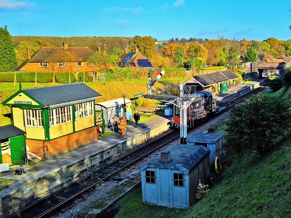
towards Groombridge.
Groombridge – Nov 2016
Here I would now add
the ‘there and back again’ extra 20 miles that I needed to make this route add
up to 200km. I had expected these few
miles to be some of the easiest of the day but somehow they were some of the toughest. Maybe that was partly mental; when you expect
the riding to be smooth anything else is unexpected and therefore feels much
tougher. Maybe it was simply that,
although the downhills on the Weald stretch didn’t really give a chance for
recovery, they did offer brief free-wheeling respite. Here on the old railway track it was
pedalling all the way. In order to make
the distance I needed to follow the railway path until its end on the edge of
East Grinstead. The final miles to that
town also include quite a steady climb.
Before then however,
at Forest Row and about 75 miles into the ride it was almost over. An unexpected turning from the old railway
path onto a short stretch of road saw me bundle over a speed bump which shocked
the bike and instantly cramped up my right thigh. I had to emergency stop, unclip and dismount
as the lactic pain shot up my leg. I was
forced into an emergency break with a lot of slow walking; thigh rubbing,
drinking water, and eating some crisis Malt Loaf! Fortunately it did the trick. I gingerly got back into the saddle and eased
myself back towards East Grinstead. The
legs were soon feeling better and I was back underway, but I knew I had to keep
better hydrated.
Forest Way – Nov 2016
After doubling back
where at the point where the old railway path becomes the main ‘Beeching Way’
road through East Grinstead I headed back to Forest Row and pulled into the
River View Café where I stopped for another coffee and a panini (and to refill
both water bottles). Properly refreshed
it was back to Groombridge and time to get back to some hills.
I was now (and
indeed had been since the double back at East Grinstead) following the route of
the Avenue Verte (London to
Paris) route which I had cycled along in my first proper cycle tour a few years
previously. That meant that I had two
big hills ahead of me. On that ride both
of those climbs had got the better of me and I had not been able to get up them
without briefly stopping (in the first case) and even having to walk a
little (on the second hill).
The first hill, the
Northern approach into Rotherfield, I had completed on a couple of subsequent
rides without a problem and once again I made my way up to the village without
needing to take a breather.
I then let the miles
(and the smaller hills) to and through Mayfield ease along knowing that I had
the toughest single climb of the day to come.
Whilst I had conquered Rotherfield hill before, I had never yet managed
to cycle up Newick Lane into Heathfield without stopping. I made sure to give myself the best chance
this time. At the foot of the hill I
pulled over and gave myself five minutes to relax, take on an energy gel and
plenty of water, and psyche myself up.
This technique had worked for me in the past; notably when climbing the
biggest hill I have still ever ridden to date – Hartside on the Coast to Coast route. Hopefully it would work again. It did.
I won’t say the riding was easy, but relaxed and mentally prepared I was
soon up the initial steep lower slopes which had always been the section that
had beaten me before. From there on I
flowed on up the rest of the hill and near the summit, on the edge of
Heathfield, I clocked up 100 miles for the day.
I celebrated by coasting down into the town centre and pulling up
outside Costa for another coffee and a bun.
With 100 miles
clocked up, and all of the big hills (bar the final push back up to my house)
behind me I could begin to feel like I was on the home straight; even though
there were still 25 or so miles in front of me.
From Heathfield the
cycle route (I had been on NCN21 since East Grinstead) joins another former
railway line on the beautiful Cuckoo Trail.
From the hill top at Heathfield the cycling South is an easy drop from
the top of the Weald to almost sea level over a distance of 10 miles; all in
beautiful wooded scenery. I have ridden this way a number of times now but the
Cuckoo Trail is never not lovely.
Cuckoo Trail – Oct 2018
Leaving NCN21 after
Hailsham I headed onto Rickney Marsh.
Here I began to struggle. I still
had 15 miles to go and now I was on the flat all the way back to Hastings. There is no difficult riding here; but on
tired legs there is no break in the pedalling.
Also I was now hitting a big psychological wall. I know this part of the route blindfold – its
a regular cycle commute. With nothing
here to look at with fresh eyes I just wanted to be home. There was still an hour of riding to go.
Rickney MarshPevensey MarshPevensey Marsh
The closer to home
it got the worse the feeling became. The
legs were empty and the head was already at home and in the bath. The worst came at Galley Hill; the low cliff
top that marks the Eastern end of Bexhill and from where I can look across and
(almost) see my house – only, and yet still, 5 miles away.
Galley HillGalley Hill Feet – March 2015
I stopped on the
cliff here for some time and made a call to my other half to pep myself up and
to take my thoughts elsewhere. 5 more
miles. That was all. And now having taken that final break I
pushed on; along Hastings prom and up the West Hill. Climb up. Almost. For the first time in over a year I was
unable to make it up the hill to my home without stopping and walking for a
short section. I just had nothing left
in my legs. I wasn’t going to beat
myself up though. I still made it. My
house is just off the top of the hill but you have to go to the top and glide
back down.
Hastings Prom – March 2015
125.95 miles. 202.69 km. I had broken the 200km barrier. I knew now that I could do it. I also knew that I wouldn’t feel the need to do it again for some time to come!
The back end of
November was approaching and I felt the need for what would likely be one last
long, full day’s ride of the year. I’d
taken the Wednesday off work and had a route planned to take me Northwards. I’d
heard that Eynsford was a nice place to visit and I calculated that it was a
good 100km ride away. The weather
forecast indicated that the wind was going to be relatively accommodating so I
got ready to ride.
I wanted to travel
light but still took a pannier with me as this was going to be a one way ride
and I wanted some warm clothes to change into for the train journey home. As I got
up in the morning it was clear that I was going to need them. I looked out of the bedroom window and then
rushed down and out of the back door to check that my eyes were seeing right in
the half light. They were. There had been snow overnight. It wasn’t much; only a light dusting, but it
had settled. I decided to carry on as
planned and had a good warm breakfast to set me up for the day, knowing that it
was possible that I might have to abandon or at least severely curtail the
riding. Being so close to the coast we
don’t normally get much snow. It’s
normally worse inland and I was going to be heading directly away from the
Channel and climbing up onto The Weald.
This Gate Muse Be…?
It was therefore a
pleasant surprise to find the snow vanished as soon as I climbed up onto, and
beyond, the ridge that marks the northern edge of Hastings. I was soon out of the town and turning off
the busy urban roads straight onto quiet back lanes. There was no evidence of there having been
any snow here at all. The morning wasn’t warm but I was properly layered up and
relishing the riding. I passed through
Three Oaks and Doleham and skirted around the East side of Westfield where I
re-joined the main road for the short and nasty little climb up into Brede. It
wasn’t long however before I was leaving these roads, which I knew well, and
turned off onto Pottery Lane and onto some virgin Weald lanes.
Weald Lane
I was in my element
now with my traditional riding technique of building up a nice steady rhythm
before screeching to a halt to admire a wonderful view across the Weald.
View Across the Weald
Before too long I
was through Ewhurst Green and dropping back onto familiar roads on the approach
to Bodiam Castle, which is of course impossible to pass without popping in for
a photo.
Bodiam Castle
North of Bodiam and
I was still riding nicely along the quiet back lanes of the Weald. Some of these I had ridden before; some were
new to me. All were lovely.
A few miles north of
Bodiam I picked up cycle route NCN18 near to Iden Green and would follow it for
some while as it rolled up and down the rolling Weald hills pushing me slowly
North Westwards passing close to, whilst avoiding, Cranbrook, Hawkhurst and
Goudhurst. The riding was tough in
places but enjoyable.
Getting Mucky on the Weald
After passing a
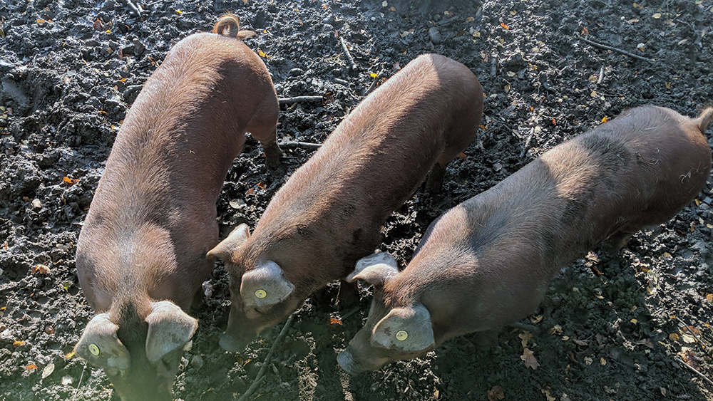
field of Alpacas and a small pen of pigs, the route heads into and through
Bedgebury Forest, which is a lovely little bit of riding.
Bedgebury Piggies
West of Bedgebury I
stopped for a sausage roll and a can of pop at Matfield which would be where I
would leave route 18 and continue pushing North through Colt’s Hill and Capel
before heading in towards Tonbridge.
Bedgebury Forest
Bedgebury Pinetum
Turn Right at Matfield
Tonbridge does not
have the nicest cycling infrastructure, or if it does I didn’t find it. The odd cycle path cut through some otherwise
dead ends, but there was a lot of riding to be done on the town’s busy, tight streets. I diverted towards Tonbridge Castle briefly
and then headed out of town along the main road to Hildenborough which I had
earmarked as my destination spot for lunch.
Tonbridge Castle
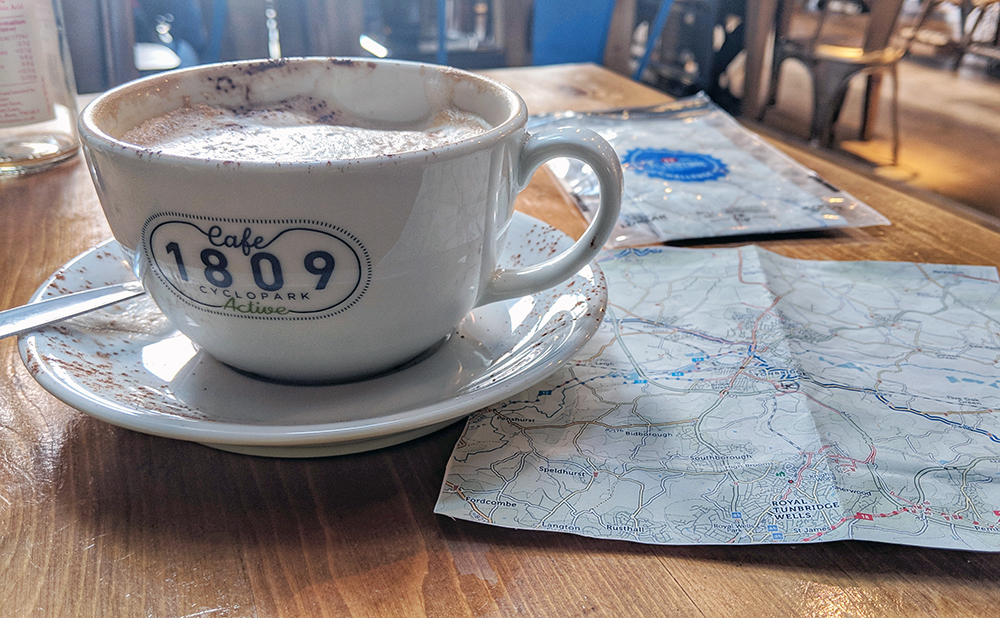
I had been aware of
Café 1809 for some time and had long been meaning to visit, but had found out
recently that its owner was closing it this week to try her hand at other
endeavours instead. This trip had
therefore felt like a chance to pay a visit and it was perfectly placed along
my route.
I parked up outside
the café using one of the many decent bike racks and made my way inside where I
ordered a jacket spud and a coffee or two which hot the spot perfectly. I had been starting to get a little tired and
cold before I got to the café. Though there might not have been any more sign
of snow, the day was far from toasty. It
wasn’t long though before I was feeling the warmth from the café and the
welcome from the staff.
Café 1809
Feeling fully
refreshed I plucked up the courage to say hello to the owner and grab a selfie
with her. Café 1809 is named after the
bib number that Dame Kelly Holmes wore when she won the 400m and 800m Olympic
titles in the 2004 Athens Olympics. Needless to say Dame Kelly was lovely and
charm personified. She managed to both put me at ease whilst totally
accentuating the difference between an overweight middle aged man and a true
athlete. She also knows how to pose for
a selfie a hell of a lot better than me.
Selfie with Dame Kelly Holmes
I left the café and
veered slightly Westwards following Noble Tree Road before heading back North
on Egg Pie Lane!
Something from Tizwas?
I soon passed more
Alpacas (I don’t think anyone in Kent keeps sheep anymore) and rolled along to
the village of Sevenoaks Weald where I got an unexpected chance for another
short rest as a builders merchant’s lorry was entirely blocking the small lane
so I got out of the saddle and stretched my legs for a few minutes.
Beastie Boys
Although mildly
annoying if I had to stop anywhere, then this was a good place. I had come this way as I was aiming for the
climb that lay ahead of me, so it was nice to get ready for it. I had got a bit out of practice on the hills
over the last month or two and at over 45 miles into the day was starting to
feel the miles. The climb started well
though, and I easily made it on the bridge that crosses high above the
A21.
Take a Breather
The bridge, which is
angled quite steeply as the road climbs up the hill, is quite a landmark when
driving North from home. I’d often
wondered what was above it and now I was finding out. I was happy therefore to use the opportunity
of taking some photos back down from the bridge in order to get my breath back.
View over the A21
I regretted doing so
however, as after stopping I struggled to get back into a rhythm and found it
stop-start up to the top of the hill. I
made it eventually though. What’s more,
now I was here I had a few miles of largely downhill riding. First along the Southern edge of Knole Park
(with deer running around just off to my left behind the big chain link fence),
and then heading North again I had a long easy drop down towards the M25 which
I was soon passing underneath.
Railway Ventilation Shaft
I still had one big
and final climb to go and I was very soon upon it. The Cotsman Ash Lane Climb turned out to be
one hill too far. I struggled up having
to walk up a part of the steepest section.
When I did feel ready to get back on and ride it was only a matter of
seconds before my left leg cramped up. I
had to jump off the bike and stretch it out.
I was soon going again but was glad to see the brow of the hill finally
appear. I did still have another five
miles before I would get into Eynsford; but it really was now all downhill from
here.
Approaching Eynsford
I rolled down into
the village and headed straight for the Castle; a small Norman keep by the
River Darent.
Eynsford Castle
Finally I then
passed back to the picturesque Ford from which the village takes its name. It might have been more picturesque if it
didn’t have a broken down van sitting in the middle of the river, but it still
looked nice. The light started to
fade.
The Ford at Eynsford
Oops
At the end of the ride
I took that as my cue to think about heading for home. I rode the short way to the station; sneakily got changed out of my cycling gear into the spare, warm clothes I was carrying in my pannier, and awaited the train back to Hastings (via a change and a coffee at Sevenoaks).
Just a few days after my visit to Dante’s Inferno and I was looking at adding a few more miles to my September itinerary. My other half was attending a conference at Cranfield University, a few miles east of Milton Keyes, and I was going up as well to sneak into her room in the evenings, and explore a different bit of the country.
After driving up, meeting her at Bedford station, and driving us over to the University (which is located in a village in the middle of open countryside and not easily accessible without a car) I unloaded the bike from the boot of the car and got ready for a first trip.
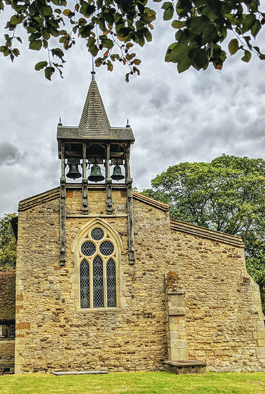
Today would a fairly easy ride. I looped around the airfield which sits at the centre of the campus and then headed South for a mile or two into Salford, a pretty village with a lovely church with some excellent bells in a fantastic wooden frame on one end.
Salford Church
The church itself was shut so I was soon back on my way and didn’t get far before coming upon an old sign village dating to the 1951 Festival of Britain. I do love coming across bits and pieces that still hang around from the Festival, so this was a very welcome and unexpected treat that got me very excited!
Festival of Britain sign, Salford
I headed on, over the M1, and entered Milton Keynes at Wavendon in its south east corner. As I suspected might be the case, Milton Keynes turned out to be mostly a pleasant cycling experience. Its famous grid road layout with roundabout after roundabout was a great example of road planning of its time. Another characteristic of those times was the provision alongside the roads of a good layout for cyclists and walkers.
Milton Keynes Cycling
The riding was a bit stop-start at the various junctions (although most of the bigger roundabouts had good underpasses for cycling across) but before long I had ridden to Bletchley and was pulling up and parking my bike in one of the old bike sheds built for the code breakers at Bletchley Park in World War II.
Parking up at Bletchley
The site and museum was my targeted destination for this outing and I spent a couple of fascinating hours exploring this wonderful site. I really cannot recommend a visit here strongly enough and would happily have spent longer here. I would also have liked to have been able to visit the neighbouring National Museum of Computing as well however it was not open on the day of my visit; I shall have to come back!
Bletchley Park
Enigma Machine
Bomba Code Breaking Computer
Alan Turing’s Office, Bletchley
I did need to get back to Cranfield though, so eventually I headed back to the bike shed and rode off again.
Rather than heading straight back I planned to complete a loop. I had to double back a short way but then headed North when I reached the River Ouzel and later, The Grand Union Canal. It was quite interesting to see another side of Milton Keynes available from this route. Between the River and the Canal I came across signs of some of the old settlements that pre-date the New Town such as Simpson village with a lovely selection of medieval buildings hiding here in the middle of this most modern of towns.
By the Grand Union Canal
I continued along the Canal until getting close to the southern edge of Newport Pagnell at which point I headed Eastwards again and rode across the low rolling hills through North Crawley and back to Cranfield to complete what was a rather nice ‘warm up’ ride in advance of the next day.
The following morning my other half woke and went for breakfast and then off to her conference. As I wasn’t officially staying there I couldn’t get any food at the hotel so instead just got ready for a day’s riding. There was a Spar shop on the campus so I’d pop in there. However when I got to the shop there was nothing for me (the hot sandwiches counter was empty and the coffee machine broken). I got back to the bike and for the first few miles headed back in the opposite direction to the one I had used to return to base the previous afternoon; through North Crawley and back towards Newport Pagnell.
Today I headed into the town centre where a handy bakery in the rather attractive high street provided me my missed breakfast. I ate at a table on the pavement as the day started to warm up and was now starting to feel more relaxed and ready for the day.
I headed North West out of the town along a B road. There was a bit of traffic around but on the whole this was pleasant riding. The road was climbing up most of the way but it was nothing more than a nice warm up. I left the road at Salcey Forest which marked the summit of that set of climbs and I subsequently began the drop back down as I rode towards the southern edge of Northampton.
I had no intention of riding through the middle of this busy town, however one of my main ‘objectives’ for the day was to be found a very short distance on the main road into the town. So rather than immediately following the cycle ring road, I initially followed the main roads until there, by the right hand side of the carriageway, was the Hardingstone Eleanor Cross.
The sorry state of Hardington Cross
The Hardingstone cross in one of just three of the original twelve Eleanor Crosses that still survive. The crosses were placed to mark the locations at which the body of Eleanor of Castile, the wife of King Edward I, had rested on its return to Westminster Abbey following her death near Lincoln in 1290.
Selfie with Eleanor
Despite having survived this long the cross is currently in very poor repair and at the time of my visit was fenced off. It was a huge shame to see such a beautiful and important national monument in such a sorry state of disrepair. I understand that Northampton Borough Council are now commencing works to restore the monument. I do hope that this is indeed the case and that it can be restored and have access to it improved so that it regain the status which it so deserves.
Save Hardington Cross
I headed back on my way, back through some underpasses under the busy main roads, and rejoined the cycle route around the town’s edge.
Northampton
The route took me through Hardingstone village (pretty) and then alongside the A45 (less so but still some decent riding well segregated from the dual carriageway). The cycle route jumps between the roadside and bank of the River Nene and progress was fairly slow; but pleasant.
Nene Valley
Eventually at the South East corner of the town I diverted onto some small country lanes and headed back out to the countryside from the village of Ecton.
Though the cycle paths around the edge of Northampton had been fine it was nice to be back onto open roads, even though they also coincided with the next set of hills. A drop and a climb around Sywell Reservoir got the legs back into action after the slow urban cycle paths. Mears Ashby is a pretty village and I took 5 minutes to rest on a bench and read some signs detailing the sad account of the crash of two American Bombers during World War II.
Meet the Lieutenant
A few more lovely open miles led me across to Little Harrowden and then dropped down towards the railway line by the old Finedon station on my way into that village, passing an old windmill/house conversion on the way.
Finedon Windmill
Riding into Finedon I noticed the church was having a summer fete so I leant by bike against a tree in the graveyard, then went in to look around the church and to partake of some tea and cake. There was unfortunately, no sign of the vicar, one Rev. Richard Coles, but its a lovely church and the villagers were friendly so I’ll forgive him.
Finedon Church Flower Festival
Finedon Church Festival
The tea and cake was great but I still needed to drop into the Co-op to get some more water (and a sneaky Calippo) before heading back off Northwards.
Finedon Obelisk
I followed the A6 for a few miles but it was easy going; it was not busy and the surface was nice and fast. It wasn’t long before I peeled off into Burton Latimer and rode through Barton Seagrove; which is a sentence that sounds more like it should be in the salacious memoirs of a 1950s Hollywood Starlet.
Somewhere just to the west of me was Kettering but I couldn’t see any sign of it and instead was continuing along some lovely country roads across a pretty bridge over the River Ise at Warkton, and up the hill into the picture postcard pretty Weekley.
The Old Post Office, Weekley
Next up just off to the right was Boughton House – a rather amazing looking stately home in some classic landscaped parklands with herds of deer running free.
Boughton Park and House
From Boughton I dropped back down to the Ise valley at Geddington; my target destination for the day. I rolled across the 13th Century bridge back over the River Ise and into the centre of the village.
Geddington Bridge
Geddington is the home of another of the surviving, indeed the best surviving, of the Eleanor Crosses. Compared to Hardingstone the cross here is much better cared for and I spent a good few minutes walking around admiring the various statues and carvings on its faces.
At Geddington Cross
At Geddington Cross
I then took a wander into the churchyard where I was ‘accosted’ by the villages resident historian, Kam. I had been planning on a quick wander around the church but instead I got a very full and thorough tour around the church. I wasn’t totally convinced of all of the stories that Kam was telling me (this is the most interesting church in England apparently) but he is certainly a captivating guide and the church does have a lot of great features including some lovely old tombs and monuments.
“Pagan” figure, Geddington Church
Queen Eleanor, Geddington Church
Geddington Church
Geddington Church
Geddington Church
I thanked Kam and left him as he was starting the tour again with another couple who had wandered in. I headed back to my bike. At the outset of the trip I had considered making this a round circuit back to Cranfield but I was hot and tired and the day was now a bit later than planned so instead I carried on a few miles further North into Corby, found the station, and climbed onto a train that was heading back down to Bedford.
Taking the easy way back to Bedford
The journey was relaxing and allowed me to get refreshed enough to make the ten and a bit mile trip back to the University. The journey back was quite straightforward and pleasant. Leaving the city was a little slow but I was soon on open roads on my way back to Cranfield. The main highlight of this little extra warm down ride was rounding off the two days in the saddle by finding another piece of Festival of Britain history in the form of The Festival pub in Upper Shelton. Happy Days.
A few weeks after coming back from my ‘Four War Tour‘ in Belgium and France and I was ready to tackle my next big day ride. I wasn’t planning on anything too adventurous and nothing that would take me far from some of regular riding routes. The aim for the day would be to explore the old coal mining area of Kent; I’d been close before on the previous trips to that part of the county, but I was less aware then of the geographical details of Kent’s coalfield locations and had skirted past some of the key sites.
I was up fairly early and on the road from home at about 8.30am. Leaving Hastings by climbing out of town on the main road at rush hour is never ideal but I’m used to it now and I don’t have to go too far before turning off onto the quiet lane to Pett village. I’ve used this route for a couple of years now as my default way out East. When I first started riding around here 5 or 6 years ago I would follow NCN Route 2 out of town and down Battery Hill through Fairlight. However the road surface on that big steep hill is now so awful I don’t feel safe on it. Although that is the higher class road and the one used by bus service to Rye, it remains dangerous whilst the quiet country lane through Pett has been recently resurfaced and is a joy to ride along; joining the main road on the flat by the Western end of the Royal Military Canal at Pett Level.
The wind was nicely behind me as I headed along the sea front; firstly behind the sea wall between Pett and Winchelsea Beach and then on the edge of the beach itself through to Rye Harbour. Up, into, and through Rye. Join the Royal Military Road next to the Canal, still with wind assistance, and then continue on the flat through to Appledore.
Rye Harbour
Sluice at the end of the Military Canal
After the flat of the canal I hung a left through the village centre and up into the low rolling hills on this North East corner of the Weald through Woodchurch (its church is made of stone). On the climb out of there I stopped to remove my base layer; the day was warm now and I wasn’t going to be needing it now. That gave enough time for a small club ride to come up past me and having stripped, redressed, and got back under way I slotted in at the rear of their group for a mile or two towards Shadoxhurst where I swung off towards Ashford.
Ashford is a town that I greatly admire for its provision of cycle paths. It’s not the prettiest town but it has an excellent network with only one minor issue; on an all too regular basis the cycle paths and foot paths swap sides. One minute you’re cycling on the left; next you turn a corner and you’re supposed to be on the right. However it wasn’t that confusion that led to me riding into a bollard. I was looking out to see if I was right in thinking that there was a shop nearby where I could get some more water. There was but I was looking around so much that I didn’t notice the great big chunk of metal in the middle of the path. It was a very slow speed impact and I think I got away without anyone noticing. It didn’t stop my riding for the day. In fact it wasn’t until another couple of weeks later when I tried to remove my front wheel to load the bike into the car that I realised that I had bent the central pin. I managed about another 1,000 miles before I finally got it fixed just last week; I just had to put a wrench into my saddle bag to make sure I could remove the wheel in case of punctures.
Ashford Park
The mishap was at least of value though as I spotted the Tesco Metro I was looking around for and topped up on water and snacks and then headed back out of Ashford through the Northern side of the town in the direction of Wye.
Wye left to rot
The cycle route North East out of Ashford is one I’ve ridden a few times and very much enjoy. Either side of Wye some quiet and pretty back roads help the miles to tick nicely by. Wye itself is a pretty village with some good cafes. I didn’t stop at any of them today though, I still had too many miles planned left to ride.
Tree Knots
The cycle path continues following the roads for a few miles until they run out and the cycle route continues on a dedicated track along the side of the hill roughly following the route of the train line. After rising above the tracks, a small opening in the trees indicates that you have reached the lovely viewing spot at Catha’s Seat. The seat, with built in bike rack storage (not being used by me in the picture below!) is a memorial to Catharine Keegan who was involved in the setup of this cycle route from Ashford to Keegan. I did not know Catha and have no connection to her but always like to rest here and raise a water bottle in her honour; the bench is a lovely spot on a great little cycle path.
Catha’s Seat
The path now starts to drop back down to the valley and into and through Chartham where you join the riverside path next to the Great Stour. The next couple of miles must be (on a good day; and I’ve only experienced good riding here) amongst the most bucolic on the National Cycle Network as it winds next to the lovely clear waters through the water meadows.
The Great Stour River Meadows
On the approach into Canterbury I turned back and headed out along a narrow and quiet lane back alongside the railway lines. I was aware of a special treat for rail nerds along this lane but, until today, I had never investigated it. What is it? Well – just watch my lovely video!
Having played on the railway tracks long enough I headed back into Canterbury. Today, other than pausing briefly to bemoan the continuing deterioration of the state of the Castle, I rode straight through the city, heading out South Eastwards having joined cycle route number 16 which crosses the North Kent Downs in the direction of Dover. I wasn’t planning on following that route too far however.
Canterbury Castle
I followed it across the open land to Patrixbourne and then on towards Aylesham. However rather than following the route which skirts around the latter village I headed in to explore it as this was one of the places that I had come to see. Aylesham was developed in the 1920s to accommodate workers coming into work at the new coal mines that were being opened in Kent around that time. It was associated with the nearby Snowdown Colliery. It was planned to grow to hold around 30,000 people but only about 1,000 houses were ever built for the colliery as the Kent seams never proved as profitable as hoped.
Water Tower on the Kent Downs
I rode into the village, stopping to get some supplies for lunch at the One Stop on the way, and then rode into the small park in the centre of the village. I sat on one of a number of benches that commemorated the mining community.
Aylesham Mining Benches
A part of the pit workings in the park with some notice boards tell the story of the mine and the village. Having seen me looking at the boards a gentleman came out to speak to me ask ask what I knew of the village. I told him that I was (fairly recently) aware of the Kent Coalmines and Snowdown in particular and had wanted to come and get an understanding of what remained of the pits and the village that had been left behind. He had been a miner here up until its closure in 1987 (he was still wearing an old miners T-Shirt). He didn’t want to tell me any stories of his own but wanted to make sure that I was aware of the legacy and the story of the village. He also pointed me in the direction of the miners memorial garden in the village council offices on the edge of the village. I was pleased to hear what he would tell me and could have happily sat and heard his stories for longer had he been willing to share more.
Snowdown Pit Wheel
Instead he headed back to the cafe he had been sitting in and I finished my lunch and loaded the remains back into my pannier.
I was very glad to have received his advice about the memorial garden. Had I not been made aware I would have passed it by unseen. The garden is only small but contains a new memorial to the lives of 57 men and boys who died during the 80 years that the colliery was active.
Snowdown Memorial Garden
Snowdown Memorial
From the memorial garden I headed across the next valley and up the hill to Snowdown station and then came to the gates of the old colliery. Despite having been closed for 30 years now the majority of the above ground mine buildings (except for the pit head winding gear towers) remain intact. The mine shafts have been capped off and the compound surrounded with razor wire but you can still get an impression of the site; though not the conditions for the workers.
At over 3,000 feet at its maximum depth Snowdown was the deepest mine in Kent. It was also the hottest and most humid. Conditions were so awful that the miners often worked naked as clothes became too uncomfortable. Miners could get through 24 pints of water in an 8 hour shift and there were frequent cases of heatstroke. Snowdown was regarded by many to be the worst to work in throughout Britain and as a result of its heat and humidity gained the name amongst its workers of “Dante’s Inferno”.
After briefly considering an attempt at jumping over the fence to take a good look around (from some concrete bollards I could likely have jumped into the compound; but I wasn’t then going to easily make my way back out) I headed back on my way. I understand that there might finally be some plans to develop the land into something new; I hope that someone might look to run some tours around the site beforehand. I would love to see around inside.
Snowdown Colliery
From here rather than continuing towards Dover I turned East along the country lanes across the hills through Nonington and Northbourne before dropping down to the coast at Deal.
Hidden Cycle Path
I have ridden through Deal many times, but before today I had never visited the Castle. I had made sure that I got here in plenty of time to rectify that today.
I rolled into the car park, locked the bike up and went in. The staff there were happy to look after my helmet and pannier whilst I wandered around. Deal Castle is probably the best surviving of Henry VIII’s coastal forts and as such is quite different from the classic view of what a medieval castle might look like. It was an entirely functional building with its petal layout designed to ensure that it had a complete 360 degree line of fire.
Deal Castle
Deal Castle
Deal Castle
Deal Castle
As well as never having visited the Castle I’d also never been onto the Pier in the town either. The English Heritage staff agreed to look after my kit for a bit longer and I made the short walk onto and along to the end of the pier.
Deal Pier
Deal Pier
Deal Pier
Deal Pier
The current pier is Deal’s third and was built with a concrete structure in the 1950s. Its been in decline lately and I found out afterwards that the main pier had only just re-opened before my visit. There was still much work to be done but progress looks to be getting made and I hope to revisit again soon and be able to get a coffee from the (at the time of my visit) closed cafe at the end and to be able to wander down to the lower deck (also closed).
Deal Beach
After a walk around I made by way back to the Castle. Coming back I noticed the gap in the railing and then the car sitting in the bottom of the moat. Back into the castle the staff told me that the crash had occurred the previous Saturday just as the castle was about to close. Miraculously the driver had walked out of the car with only superficial injuries. I gathered my kit and returned to my bike for the very short ride to Deal Station where I ended my ride and waited for a train home. My legs were tired and I was feeling the effort. I certainly hadn’t been working in Dante’s Inferno though.
There was another promisingly bright and sunny day working its way across Iepers market square and around the edges of my hotel room curtains as I awoke at 6.30. I started the day sitting at the table in the chamber writing my diary for the previous day and then calmly got dressed back into the lycra for the final day and gathered my belongings together. (Although not totally hygienic my routine on these 5 day (or thereabouts) tours is to take two full sets of cycling clothing and alternate them each day. On my first tour along the Avenue Verte I tried rinsing my kit out in the overnight hotels. However despite being made of no natural materials what so ever I found that the clothing didn’t fully dry overnight. It was therefore easier on subsequent tours to merely air my kit overnight! That did mean that today, on day five I was putting on this kit for its third outing of the tour!)
As is often the case with my last days on tour, today would be a strange one. In mileage terms I had around only 55 miles to cover today and the going would be virtually flat all the way. However I was booked onto a 4pm sailing out of Dunkirk and whilst I could probably miss it and get the 6pm sailing I wanted to be done and heading home by then. I had more than enough time to get to the ferry and still have a good day of it but I have usually found the last days on tour to be a little stressful when there is a deadline to be met.
Leaving Iepers
After finish writing my diary and packing my kit I was still a little early for breakfast. Whilst I didn’t want to be leaving late I didn’t want to miss a paid up feed so I took my bags down to the hotel’s loading bay where my bike was secured against some sort of water pipe and loaded the panniers onto the rack so that I would ready for the off as soon as I had eaten. I took a wander out onto the streets of the town to the Spar shop around the corner, gathered some supplies for the day and loaded them into the bags on my return. As I wandered back upstairs I found breakfast was just opening. Perfect timing. After the requisite coffee, pastries and yoghurt I was ready for the off.
Final Continental Breakfast of the Trip
I slowly wound my way around the town square one last time before heading off to the North of the town to meet up with the Ieperlee canal where I joined the tow path on its Western bank. Fortunately I had not gone much farther when I realised that I hadn’t started my GPS tracking for the day so I pulled over and rectified that mistake.
At the end of the Ieperlee
Five easy miles followed along what now is just another lovely easy to ride along canal path. Only very occasionally did I pass any sign or indication that this canalised river had served as a front line at times during the war.
Along the Ieperlee
Just before Zuidschote I left the canal for a few more miles on quiet country roads. They were all well marked using the excellent Belgian cycle route marking system and I followed that rather than fully studying my maps. Not long after leaving the canal I came across what is now a simple aluminium cross flanked by French and Belgian flags. An original monument here was apparently much more graphic. It was built to mark the attack on 22 April 1915 when 180,000 kilos of Chlorine gas were directed at the French and Belgian troops holding this side of the canal. The monument depicted a French soldier gasping and clutching at his throat as two of his comrades lay on the ground beside him. During the Nazi occupation in 1942 the Germans took offence at this depiction and blew it up. It was therefore replaced in 1954 with the simple aluminium ‘cross of reconciliation’ which stands there now.
Zuidschote Original Gas Attack Monument
Cross of Reconciliation
From Zuidschote I headed North again using the lovely wide cycle paths to the side of the calm, quiet country roads.
Belgium
I passed through Reninge and Lo-Reninge before magically riding into Lo. Lo was something of a treat with some gorgeous buildings surrounding a cobbled square boarded to the North by a church lined with a fountain and sculptures (which I managed to take only rubbish photos of).
Lo Church
At the church the route turned me Westwards for just long enough to leave the town through the remains of its old wall and gatehouse before coming to the next canal which would take me back North again almost to the sea.
Lo!
Lo Town Gate
However before I could join the canal I had the small matter of having to wait for a small pleasure boat to pass by before the bridge that I needed to cross to reach the tow path on the far bank was closed.
Lo Obstruction
Canal, Boat and Windmill at Lo
Another lovely but uneventful five miles passed along the canal. There were lots of other groups of cyclists and runners out who were all up for cheery waves and I enjoyed seeing some classic low land canal architecture. The miles flew by.
Canal Bridge
Canal Bridge and Cycle Route Signs
Before I knew it I was rolling towards the centre of Veurne where a short side branch of the canal led me neatly onto a stretch of town centre roads before beginning the section Westbound parallel to the coast on some quiet country roads. I had now turned around into the wind so the rest of the day would be a bit slower; however I was well in front of the clock at present.
On one short magical stretch of track I had to turn to the North. I knew that I was close to the Franco-Belgian border before suddenly realising just how close I was. This track was it. If I veered from the right hand side of the track to the left I would leave Belgium and enter France. As a child I always though borders were all like the ones I had seen Steve McQueen try to jump over at the end of The Great Escape. But this is 21st century Europe and there is no border.
The France-Belgium Border Path
At the main road at the top of the track the beauty of the open European border became even clearer. In the middle of the main road the former border check post has now been transformed into a coffee and chocolate shop. Ah Europe. Why on earth would we ever want to leave you?!?!
Coffee and Chocolate at the Border Post
Perhaps foolishly I decided to forgo the opportunity of coffee and chocolate and instead turned to face the West and so left Belgium for the last time on this trip. Of course that meant that I was also leaving its superb cycle network and entering the slightly less impressive French system. It is still good of course, just not up to Belgian levels. Although the main A19 road runs parallel slightly inland I was now following a busy tourist road along the French coast. I didn’t have to go far though before I swung a right and headed to the beach at Bray Dunes.
Not a Cycle Route Yet
At low tide along the beach here I understand that it is possible to still see remains of some of the boats that were sunk in the beach evacuation. I didn’t have the time to fully explore and wasn’t’ sure of the exact location of any such remains so I sat on the sea wall looking out over the long stretch of beach and dunes. In late May and early June 1940 the beaches were filled with thousands of men (mostly British but also some of the French and Belgian armies were also evacuated back to Britain). They were waiting patiently here (for the most part) for their turn to board one of the famous flotilla of little ships that would carry them to the larger vessels waiting out to sea.
Bray Dunes
Now the beach at Bray is a popular seafront holiday destination much like many similar towns on the English coast opposite. Without seeing any of the remains of the boats and tanks I was left to admire the blue sky and sea and the crisp clean sand covered with families making the most of a lovely summer day. I stopped and had some food and applied sun cream as the day got warmer.
Bray Dunes
Bray Dunes
After a false start out of Bray as I attempted to take a short cut I was back on the road towards Dunkirk.
Zuydcoote Station
On the left next to the road in the small village of Zuydcoote I stopped to look at what would be the last war cemetery I would visit on this tour. It also turned out to be one of the most fascinating. For the larger part it houses men who died in the First World War but is split into three parts. The Western end houses a small, traditional Commonwealth War Graves Commission Cemetery containing a little over 300 graves (including one Belgian). The cemetery was linked to the military hospitals that were housed in the area from 1917. As such the cemetery was unique of the ones that I visited in having most, if not all, of the graves containing identified men. Next to the CWGC cemetery a post armistice cemetery contains the bodies of over 1,000 French soldiers of the war. Between the CWGC graves and the main bulk of the French men were two rows of different grave stones, marking the remains of French Muslims. At the east end an annex contains a further 170 graves, also interred after the armistice, of German soldiers. It is certainly interesting to see all of these graves lined up next to each other with just one single wall surrounding them all. Particularly poignant in the German section were the graves of two soldiers. Most of the German graves have quite a distance between them; more so than is the case in the French and Commonwealth sections. However two graves were set closer together; one a standard German cross; the other a Star of David.
Zuydcoote WWI French Cemetery (with WWII cemetery to the rear)
Zuydcoote WWI CWGC Cemetery
Zuydcoote WWI French Muslims Cemetery
Two Germans Side-by-Side
A fourth section of the cemetery to the South of the First World War area houses another large group of French graves. These men all died in the Second World War. These were just some of those who gave their lives defending Dunkirk and the beaches around Bray. These were the men who bought the extra time needed to keep the advancing German Army at bay long enough for Operation Dynamo to evacuate as many troops as it did back to Britain. Without their bravery and sacrifice it is certain that a much smaller contingent of the British Expeditionary Force would have been saved. It was also interesting to note that, unlike the French graves from WWI, in this section the (not inconsiderable number of) French Muslims were buried right in and amongst their colleagues.
Zuydcoote WWII French Cemetery
An old train line runs alongside the road into Dunkirk. It looks as though there might be plans to convert it to a cycle/foot path but for now I had to continue along the roads; although perversely the roads seemed to get less busy the closer I got to the town. Before long I was at the entrance to the docks area; marked by a memorial to the allies made from quayside paving stones.
Monument of the Allies
From here I continued along the harbour side before eventually making it to the ‘East Mole’; the harbour arm extension which saw the bulk of the evacuation. Back in 1940 this narrow arm would have been filled with troops lined up to board the ships. The actual site was used by Christopher Nolan in the 2017 film of Dunkirk. He rebuilt the Mole extension at which most of the ships docked. His reconstruction has been removed again but the main harbour wall is still extant. Today the arm was filled with locals fishing from it but I wound my way past them to the far end. It is odd to think that this now serene and small stretch of concrete proved so vital to the war effort. The small ships are the big story of Operation Dynamo, but in reality around 200,00 of the 338,226 men who made it back across the channel boarded ships from this long but narrow limb of concrete.
The remains of the East Mole
East Mole Selfie
Dunkirk East Mole!
Dunkirk East Mole
After a breather and a chance to reflect sitting on the dock of the bay, I headed back in towards the centre of the town. A few other sites and memorials lined the docks. I didn’t have time to visit the Operation Dynamo museum. I really must allow myself more scope to make such stops on these trips but I never learn. I had to get to the ferry. Dunkirk ferry terminal is a good ten miles or so west of the town so whilst I was OK for time I didn’t have enough spare to be hanging around.
Dunkirk
The cycle paths from the East Mole into the central harbour area had been lovely. Wide and well signposted.
Dunkirk Harbour
Now though I had to find my way to the port and both the signs and the cycle ways soon dried up. There were some suggestions that a new cycle route is being built in this very direction. However, despite one sign proclaiming its completion date some 11 months previous, there was little sign of progress. Indeed the limited works seemed to have only served to close the few sections of cycle way that were originally in existence. I ended up joining busier and more polluted main roads as I headed through the western suburbs of the town. I probably wasn’t following these roads for too long but it was nasty, dangerous, and slow going and was threatening to put a damper on a good day and an excellent tour.
Dunkirk Bath House
Fortunately at the edge of the town where the road got busier, I finally re-joined one of the old sections of cycle route; at least for a mile or two into the village of Loon-Plage.
Loon Plage!
There was another bit of confusion at the northern edge of the village when the cycle path signs ran out and the only directions off a roundabout suggested I had to head onto the motorway. I completed a circuit of the roundabout, headed back towards the village, found a safe spot and consulted my phone GPS mapping. It indicated that I could follow the exit marked to the industrial estate. This did indeed prove to be a much nicer road and before long I was joining the traffic queuing to check in to the ferry. The ride from Dunkirk had not been fun but it had worked out OK and here I was with almost perfect timing.
The End of the Ride
I had time to pull into the ferry terminal, finish off my picnic supplies, and get changed out of the Lycra for the final time on this trip. I wasn’t entirely finished in the saddle but to all intents and purposes my tour was now completed. I cleared customs. This went OK despite my having a conversation with the customs officials in which I joked that my panniers contained various body parts. I really must learn that these situations are not the ideal places for jokes but I got away with it. This time.
End of Tour Selfie
I was one of the first onto the ferry (and at the other end was the very first off). And so it was that my tour was complete. I had the welcome chance to get up onto the main deck and claim one of the prime seats at the rear of the ferry next to the restaurant. One ferry canteen chicken curry (surprisingly hot) later and I could properly relax at the end of a fantastic trip. All that remained at the other end was to navigate my way out of Dover harbour (not an easy feat as it turns out) and get the train the short ride back to Ashford where I could place the bike in the back of my waiting car and drive home.
When I came up with the idea of this tour my main focus was always to be the sites of the Somme and Ypres and to be visiting them in the year of the 100th anniversary of the end of the War. The concept of ‘Four War Tour’ was always a little contrived and building Waterloo and Agincourt into the trip potentially felt a little frivolous; whilst they were important historical battles the direct effect on those who fought was so much lesser than the slaughter of the Great War.
As I worked my way from Mons around Cambrai and towards the Somme these concerns were not vanishing. Waterloo had felt like visiting the equivalent of an English Heritage or National Trust site whereas the emotional pain of seeing row after row of graves in cemetery after cemetery was so much more raw.
In the end however I think the tour worked. Taking in Waterloo allowed me to start the tour nicely and build up for the ‘main event’. The trip from Albert to Agincourt gave me a break from the emotion that the stories of the Somme offered and that were to come again as I approached Ypres. I loved visiting the battle field and the Museum at Azincourt – it is off the main tourist route but was well worth the trip (even in the non stop rain).
In fact if any part of the trip felt to be the weak link it is that I should have allowed more time to properly take in the beaches around Bray and Dunkirk and to visit some other World War Two monuments. Were you to take this diary as any incentive to make a similar trip (I would be hugely honoured were that to be the case) then exploring such options would be my suggestion. On the whole though, although being one of my easier tours in terms of physical effort (miles and hills; if not wind, sun and rain), it was so emotionally draining at times that it more than made up for the lack of big hills climbed. This was a great tour and I’d happily recommend it to anyone.
I awoke to find a brighter, drier looking day with the sunlight pushing through the curtains hinting at the prospect of a much more pleasant day’s riding than yesterday. However, inspection of my kit showed that it was only slightly drier than when I went to bed. I would certainly be putting on some wet shoes and loading equipment into still damp panniers. I was pinning my hopes on riding in the warm in order to get things dry.
The Peacock Room
I went downstairs to the breakfast room where Richard had laid out a good spread of continental goodies. I tucked in. Richard joined me for a short while and we chatted briefly. I had made the assumption the evening before (after he had told me that he had come to running the B&B after leaving the British Army) that his problems walking were a result of action. He told me this morning that he was suffering from M.S. and that as a result they were now looking to sell up in France and move back to the U.K. to be closer to family. I was at a loss for the right words but wished him well; he struck me as the sort of person to be able to make the best of situations.
Fully loaded up on pastries I returned up the rickety stairs to the ‘Peacock’ room. I gathered all my soggy kit into my damp bags and carried them and my newspaper filled shoes down to the front door where I squelched my feet in, and gathered and loaded up the bike.
Leaving Huechin
I left Heuchin continuing in the direction I had arrived. That seems like an obvious statement but it’s not always true that you find an overnight spot quite so perfectly on the planned route. The first mile or two can often involve a bit of doubling back to get underway.
For 4 or 5 miles the road climbed slowly up the valley which proved to be a nice warm up of my slightly heavy legs. My planned route had me diverting onto some quiet roads just a mile or two into the start of the day; however the “main” (single carriageway) road I was following was fairly empty. The wind was behind me and I had got a good speed going. I took the snap decision to stay on the good tarmac and keep my legs spinning. I normally regret these decisions quite quickly; but not today.
Saint-Venant (I think)
As I approached the roundabout at the summit of the hill I met a couple of cyclists in full touring setup also approaching the top but from the opposite direction. We exchanged smiles and waves knowing that we had all finished our climbing for a while. Across the roundabout I applied my brakes and pulled over. Laid out in front of me were the last few miles of France. There was a lovely long straight downhill road to make the most of but I wanted to take in the view before I sped down the hill.
The last few miles of France
The next few miles shot by. It was 10 miles that were almost entirely downhill and they ticked past quickly. There were a couple of sections where I followed side roads to cut a corner or two but I mostly stayed on the main routes through Isbergues and Saint-Venant until I reached Haverskerque where I met back up with my planned route.
Veg-o-matic
I was not only off the main roads now but before long I was off the roads entirely as I joined a foresters track through the centre of the Forest Nieppe. The going was slower, especially as I found myself steering around large numbers of suicidal game birds. It was quite pleasant to be completely away from traffic for a while none the less. Slightly less pleasant was the short shower that greeted me as I entered the forest but it had finished before I left the woodland.
Fowl in the Forest
The next few miles were a mix of quiet country lanes with occasional forays onto busier (but not busy) main roads on the way to the pretty border town of Bailleul. It was getting close to lunch hour but the town was looking quite busy and I fancied somewhere quiet to stop.
Bailleul
A mile out of town I chose, as is my wont, a random corner next to a Maize field to hunker down on and have lunch (which I had clearly picked up somewhere on the way but cannot for the life of me now recall where).
Lunch
Back underway I soon crossed the border into Belgium. I didn’t know exactly where the border was, but coming into the village of Dranouter I recognised from the road signs that I was no longer in France.
Dranouter
Spitfire piece at Dranouter
After briefly taking a wrong turn that started to take me up a steep hill I doubled back to the junction at which I had gone in the wrong direction. It was at that point I properly noted and understood the system used in Belgium to mark cycle routes. Rather than a system of numbered routes as is used in the U.K., Belgium numbers its junctions. Each junction is assigned a (seemingly) random number and then direction signs point you in the direction of the next junction numbers. Looking at my maps I realised that they were marked with these numbers and as such I could simply follow them. The system appears to work beautifully. Once I worked it out and could see the numbers I was due to head to it proved easy to follow the network. The steep hill I had started up was one approach up the Kemmelberg. One of the classics of Belgian riding its cobbled track from the village is one of the main cycling climbs of Belgium but I was done with pavé.
As I rode around the side of the Kemmelberg hill the skies darkened and the heavens suddenly opened. It was just as well I had skipped the opportunity to race downhill on the cobbles. My shoes had just about finally dried off after yesterday’s non stop rain so this wasn’t welcome. Fortunately there was still a good stretch of downhill into the village of Kemmel from my approach and straight ahead of me was a church which looked open and welcoming. On entering through the porch I soon realised that the current focus of the church was a display of the story of the Irish Army who had been based in the town. It was a fascinating display and kept me occupied for just a little longer than the downpour lasted outside.
With the skies clearing, though the roads quite wet, I headed North East out of Kemmel and soon came to the first Commonwealth War Graves Commission Cemetery of the day at Kemmel Chateau closely followed by another at Godezonne Farm.
Kemmel Chateau
Godezonne Farm
I wasn’t much farther on again when I came to the small Elenzwalle Brasserie Cemetery at a cross roads near Voormezele. Although all of the CWGC cemeteries have been created to a relatively standard set of designs and layouts, everyone has a different story to tell. Notable at Elenzwalle were the graves of men from the British West Indies Regiment; a stark reminder that this was indeed a World War and many men from all of its four corners came to this corner of Europe to fight and die.
West Indian soldiers at Elenzwalle Brasserie
The other side of Voormezele came Spoilbank and Chester Farm. I came to Spoilbank first. It contains the remains of 520 men (125 unidentified). A further 420 men (all bar 7 of them whom are known) are buried at the next cemetery at Chester Farm. Chester Farm gave another reminder that in the end we are all as one. A handful of German men are buried shoulder to shoulder with those they were fighting. Futility but togetherness at the last.
All one at the end
To give an idea of how close these cemeteries are located I only need to say that they sit in opposite corners of the same farmers field. There really is no escaping the past in Flanders. And nor should there be.
Chester Farm and Spoilbank
Spoilbank and Chester Farm were related to fighting at ‘The Bluff‘ in 1916 and it was to that battle field that I was headed next. Using my new found knowledge of the Belgian cycle route signs I decided to follow the numbers rather than the route I had planned in advance on the maps I was carrying on my handlebars. I am glad I did as this alternative route took me through what is now a very peaceful and beautiful country park and open woodland. It is hard to picture the horrors that occurred here 100 years previously. Were it not for the lines on the park marking the locations of the front lines of the fighting it might be possible to never realise the significance of the location. I was taken by how close the battle lines were; the markers were barely 50 yards apart.
The Bluff Trench Lines
Leaving the parkland I saw some more signs to ‘Hill 60’ – I had spotted a few back in Voormezele – and very soon found myself at that location. Hill 60 was the site of fighting between December 1914 and April 1915 when it was claimed by the Germans, and then again through 1917 and 1918. Fighting was severe and at very close quarters. Mines were used to detonate trenches with brutal consequences. The whole hill has been left to nature as a memorial and graveyard.
Hill 60
Whilst I had been struck by the proximity of the trenches at The Bluff, they had nothing on Hill 60. To say that they were less than a stone’s throw apart would be inaccurate. Most people throwing a stone here would send it well beyond the trenches opposite. In the picture below the Allied front line is clearly marked and visible. The German line can be seen marked on the boards of the next, slightly lower, platform.
Hill 60 Trench Lines
Leaving Hill 60 I had almost a whole two miles before the next memorial I would stop at. A short diversion from the road went to ‘Canadian Hill 62‘ (I didn’t find Hill 61). A monument and memorial, though not a cemetery, the hill is a beautiful and peaceful site. I sat for a while on one of the many benches and ate some food whilst looking over a short few miles to get my first glimpse of the town of Iepers.
Canadian Hill with Iepers in the distance
Leaving the sanctuary of Hill 62 I continued on a bumpy concrete farm track before joining the cycle path next to a main road and then heading across a motorway before coming to the monument to The 1st Battalion of the Black Watch at the appropriately named Black Watch Corner. Here on 11th November during the first battle of Ypres, the British Expeditionary Force faced some of the fiercest fighting of the war to that point in their defensive fight back to the coast. On 13 August 1914, 1,062 officers and men of the 1st Battalion Black Watch had set off for France. By the end of the fighting here on 12th November, a mere 91 days later, only 111 were left alive.
Black Watch Corner
Black Watch Corner sits at the South West of Polygon Wood which was to see further fighting during the Third Battle of Ypres in 1917. It was into the Wood that I now headed. The wood itself is now another beautiful and peaceful place, although I did spot the remains of at least one concrete bunker hidden in amongst the trees. I rode along the west side of the wood and then turned east to follow its northern edge.
Almost at the opposite corner of the wood from Black Watch Corner I came across two very differently sized cemeteries opposite each other.
The smaller Polygon Wood Cemetery was created at the time of the fighting. It contains “only” 107 commonwealth graves (plus one German casualty) including 60 men from New Zealand. The graves are laid out in the more haphazard manner of those cemeteries that were started during the actual fighting.
Polygon Wood Cemetery
Across the road opposite is the larger Buttes New British Cemetery. This cemetery was made after the armistice with graves of men brought from around the area to this single site. 2,108 men are buried here, of whom only 431 have been identified. The neighbouring memorial to the men of the 5th Australian Division built on top of the butte provides a high up view across the whole cemetery. It gives a view not usually afforded in similar cemeteries. The cemetery is solemnly beautiful. The multitude ordered lines of white headstones contrast well with the light green of the grass of the cemetery and the irregular dark greens of Polygon Wood beyond.
Buttes New British Cemetery Panorama
A short way further on and I rolled downhill into the village of Zonnebeke. The village was one of the main locations of fighting during the 1917 Battle of Passchendaele and was abandoned and destroyed during the war. Some of the battle site has been reopened as a peace park and Museum. I rode into the park and stopped to visit the smaller museum located in an old farm house. However whether it was fatigue, or expectation of what I thought might be here, I was rather underwhelmed. The park has a series of small peace gardens dedicated to the various nations who fought here but they didn’t seem that well thought through or maintained.
With still some miles and sites to cover and a deadline to meet in Iepers, I passed by the Museum. I am told it is very good and maybe one day I shall return, but for now I wanted to push on. I wasn’t far from Iepers but that lay a couple of miles back West from Zonnebeke and I still wanted to complete my pilgrimage by heading another couple of miles East. I found and followed the disused railway line; now a peaceful and lovely footpath and cycleway. Back in the war this was the ‘Road to Passchendaele’. In the mud and mayhem of the trenches and fighting, the railway line was the most reliable way to (and from) the front.
The Road to Passchendaele
A short while later, using a combination of the old line and then the main road, and I made to the furthest point of the day and to the village with the beautiful name and its terrible associations. Unsurprisingly perhaps Passchendaele village itself was something of an anti climax. Like so many such villages in the region it was totally destroyed during the war. Whilst the village has been rebuilt and is pretty enough it does, naturally somehow lack the character that a naturally evolving settlement gains and somehow you can tell that there is something missing; something still dead in the cobbled streets.
Opposite the church on the main square a notice board shows the “church” as it was at the end of the war. It was just a pile of rubble. The only indication that this particular pile of bricks and mortar was the church being the sign erected next to it.
Passchendaele Church
I took a final spin around the streets before heading back to the old railway and then on and into Iepers proper. However I still had one more place to visit on the way. It involved only a short deviation from the railway line and up a little rise. I pulled in to the busy car park and locked the bike up; but didn’t feel the need to take my panniers off and secure my kit. Maybe that was foolish but it just didn’t seem required.
A visitor centre on one corner of the site tells the story of the fighting that occurred here and some of the stories of the men buried here now. It seems all part of a scheme to slowly prepare you for what is to come. Leaving the visitor centre a pathway takes you around the North edge of the site. As you walk along looking over the low surrounding wall you slowly get to take in the size of what lies inside. At the North West corner you can get a real feel for the scale and then, halfway along the western wall, is the gateway that provides access to Tyne Cot Cemetery.
Tyne Cot Gate
Tyne Cot, or the Tyne Cottage was so named by the Northumberland Fusiliers. The farm was a German defensive position near the railway level crossing. It was captured in 1917 and started to be used as a dressing station and subsequently began its existence as a cemetery. After the armistice the cemetery was expanded as bodies were brought beck from around Passchendaele and reburied in Tyne Cot.
Tyne Cot
In total just under 12.000 men are buried here making it the largest commonwealth cemetery from any war. Only 3,605 of the graves contain identified men. At the rear of the cemetery the wall forms a memorial for some 35,000 men who’s bodies were never found and identified.
Tyne Cot Wall of the Missing
The sheer scale of seeing so many burials and so many names should be over whelming but the site is so beautiful and so full of life from the living who were visiting and paying their respects.
Tyne Cot Memorial
As well as the size of the cemetery there are some additional differences that help to tell the tale at Tyne Cot.
Tyne Cot Great Cross
Three of the concrete German block houses were built into the layout. Two of these are in the Western end of the cemetery surrounded by graves and trees.
Tyne Cot Bunker
The third of the structures was built into the base of the Great Cross at the centre of the site. A small ‘window’ gives a glimpse of the original structure.
Tyne Cot Great Cross showing the Block House
I spent some time wandering around the cemetery. Reading the names of the known and looking at the long lines of graves of men “Known unto God”. After reading just some of the lists and lists of names of the missing. I found a quiet corner near one of the block houses to rest up for a while and to take it all in before I set off again.
Tyne Cot is so large that it is hard to really grasp. It is only with travelling around the area of the Ypres Salient that you begin to get a fraction of the true impression of the horrors that occurred here.
Tyne Cot Panorama
I returned to my bike and followed the road in to Iepers. The last few miles of the day were largely uneventful. Approaching the town centre from the direction of Passchendaele brings you through the Menin Gate. I stopped beforehand to admire the gate from the outside and to take an ‘arriving at Ypres’ selfie before riding into the town through the iconic structure.
At the Menin Gate
Like the wall at the rear of Tyne Cot and at Thiepval in The Somme, the gate lists the names of those who died with no known grave. Some 54,395 names are inscribed on the Gate’s walls. The names are those who died up to and including 15 August 1917. The 35,000 names at Tyne Cot are those who died on the Ypres Salient with no known grave between that date and the end of the War. Between the Menin Gate and the wall at Tyne Cot are listed roughly as many names as the total population of Hastings where I live.
At the Menin Gate
My hotel for the night was slap bang in the centre of the town and easy to find. The entrance was down a side street from the main square. I checked in, locking my bike safely in the deliveries area, and went to my room to freshen up and get changed. The room was excellent and directly overlooked the main square. For some it may be too close to the centre but I was quite looking forward to that after spending the previous three nights in quiet locations. I showered and polished off the so far uneaten remains of my lunch before heading out.
Hotel O Iepers
I had a bit of time to spare before the main event of the evening so I went out to explore the town and the funfair setup in the square. With a pocket full of change I put a 50 cent coin into a grab machine and immediately walked away with a little soft toy Seagull. Wipers the gull and I continued walking around taking a look at the town. Although, much as is the case with other such towns in the area (see Passchendaele above) the town was very badly damaged in the war and much of it has been rebuilt, it still manages to maintain a bit more of a sense of place than some other similar towns.
Wipers in Iepers
Wipers in Iepers
Wipers in Iepers
At about 19:15 I made my way back towards the Menin Gate. By a very strange quirk of fate I had discovered that one of my old University friends also happened to be in Ypres on the same day and so we had agreed to meet up near the Gate ready for the nightly Last Post ceremony. The ceremony, which has taken place here every night since 11 November 1929 (with the exception of the years of the Second World War), was incredibly moving. It should undoubtedly be a part of the itinerary of anyone visiting the area of Flanders and The Somme. A number of groups and individuals (some clearly of a military background; others maybe not) laid wreaths at the Gate. Bookending the ceremony the buglers of the Iepers fire brigade service played the Last Post and the Réveille as they have done for almost 90 years now. Long may they continue to do so. I hope that so long as the Gate stands (and hopefully beyond that too) this pure act of daily remembrance continues.
Last Post Ceremony
After the ceremony Alison and her group invited me to join them for a meal and a beer or two. It was a lovely end to a long and emotional day.
With Alison at Ypres
As I said goodbye to them at the end of the evening I took one more walk around the square which was now closing down for the night. The lights turned off stall by stall and the hubbub and music of the arcades was carried off in the breeze until a dark calmness was restored. I sat on a bench for a few minutes allowing everything that I had seen today to sink in before retiring to my hotel room.
At the start, and indeed at the planning, of this trip I had wondered of my own motives for visiting here. I am not aware of any family members who fought here in the Great War but I understood now that this was not the reason for my coming. I wanted to get a feel for myself, to whatever level I might be able to do so, of the events and destruction that occurred here 100 years ago. In coming here to Ypres and Passchendaele and also to The Somme I had increased my understanding of how Terrible this war was and was even more assured of how important it is to bury nationalism and secularism and any other such unjustifiable causes of conflict. We are one world. One people. A visit here was really helping to reinforce that. Coming here wasn’t about ‘celebrating Britain’ or any such rubbish. It was about placing a value on living in harmony and understanding. That may be a futile desire of mine but it would be the true legacy of these men, of all flags and nations, who perished in Flanders Fields.