Coast to Coast in the footsteps of Hadrian
In September 2019 I left the bike at home and instead took off on foot with my other half on a walk across the coast of Britain following the line of Hadrian’s Wall
Individual Posts:
You can read about the whole trip in one go on this page, or if you’d prefer you can read the individual posts from each of the days of the trip using these links:
- Hadrians Wall Walk Day One – 19 September 2019
- Hadrians Wall Walk Day Two – 20 September 2019
- Hadrians Wall Walk Day Three – 21 September 2019
- Hadrians Wall Walk Day Four – 22 September 2019
- Hadrians Wall Walk Day Five – 23 September 2019
- Hadrians Wall Walk Day Six – 24 September 2019
The Whole Adventure:
2019 was a different year for me. I didn’t do one of my annual cycling tours due to a variety of factors; mostly just time slipping away during the year. I had some tentative plans for a couple of possible routes but I’m going to keep hold of those ideas for the future (though, as I am writing this up almost a year on from the walk described here, Covid-19 has put paid to those plans happening in 2020 as well).
Instead, towards the end of the summer when we’d still not had any real sort of a break, Nash suggested planning a trip. I was thinking of something nice and relaxing. A week somewhere to France to chill quietly perhaps? “I thought we could walk the length of Hadrian’s Wall” came the suggestion. So I was almost right.
I won’t bore you with the details, but after a few checks of maps, B&B booking websites and guide books, we came up with a plan to complete the route over six days of walking (four full days with a “half day” at either end). So it was that on a Thursday in the middle of September we set off drove north up the A1. We parked the car up in the long stay parking at Newcastle Airport and, laden with a suitcase and a medium sized rucksack each, we walked into the terminal, straight back out the other side, and got the Metro into the City Centre. After getting lost in some underpasses we made it down to the river front and checked into our base camp: the Malmaison hotel. We would be staying overnight here tonight and we were also booked back here for a final night at the end of the trip. With some more spartan accommodation awaiting us en-route we had treated ourselves to a quality room to bookend the adventure. As such we could bring some nicer clothes for travelling and the evenings in town here and leave the suitcase with the hotel whilst we were away walking. We were too early to check in but we left the suitcase and one of our rucksacks at reception. We wouldn’t need to be carrying much for today’s warm up walk.

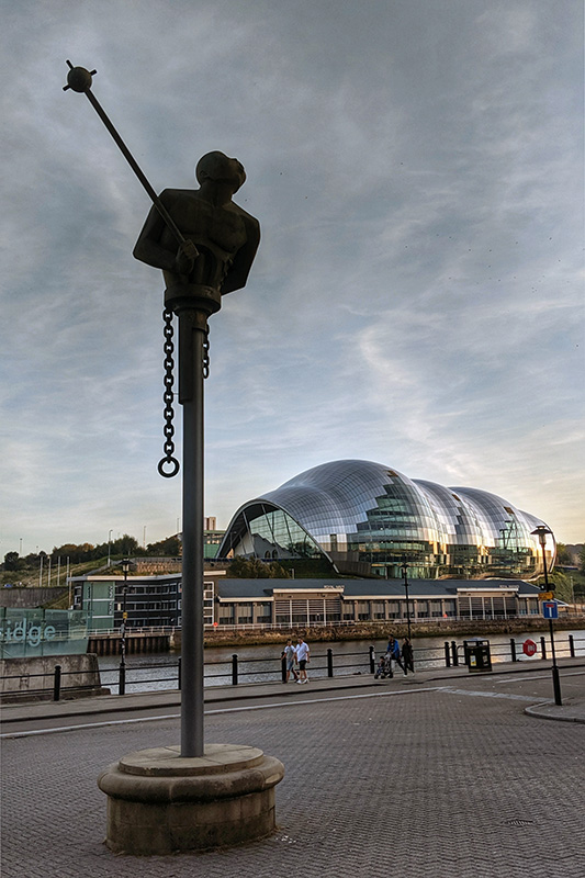
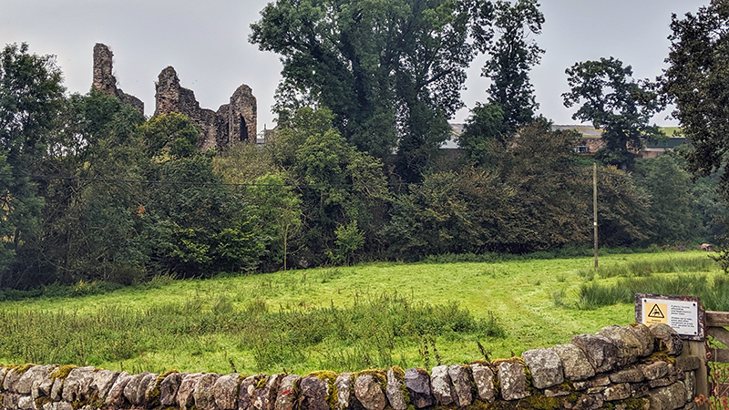
We headed back up the hill to Manors Metro station and got the yellow train east towards the end of the wall at the appropriately named Wallsend (aka Segedunum). As the name suggests, the station is close to the fort that guarded the end of the wall overlooking the River Tyne. The museum was quiet so we had a good chance to explore the excellent exhibitions, take a look over the site from the viewing gallery, take a wander around the site itself, and have a panini each in the café.


Having got ourselves into the Roman spirit we made ready to begin. Back at the museum entrance we bought our “passports” and collected our first stamps just as a small group entered. They had just completed the walk in the opposite direction. After congratulations and good lucks were shared, Nash and I made our way down to the southern gate of the site and onto the path ready to start the walk.
Today we had just four miles or thereabouts ahead of us, more aligned with the river than the line of the wall. It was a hot afternoon and we were going to need plenty of water, even for this short walk.

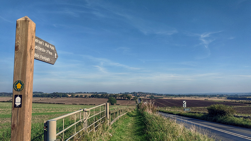
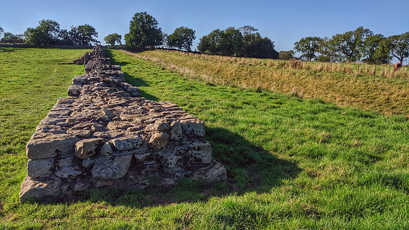
The very end of the wall is now lost under the remains of the derelict Swan Hunter ship building yard but one of the best remaining sections of wall is right outside the fort and as such forms the traditional start to of the route. From here we headed Westwards. For most of the today we would be following the start of the Hadrian’s Wall cycle route which I had ridden back in 2015.
For the first mile or two the path sits at a good height above Tyne, but the views are intermittent as you pass through wooded parks and around housing estates. The walking was nice but largely uneventful. One of the key tests for today was to see how our limbs would hold up. Nash had damaged her knee a month or two previously and she was a little concerned about how it might take to all this walking. She was testing a new knee bandage which needed a bit of regular adjustment but seemed to be helping. I had been forced off my bike 3 or 4 weeks earlier by a driver pulling out at a roundabout and as a result had a fairly badly swollen foot. It was much improved by now but still not quite right.

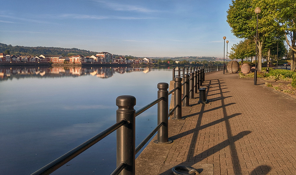
At the end of one stretch of park the pathway drops down to the riverside and the rest of today would be at waterfront level as we walked back towards the city centre. It’s hard to believe that you are so close to one of the major UK city centres as you follow the lovely waterside path. We were just a mile or so from the centre of the town but could barely tell as we looked across the river to the green banks on the other side. The occasional riverside industrial units gave the game away a little, but it’s still hard to imagine that you are so close to the core of one of the UK’s major cities at this point.

After only a little over an hours walking from Segedunum we turned a corner in the river and saw the sites of Newcastle honing into view in front of us. Within very short order you glimpse the Baltic Mills and the Sage on the Gateshead side of the river, and the various bridges crossing the Tyne, most notably the iconic Tyne Bridge. After a brief stop to fill up a water bottle at a bike shop we carried on and before we knew it we were back at the Malmaison.


We were both hot and had a few aches and niggles but on the whole we felt pretty good. We settled ourselves into our room and both had a long bath each before heading to the hotel restaurant – we had got a deal which included a two course meal and a glass of Prosecco along with a nice room overlooking the River. It was nice to then be able to simply get the lift back up a couple of floors to our room with its very large and very comfortable bed. Our accommodation for most of the remainder of the trip was likely to be a bit more basic.


Friday morning and it was time to start the walking proper. We got all of our kit ready, leaving anything that we wouldn’t need for the next five days in the suitcase which we would be leaving at the hotel. We made sure our respective troublesome joints were strapped and ready for a full day of walking. Before setting off we made full use of the hotel buffet breakfast and made final adjustments to the bags. Then it was time to checkout and shortly afterwards we were standing on the quayside ready to walk.


Ahead of us today we had 15 miles. The day promised to be one of two halves. We would start with 9 or 10 miles following the Tyne valley upstream, and then the remainder would be following the wall on higher ground above the valley.
We had a glorious bright and clear morning to set off into, and the gorgeous Tyne bridges lay just in front of us. After a quick diversion to a Tesco Metro to gather lunch and snack supplies we headed upstream out of the City through Elswood. We soon got into a good, steady, stride. The path is tarmac here, though it does lead away from the riverside every now and again following some old waggon way routes and various other footpaths, but you get a real feeling for how lovely the Newcastle area is even in some of its more deprived areas. We passed the Lemington Glass Works site and a statue commemorating the 38 lives lost in the Montagu Mining Disaster of 1925.


At Newburn the path passes back down to the riverside and we took a break on a bench by the Riverside Country Park visitor centre where the cafe provided us with coffee and a biscuit as well as refilling our water bottles. I had stopped on pretty much the same bench on my cycle ride a few years earlier on a similarly warm day.

The Tyne valley along here is glorious and the going was still good, although by now we feeling a little frazzled and hadn’t gone quite as far as we had hoped by this time of the day. The path diverts away from the river to follow the old Wylam Waggonway track for a mile or so before we had to turn to the right and tackle the first hill of the walk; a long but steady climb up onto Heddon on the Wall.

After a few hours walking and having got used to flat ground the hill took it out of us a bit, but eventually we made it to the top. We took a short diversion (although it felt a lot longer at the time) to get our first glance of the wall since leaving Wallsend, and then found a small park close to a garage and shop. We got some fresh drinks and some extra food from the shop, made use of the garage toilet, and had a good refreshing lunch on a bench in the shade of the park.
Despite the time we had already taken we still had a long way to walk today. We were over half way; but not by too much. From now on up we were off the flat riverside land and, whilst we had climbed the main hill of the day, the path ahead promised some good undulations and lots of stiles to climb over.
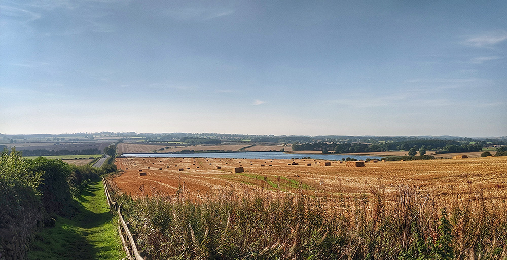
At least we now had the feeling that we were actually following the wall. The vallum was obvious to the south in many places and there were some suspiciously well faced stones in some of the field walls. The miles ticked over slowly. We were tired now; out of snacks and low on water. A couple of diversions around some fields were known and planned for, but still felt like they were taking us out of our way when we just wanted to get to the end of the day. Passing the Great Northern Lake (a couple of reservoirs built to power some of the Victorian factories of Newcastle) indicated that we were getting close – just a mile or two to go – but despite the open countryside we couldn’t yet see our destination in front of us; it was hopefully hidden behind some trees rather than still beyond the horizon.
The light was starting to fail as we eventually came out of a footpath to the side of the road and realised that we had made it to the hamlet of East Wallhouses and our destination for the night The Robin Hood Inn was clearly visible. It was a very welcome site and is a lovely pub – if you’re up that way it’s definitely worth a visit.
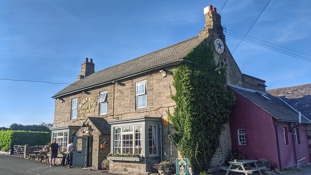
We had twin rooms for the night (due to availability rather than choice). We rested up and got refreshed and slowly and gingerly on tired legs walked back down to the bar for a much needed pint or two and a lovely pie based supper before heading back up for a well earned sleep.

We woke up on the Saturday morning stiff but ready for another day of walking. The day was looking quite bright as we dressed and stiffly negotiated the stairs down to the bar for breakfast. We’d done one full day of walking but were still unsure how we might get on today. We ate well – though not so much that we couldn’t move! As well as breakfast, the Robin Hood Inn had prepared a packed lunch for us both. As we continued westwards we would be in fairly open countryside and were not likely to come upon too many supermarkets.

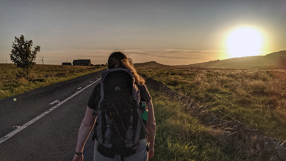
Ready for off we gathered our bags, checked out, stamped our passports at the box on the wall of the pub, and started walking West, leaving just after 8am. By now, in late September, the sun was still low on the horizon at this hour. There were a few morning clouds but it looked like they would burn off and it promised to turn into a nice day. The path follows the line of the ditch by the side of the busy road but it was a pleasant start. We passed Wallhouses and Halton Shields and across a small part of the unexcavated fort at Halton Chester before coming to the roundabout that marked the junction of the Wall and the Roman Dere Street (which ran from York into Scotland). There was likely an impressive gate here at the time of the wall but now there is just an old pub recently converted to a coffee shop and café. There weren’t going to be many places to stop so, although we had not yet ventured overly far, we took a quick break for coffee and cake.


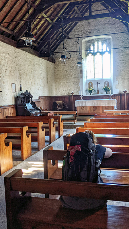
For the next few miles, the remains of the Vallum on the South side of the wall were particularly clear. The path then carried on through a plantation which had some uneven ground and lots of tree root trip hazards, however the trees did provide some cover from the sun which was now getting quite strong. We were about 8 miles into the day by the time we arrived at the site of the Battle of Heavenfield where we made a quick diversion to look at St Oswald’s Church (where we also made grateful use of the pews for a few minutes to rest our feet).

From here we started to drop down from the hills and came upon the first visible stretch of wall since Heddon. The path then takes a diversion along some lanes to avoid a busy stretch of wall side road with no footpath. We headed down into the North Tyne Valley and towards the first major Roman site since Wallsend. After walking to, and across, the bridge over the river, and having walked through Chollerford we were very much ready to have a break at Chesters Fort.


We paid the entrance fee and started with a good look around the excellent antiquarian museum and then found a bench to sit and eat our packed lunch. We had a look around the excavated remains of the fort, probably slightly less full heartedly than we would if we weren’t already tired. We had an ice cream, stamped our passports, and got back on the road.


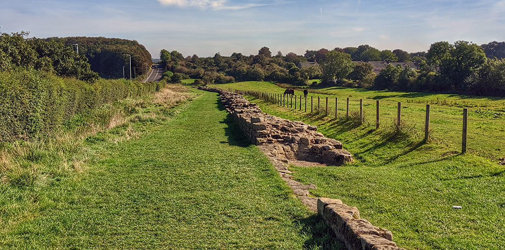
From the valley the only way was up. From the top some stiles (there are a lot of stiles on the route) led us into a field and into Northumberland National Park. Upon entering the park we were soon we were starting to get to the good stuff so far as the wall is concerned. The stretch through the National Park would take us the rest of today and most of tomorrow. Within the Park we would be following some of the best preserved bits of the wall along the most beautiful and dramatic countryside.

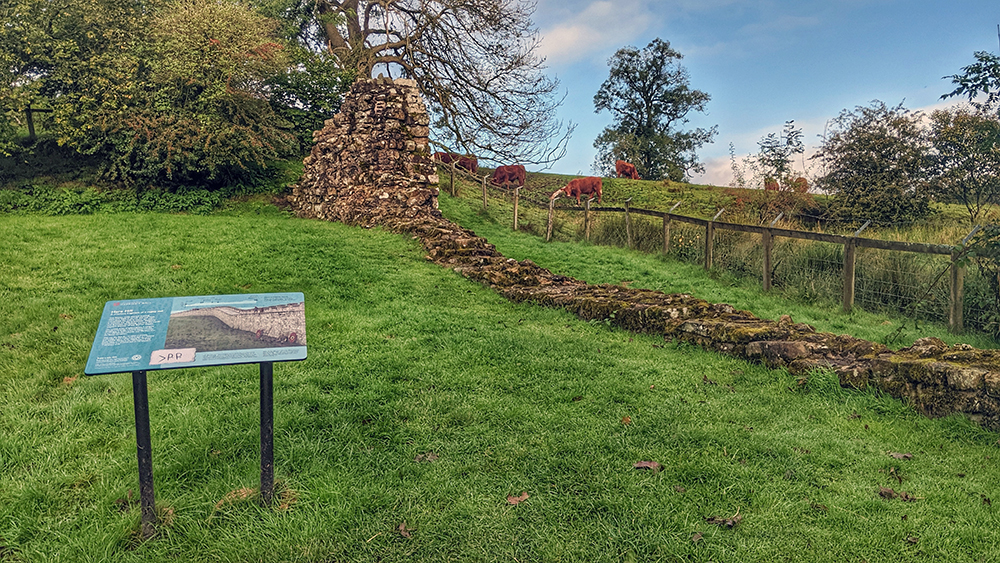
The start of this stretch is marked by a stretch of wall at Black Carts. This is the longest section of wall so far on the route coming in this direction. The joy of finding some proper wall remains here also helps to hide that you are still slowly but steadily climbing onto the hills.

The wall remains disappear but the ditch remains very evident and before long we were turning the ‘corner’ at Limestone Corner. We were at the most northerly point on the walk and the landscape was opening up wider and wider with every passing mile.
It was also getting later though and we had to press on. It was almost 5 o’clock by the time we turned the corner with the best part of 4 or 5 miles to walk. The path follows the line of the ditch close to the road but on the grass, the path is quite uneven and the walking was slower as a result.
Despite this we were soon at the site of Brocolitia Fort, partially excavated but with no extant above ground remains. The path here crosses the road and skirts around the fort. It is pretty, but did add a few more yards onto the straight line distance remaining. You do, however, get to visit the temple of Mithras which is evacuated and open for viewing. After the fort we crossed the road back onto the ditch and some more uneven ground.


With time ticking on, and the sun beginning to set, we came to a point where the path and the road diverge. Here we jumped the fence and onto the road. Our guide book warned against doing this, but we were late and our B&B was a short way ahead alongside the road so this should be a good shortcut. It wasn’t much fun though. Although not the busiest stretch of road, being straight and open most drivers were, shall we say, playing fast and loose with the speed regulations.
However in front of us we could spy the Old Repeater Station and, at just around half past six and roughly 10 and a half hours after leaving the Robin Hood, we arrived and kicked off our walking boots. Les, the owner of the B&B was cooking and we had just enough time to shower and change and join him and two other walkers for a simple but excellent supper and a couple of beers. The other two gentlemen, not traveling together, were an American retired teacher and a Dutch airplane mechanic and Roman reenactor.
The company was excellent. We exchanged tales of where we had been and what was ahead (we were walking in different directions so could share tips). Both gents were using a service that was transporting their luggage from one B&B to the next. Why didn’t we think of that? I resolved to call the company in the morning and see if we could do the same.
Tired, but feed and refreshed, we went back to our bunk beds and fell quickly to sleep.
Sunday morning and we awoke in our bunk beds at the Old Repeater Station. We were tired but ready for another day on the wall. This wouldn’t just be any day. We knew that this was likely to be toughest and, spoilers, it was.
After breakfast I made a call to the luggage company that the other walkers were using and, in exchange for leaving them £20 in an envelope, they would take our bags to our overnight stops on both of our remaining days. Some of our kit had to be transferred into carrier bags as I was still going to be taking one rucksack, but it would only be carrying the supplies we would need for the walking hours.
We set off into a beautiful morning. However it was a beautiful mix of low sun and dark clouds. It looked unlikely that we’d get through the day completely dry.
A very short walk on the busy road and a trek along a farm track brought us back onto the wall path at Sewing Shields Farm and onto the crags.

Although we’d been watching the countryside open up as we headed west the previous day, we really noticed the difference now. From the urban sprawl around Newcastle the country had been expanding, even until later in the day (somewhere around Limestone Corner), the landscape was still regular farm fields with hedges and fences. Now everything was high open moorland intercut only with occasional low stone walls. It is a beautiful part of the world.
After about a mile we approached Housesteads Fort, probably the best of the sites situated directly on the wall. The last time I came here (on a short afternoon walk from Brocolitia whilst visiting an old friend in the North East) it was possible to continue walking on the wall straight into the fort. Now, however, a fence on the wall meant that we had to go to the English Heritage ticket office and pay entry. Which was, of course, perfectly fine with us.


We had started the day a little later than planned (largely due to sorting the luggage). We had anticipated being at Housesteads before opening hours so it was a double edged sword that we were able to get in. We could visit, but we couldn’t spare too much time so we had a brief look around, used the toilets, stamped our passports, and walked back to the wall at the West side of the fort.
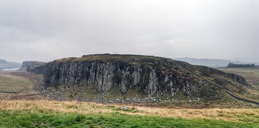
The path continues along the crags. With such a sharp cliff face making a natural barrier from the north it’s a wonder that a wall was needed at all. If any attackers did make it up the crags they would surely have little energy left for a fight.
We passed the beautiful remains of Mile Castle 37 and dropped down to the farm next to Mile Castle 38, then back up some stone steps onto the narrow path overlooking the drop to Crag Lough.

From Housteads, atop the crags, admiring the wall, and the countryside across the Lough is one iconic view after another.
And then you come to Sycamore Gap.
The most famous and photographed section of the wall, and therefore the busiest section full of daytrippers coming here from the nearby Castle Rigg carpark. It was also where the first drops of rain started to fall.

We had the approach to the famous tree largely to ourselves but there was a lot of for traffic from there on for the next mile.
We also had the first taste of how the walking would be for the next few miles as we headed up and down some steep, rocky tracks. We had been warned that this section felt a lot longer due to all the hills and we were about to find out how true this is.
The rain was quite heavy as we approached the car park and some of the group of German students being marched across to Sycamore Gap did not seem pleased to be dragged out in the rain and mud.
After passing to the other side of the nearest car park from the gap, the number of other walkers dropped back down again and we largely had the path to ourselves along the ridge of Winshields Crags.

We had, at one point, considered a diversion here to visit Vindolanda. We had by now however agreed to just continue on our way without deviation. It would be a three mile extra walk plus time (which we couldn’t spare) at the site. We would come back another time. Possibly even by breaking our journey back to Newcastle.
It was the right decision.
At the trig point on Winshields Crags we reached the highest point on the trail however, whilst the direction now would be West and Down, we were far from down with any uphill climbing.

Bogle Hole, Caw Gap, Bloody Gap, Thorny Doors, Hole Gap. The next few miles were a near constant round of ups and downs. The rain had eased but the path was now slippery and as a result, carefully picking our way down from the crags was just as slow as climbing back up the other side of each of the gaps. It was also very tiring work.

At Cawfields we made use of the toilet facilities in the car park and took a break on a bench for a mouthful of coffee and a biscuit. We needed some sustenance, however, today we did not have any lunch with us so only had the lightest of snacks.

From Cawfields there was a bit of respite on some more even territory across to Great Chester Fort, another of those still buried under fields, yet whose outlines are easy to see.

If we thought we had been lulled into the easier walking of the last mile, we were right and we were soon brought back to earth. The ground became more undulating and. as such. our progress slowed again.
At King Arthur’s Turret we were close to done. At the bottom of that gap was a road. Spying more crags and climbs and dips ahead we took a quick look at the map and without any hesitation followed the road. Yes, we might officially be deviating from the path but the distance would be the same. We were tired. We were hungry. We were both a little emotional. We were close to throwing in the towel. We needed the easier walking on the much more even road and would follow it to its end and our planned break at the Roman Army Museum.
We might have missed something amazing here by taking the road. Who can tell? Not me that’s for sure. But for us, at that time, we had made the right decision. We paid entry into the museum and had a quick look around. It was much later than we hoped to be here. It was gone 3pm and the museum closed at 4.
We enjoyed the exhibition, though not as well as we should. Then we went to the tearoom and ordered the last remaining sandwiches and cake that were still available.
Had it not been Sunday we may well have finished the day at this point. There was another 8 miles or so to go and we were shattered. However, the AD122 bus along the wall was not running today. If we were going to bail we’d either have to try and persuade a taxi to pick us up here and take us to our B&B, or we could get a bus back to Haltwhistle, a train to Brampton or (more likely) Carlisle, and then get a taxi. It seemed more trouble than just keeping walking. What was more, having rested and actually having eaten properly for the first time since setting off from the Old Repeater Station, we both felt refreshed and ready to tackle the remaining miles. I was doubly glad that the new feeling of refreshment would keep us walking. Not only as we naturally really had no desire to give up, but also as it was very close to this point that I had suffered a major mechanical problem when cycling along the wall a few years earlier and had to abandon from here and start again the following morning in Carlisle.
We were now almost off the hills (and almost out of Northumberland National Park). Leaving the museum we were back to following the line of the vallum rather than the wall; indeed we were not going to see too much of the wall from here on in.
We passed Thirlwall Castle and carried on across some fields towards Gilsland. Through the village, across a couple more fields, and down towards the River Irthing, which not only has another great section of wall to admire, but also the footings of the Roman Bridge that crossed the river here.

The bridge itself has long gone, but a new replacement has, fortunately, been built and so we were very soon and easily on the other bank and ready to head back up a surprisingly steep hill to rejoin the wall, which was surviving quite well here.
A few yards on and we came to the fort of Birdoswald. By now we were too tired to stop and admire the site. This was just as well as it was also too late and had just closed up. We were able to stamp our passports from a box on the wall though before carrying on along our way.
We were now 2 to 3 miles from our base for the night and were desperate to push on and get there. The path here crosses some fields to avoid the road but we wanted to push on. It was late and the road was quiet. Unlike our earlier tarmac diversion we were actually closer to the line of the wall by staying on the road. Being dead straight and largely flat, we could vaguely see our destination in the distance but it felt as though we were never getting any closer.

It was close to 7pm by the time we finally made it to our destination; Quarryside B&B. We arrived and were welcomed by our hosts and we were pleased to find our bags waiting for us. I’m so glad we had made those arrangements. We were exhausted and not having to carry our luggage had been a godsend.
As pleased as we were to get to our room, we had to shower quickly and get changed as our hosts were keen to get us out of the house. This was not a bad thing. The village of Banks does not have any facilities so the hosts were driving us to a local pub for dinner.
We were taken to the Belted Will Inn a fair few miles away where we had an excellent and massive meal. When we were finished the pub landlord, once he had cleaned up in the kitchen, took us back to the B&B. Apparently this arrangement has been in place almost every day for around 15 years. Hospitality at its most remarkable. It made for an excellent end to a very long day and was most welcome. Once back at the B&B we were soon fast asleep in a very comfortable, large double bed.
We had a fantastic nights sleep in the lovely room in Quarryside Bed and Breakfast in Banks. The view from the bedroom window was gorgeous with lovely views out across the Irthing valley and the fells to the South. The garden was filled with birdlife and, though a little cloudy, the day looked like it would be a good one. The breakfast did not disappoint and soon, feeling full, we were ready to put our boots on and get walking. As we had the day before we left our bags at the accommodation ready for them to be collected and taken to our final night’s resting point another 20 miles or thereabouts to the West.

As we left our host suggested that stop for a coffee in the village of Walton. We said that we would.
We left the village of Banks behind us and, after passing a tall section of (largely reconstructed in the 19th century) wall, we were back into some fields and admiring the views ahead of us. We were on some of the last of the high ground. From the hills on the field we had a lovely panorama of the flatter land ahead of us and also, off to the side, the hills of the Lake District were filling the landscape to the South.
We walked across more fields still following the line of the wall, although there was less evidence as we moved on. Before Walton a diversion due to a broken footbridge had us following a small country lane into the village. As we crossed King Water River, off to our right, and covered under turf (to protect its structural integrity) were the remains of the Roman Bridge. These hidden remains would be, according to our guidebook, the last time that we would ‘see’ the wall.

In Walton we found the Reading Room coffee shop. We were still full from breakfast and were low on cash at this point so we only stopped for a coffee but we were glad that we did. The café owner told us that Elizabeth from the B&B had a habit of popping in to see if her visitors had stopped in as per her instructions. Although we were not likely to be back this way and staying at Quarryside again at any time soon we somehow felt as though we had passed a test and avoided a curse!

On leaving the village we came across the first of many honesty boxes that we would find from here on. With very few shops on the route a number of households leave cool boxes full of pop and snacks to sell to passers by who are asked to just leave money in a pot. It’s a lovely system and hopefully the number of boxes we passed are an indicator that it works.

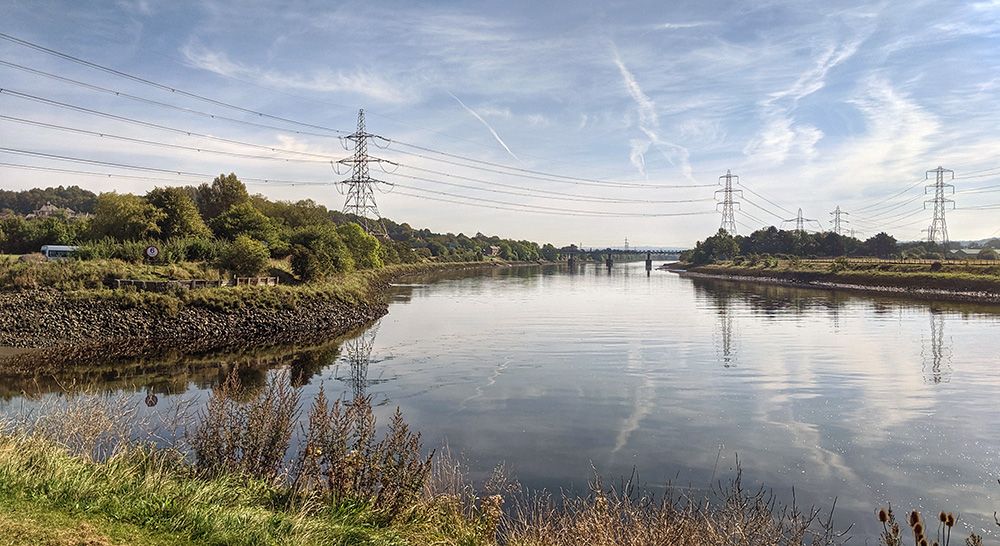
The next few miles were largely uneventful. The path mostly cuts across fields with the occasional short section on a quiet lane. We passed to the side of Carlisle Airport and, in the village of Crosby on Eden, left the line of the wall behind us for the remainder of the walk into Carlisle. We would now be largely following the line of the River Eden to the city instead. We stopped on a bench in Linstock to have some refreshments (Quarryside had prepared us a packed lunch for the day) and then crossed over the M6, passed through Rickerby and into Rickerby Park, crossed the Eden and followed the riverside path into the centre of Carlisle.

The next stopping point was the unassuming leisure and entertainment complex, the Sands Centre. We stopped here both to use the toilets and also as this is the latest of the passport stamping sites on the route. As were low on cash, I made a mercy dash into the city centre to find a cashpoint and also to pick up some blister plasters! On the way I almost ran into a TV crew. This was the day that Thomas Cook had gone into liquidation and the local BBC crew were filming a piece outside of the closed store. I wonder if I made it onto local news?
Ready to continue, we would still be following the meandering twists and turns of the River Eden for the next few miles Westwards. We were now tired and though the path is quite pleasant it did feel much as though we were merely walking for the sake of it by now.
At Grinsdale we finally got to leave the riverside path and were back to following the line of the wall. Not that there is much evidence of it. At Beaumont we had reached the end of our day on the wall; though still had a short walk towards Monkhill and our base for the night at Roman Wall Lodges. We were more than glad to have found our way to the accommodation. The very friendly and welcoming host, Paul, met us and showed us to the log cabin which was to be our home for our final overnight stop. Our bags were waiting for us and we gladly kicked off our boots, showered, and rested up for a few minutes.

Once refreshed, although our feet were swollen and though not keen to put shoes back on, another short walk down the road took us to the Drovers Rest pub where we had our fill of some excellent value, and well stacked burgers. Stuffed and properly refreshed, we made our way back to the cabin and fell soundly asleep.
We slept well in the cabin at Roman Wall Lodgings, woke up, dressed (gingerly putting our well worn feet into our boots) and headed to the reception cabin where Paul was cooking up some excellent breakfast wraps and preparing us a packed lunch.
We discussed our plans for the day. The original plan was to crack on with the last few miles to the end of the Wall at Bowness on Solway. From there we could get one of the two or three busses running back to Carlisle. This plan involved us having to carry our kit with us. We had rather got used to the idea of travelling a bit lighter over the last two days. We were tired. Our legs and feet were not happy with us. Paul had a much better idea.

We could leave our bags at the site and arrange for a taxi to meet us in Bowness. Paul had a deal with a local driver who would do the run into Carlisle for a fixed price, and would be happy to come back via the site for us to collect our bags on the way. Not only did this sound like a much better plan, but on checking, the cost of the taxi was not much more than the price of two bus tickets. Sold.

We left the campsite the way we had come the previous evening, re-joining the wall path at Beaumont. The lovely church is likely made of stone from the wall and is, apparently, the only church that sits exactly on the wall’s line anywhere on its route.

In Burgh-on-Sands we sadly didn’t have time for me to make a hoped for pilgrimage to the monument to Edward I. It lies about a mile north of the route and marks the spot where he died on his way to fight the Scots in 1307. At least the village has a statue to him next to the path which I could pull some stupid poses next to instead.

Leaving Burgh we were following an arrow straight road along the line of the wall and across the very flat and low lying marshes of the Solway Firth. Fortunately the fabled winds were relatively light and we were not in a time of year at which any potentially dangerous high tides were forecast.

At Drumburgh, the ‘castle’ built to protect its occupants from attacks by the Rievers has a couple of Roman Altars sitting in the front yard. The village also has an enhanced honesty snack box: a covered tuckshop with toilet facilities. We made use of both. I do like a Calippo and to get one here was most welcome.


For the next few miles we left the road and were back across some fields; passing through the village of Glasson, and then some more fields, re-joining the road close to Port Carlisle.
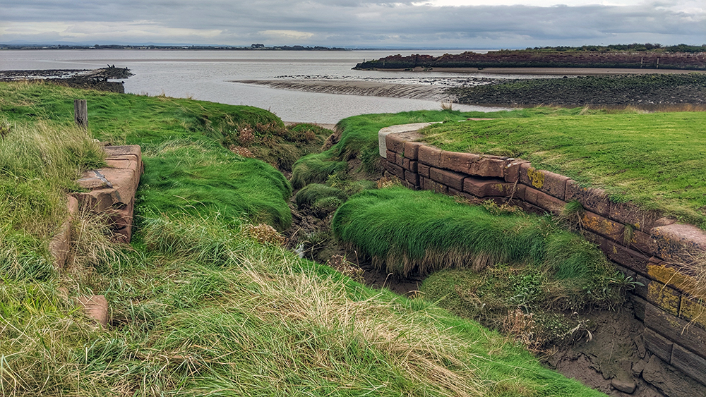
Port Carlisle is a strange place. Built in 1819 (on the previously named hamlet of Fisher’s Cross) the port was built at the end of a canal designed to allow goods traffic directly into the centre of Carlisle. The canal was short lived but was superseded by another short-lived enterprise, the Port Carlisle Railway. The wall path follows the edge of the Solway Firth into the village and across the silted up remains of the harbour entrance.
We left Port Carlisle and were back onto the road, but we were now almost there. We were into the final mile. It seemed to both go quickly and yet take forever. By this time we were just putting one foot in front of the other more in hope than expectation. We rounded a corner and there was the start of the village. A footpath in the village leads you back to the waterfront, and around another corner, and there it was. I’d been here before and so knew what to expect. Nash saw the little hut that sits on the path and looked round to me. “Is that it? Have we done it?” We had indeed.

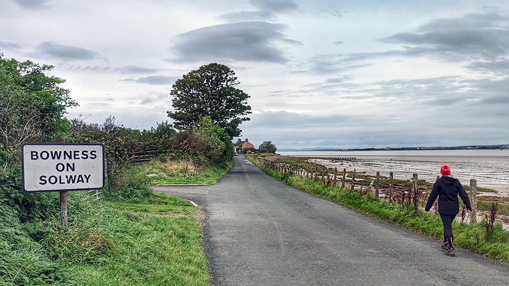
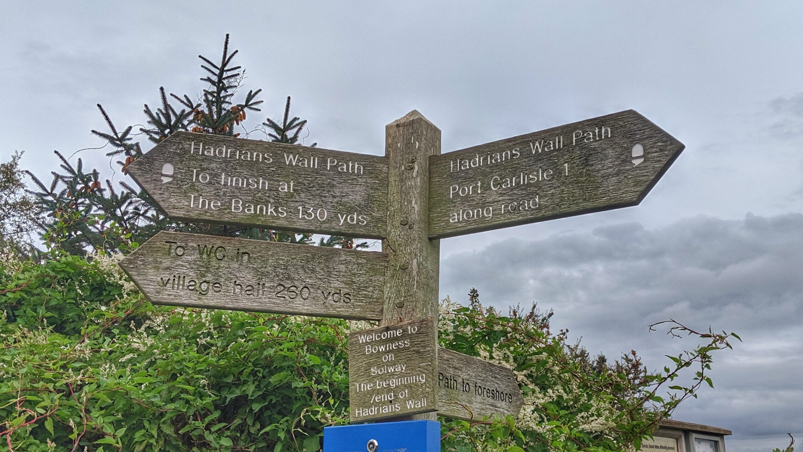
We were both quite emotional. It had been a long walk. Over 80 miles across four full and two half days. We took in the results of our efforts, put the final stamps into our passports, and finished our lunch as a celebratory treat.

We had finished about 15-20 minutes before our taxi was due to arrive. We wandered into the village centre. Sadly we didn’t have time to visit a pub, but did find an open toilet in the village hall. As we came out we saw a taxi pull up (a few minutes early). We met him and poured ourselves into the cab.
The driver was nice and friendly. Though he was driving nice and steadily it took a disconcertingly short amount of time to get back to Roman Wall Lodges to collect our bags. After a few more minutes we were driving into the big city and were dropped off at the station. We bought our tickets and, with about half an hour to wait for the train, picked up a couple of take away coffees.
The ride back on the train was rather surreal. We couldn’t really directly see where we had walked but we could work it out and it was odd to count back the days as we passed the places where he had our overnight stops. We were too exhausted now to contemplate the possibility of breaking the journey at Bardon Mill and making the 3 miles or so round trip to Vindolanda. We had tickets from our visit to the Roman Army museum but they were valid for a year. We promised ourselves that we would use this as an excuse to come back in 2020 and do a more leisurely visit with the car. Sadly of course, Covid-19 prevented that from happening in the end.
Instead we stayed on the train and all too quickly we were pulling into Newcastle. We had one final bit of walking to do; down to the riverside and along to the Malmaison.
Our suitcase was still waiting for us and the reception team greeted us and congratulated us. We had been given a better room higher up in the hotel overlooking the riverside. We made our way up in the lift are gladly crashed out on the massive and comfortable bed. When we were washed and refreshed and ready we were more than happy to put on the nice clothes that we had left in the hotel. First up we had a voucher for a celebratory cocktail that we cashed in at the hotel bar before making our way to a restaurant a few doors down for a slap up Mexican banquet.
We ate well, taking our time and savouring that tomorrow we didn’t have to walk anywhere. We were actually booked in for two nights at the Malmaison and spent the next day exploring the city – but entirely at our own leisure and with nothing that we had to do and, more importantly, nowhere that we had to get to by the end of the day. Newcastle is a great city and we had a lovely day. We didn’t venture far but made the most of the day and our extra night at the hotel.

What a fantastic end to an amazing trip. There is quite a diversity of landscape across the width of the country and all of it is lovely.