A Ride the Size of Wales
“The Welsh Green Way” (as I understand it to translate to in English) is a cycle route taking in the whole of Wales between either Chepstow or Cardiff (where I started from) in the South and Holyhead at the far end of Anglesey in the North. I set the ride as my annual tour for the summer of 2016, It was tough going in places, but immensely fun. I would recommend the route very highly.
Individual Posts:
You can read about the whole trip in one go on this page, or if you’d prefer you can read the individual posts from each of the days of the trip using these links:
- Lon Las Cymru Day One – 26 July 2016
- Lon Las Cymru Day Two – 27 July 2016
- Lon Las Cymru Day Three – 28 July 2016
- Lon Las Cymru Day Four – 29 July 2017
- Lon Las Cymru Day Five – 30 July 2016
The Whole Adventure:
Valleys
Having tackled London to Paris in 2014 and Coast to Coast and back in 2015 I had chosen the location for my 2016 summer holiday to be Wales – from bottom to top.
Lon Las Cymru is one of the longest and toughest of the major cycle routes in the UK. Having read about it and how some of the hills could prove quite tricky I thought I’d give it a go and so it was that on 26th July 2016 I found myself headed to Wales.


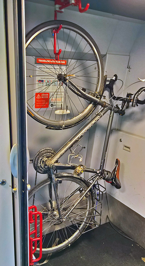
I’d done most of my packing the night before but gave a final check in the morning, made sure the house was safe and secure, had a little breakfast and then made the first short ride of the day down to the local station. I arrived in plenty of time and was soon on a train headed towards London. The train from Ashford International into St Pancras was full and I had to squeeze my bike in with three others and a lot of people. The three ladies with the other bikes were all headed towards East Anglia. They have been slowly doing the coast of Great Britain a piece at a time and this summer were off for a trip around the Norfolk coast. The idea of doing a very long route in several well defined and different trips sounds like a great idea.
On arrival in London; I had to get back into the saddle and ride from St Pancras to Paddington. I hadn’t left myself a huge amount of time but I still took the ride fairly easily (I upset a few cycle couriers by refusing to ride through red lights) and I got there quite happily and in sufficient time to get my bike into its pre-booked slot on the train to Cardiff. The train ride went nice and smoothly; I chatted to a few of my neighbouring passengers, and before long we were pulling into Cardiff Central and I was off having retrieved the bike.
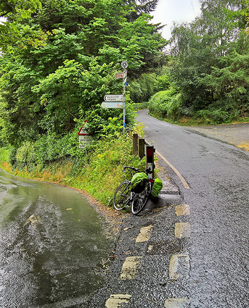
Another short ‘commute’ style ride took me down to Cardiff Bay where Lon Las Cymru officially starts; although I couldn’t find any sort of official marker. Indeed; having taken some ‘setting off’ photos I got ready to start the ride proper and immediately got lost. What few signs do exist appear to point in contrary directions. The bay area was also very busy but after a frustrating couple of minutes trial and error in varying directions I eventually managed to find myself following some National Cycle Route 8 signs and heading back out of the bay and towards the Taff river.
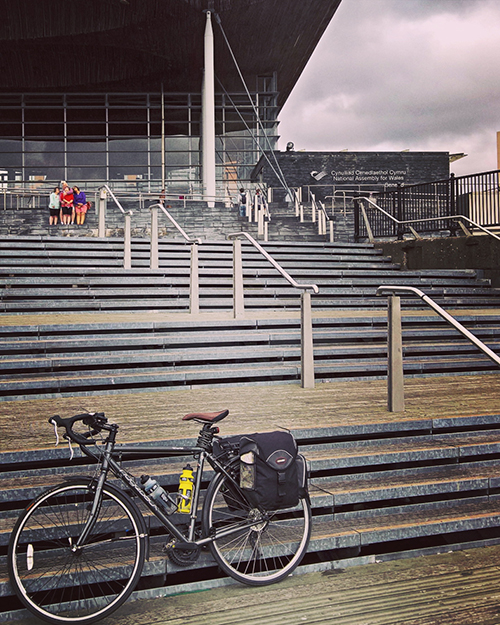
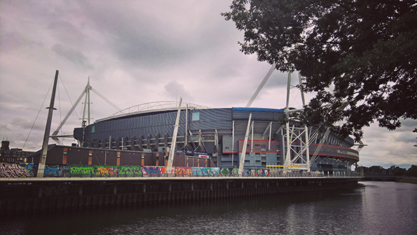
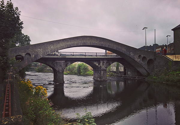
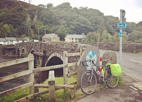
The start of the route winded around some parks and side streets before joining a riverside path close to the Millennium Stadium. The first few miles were quite slow riding as is the stop start nature of town centre trails but slowly the ride opened up more and more as I progressed through the suburbs northwards out of the City.
The track crossed under the M4 close to Castell Coch (I decided not to go up to the Castle) and after crossing some busy roads near Taff Wells it finally swapped onto old disused rail lines. The track along this section is nice and easy going but, as many others have mentioned before me, infuriatingly dotted with a large number of gates and other obstructions; many of which are incredibly badly designed for cyclists (particularly those with panniers); which is something of a shame for a long distance cycle tour route.


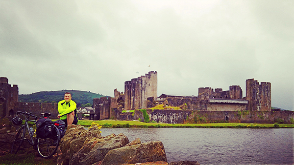
At a point a couple of miles north of Taff Wells the track splits in two and at this stage I had chosen to divert off the main track and detour off to Caerphilly; after all what is the point of cycling through Wales if you don’t stop at a castle or ten? I had been to Caerphilly a few years before but was looking forward to a return visit and a two mile detour each way should be worth the diversion.
Unfortunately, the lady on the Cadw desk at the Castle was about to turn out to be the one and only mean spirited ticket office person I would come across on my travels. She refused to either let me leave my paniers in the ticket office or lock my bike up the other side of the ticket gates. Unwilling to carry my bags around the castle or leave them on the bike on the public side of the gates I instead had to merely ride around the exterior of the castle. To compound things it duly began to rain. I had a small bite to eat sheltering against the external curtain wall and got into my wet riding gear before heading back towards where I had diverted off the main course at which point some more miles on roads, old rail lines and riverside paths brought me into Pontypridd.
At the short glance I afforded it, Pontypridd looks to be quite a depressed town. The ‘Pont’ itself is rather impressive but the town, or the parts that I cycled through at least, were quite run down. Working my way through the streets I stopped at a corner shop to get some Lucozade and water and then managed to get lost on the edge of the town whilst attempting to find the start of the Trevithick Trail.
Once I had managed to locate the correct path I was soon on some nicer riding although the track surface is quite rough in places. I met a bunch of guys on road bikes coming the other direction. One had a flat and they were looking frustrated. I stopped to see if I could offer assistance but they needed a replacement tube and my spares were too wide (though much more suited to this rougher terrain) so I had to leave them. The first section of the Trevithick Trail passes through a lovely section of the upper Taff valley and though progress was fairly slow I was enjoying the riding.
I was briefly taken out of any reverie as the cycle path passed under a road bridge on a section where it diverts from the old train line. For some unfathomable reason the climb out of the underpass consists a set of steep steps with no option than to get off and walk the bike up. It would have been easy to leave half the path with a cycle track but for some reason this had not been built. These are small and minor inconveniences but it can be very frustrating as interruptions such as these take you completely out of any focus.
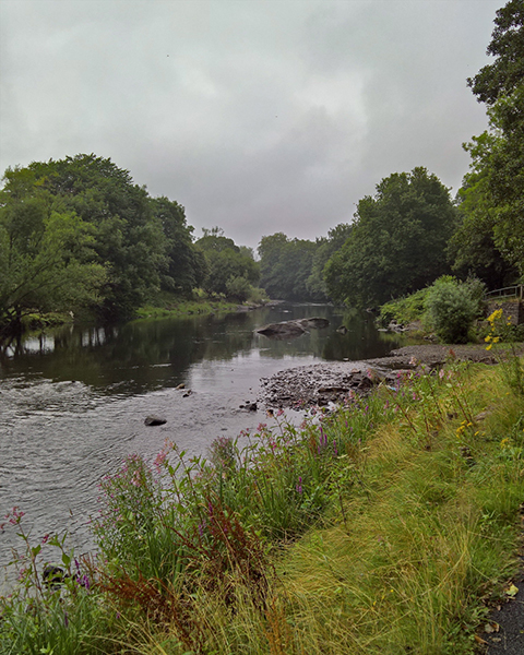
Fortunately once back in the saddle I was rewarded with the best riding of the day along the higher valleyside of the Taff with views across the river and the old coal mining works that could be spotted from time to time.
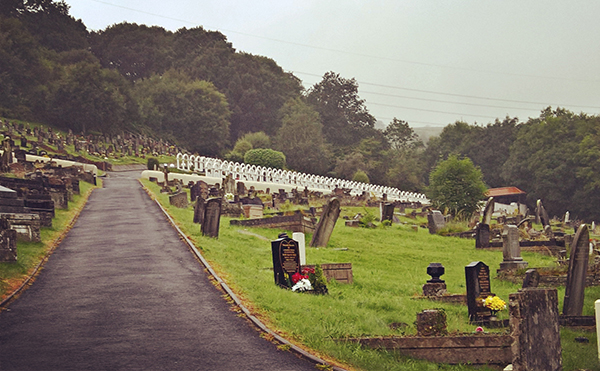
I had noticed on the map that the route passed through the old mining village of Aberfan and had considered a detour into the village to pay respects to those who had died in the infamous school disaster there. However any diversion was unnecessary. The Lon Las Cymru route passes right by the gates of the village cemetery and I immediately spotted what could be nothing other than the graves of the poor children who lost their lives in 1966. Stopping here should be an absolute must for anyone riding this route. The memorials to the children are utterly devastating. Many gave details of their lives and hobbies and far, far too many had additions to show that they had since been ‘reunited’ with their grieving parents. I don’t mind admitting that I shed a few tears in the fading light in the cemetery before making the final ride down into Merthyr Tydfil.
The ride had been slower than I had originally anticipated and with the diversions to Caerphilly and Aberfan the last of the day light was almost gone as I found my way to the Tregenna Hotel; a slight faded but still charming little town house hotel on the northern side of the town.
I had thought about heading into the town to find some dinner but it was later than planned, I was tired, and the hotel was doing evening meals so I had a quick shower in order to freshen up with haste and get back downstairs before the kitchen shut in time to order a god ‘pub curry’ and a pint of Heineken before heading back upstairs for a longer soak in the bath and then bed.
Day One Stats:
- Distance: 37.6 Miles
- Ride Time: 3 Hours, 32 minutes and 42 seconds
- Maximum Speed: 36.0 mph
- Average Speed: 10.6 mph
- Ascent: 1,660 feet
- Strava: https://www.strava.com/activities/654444054
Beacons
When planning my attempt on the LLC day one was always supposed to be very much a gentle and easy introduction. I quite regularly ride 35 miles; I try to do at least one such ride a week in the summer months. Those rides are fairly easy though on a known route and without much in in the way of hills.
There hadn’t been too many climbs on the way from Cardiff to Merthyr and whilst it was an uphill ride along the Taff valley it had been slower going than I had anticipated. Once again I had found myself overlooking the pannier factor and just how much of a difference a couple of well laden bags can have on the average speed of a days riding. Though I had detoured to Caerphilly and had stopped quite a while at Aberfan cemetery I still arrived at the hotel a good couple of hours later than I had planned.
Today was to be a bigger day with 72 miles planned to Rhyader. I had even considered some extra detours along the way (which would involve a major climb). Time would have to tell if that would happen or not; but that was a decision that was only to be made a few hours into the day, once I had a better idea of my progress. Before then were more important matters to take care of; breakfast, bike check and get ready for the off. I was up at 7.30 for a so so breakfast in the hotel and was in the saddle not too long after 8.15. I warmed up with a short ride up the hill towards the Trevithick memorial which marks the start of the worlds first locomotive hauled railway journey. After a quick salute to Richard Trevithick I headed back down and found my way, via a stop for supplies in a local Spar shop, back onto NCN route 8.
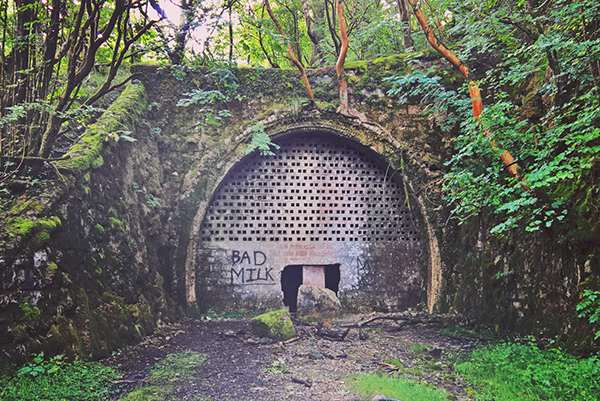
At the north end of the town the trail passed down a narrow footpath, over a main road and then opened out onto another old train line which winds its way towards Brecon. This section of the ride is littered with the goodies that one hopes for on an old railway line; a lovely viaduct, some old remains of a station/sidings and just to the side, the entrance to the abandoned Morlais railway tunnel which still has a large and grand entrance albeit boarded up with just a big enough gap left to entice people in. Apparently the tunnel can be walked through but that was not for today. Soon afterwards cycle route 8 abandons the track bed as for the next few miles it is still in use by the Brecon Mountain Railway.
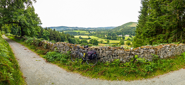
Its no immediate loss however as the route joins some quiet lanes down to, and around Pontiscill which, as is the case with most reservoirs, offers some beautiful scenery to admire as you pedal your way northwards and up. At points around the reservoir the formal route 8 diverts from the road and follows forest tracks instead. I had heard from a recent rider on a forum post that these tracks were badly churned up so I chose instead to continue following the road line instead for the next section down past the Talybont reservoir.

Having not ridden the tracks I can’t comment on how they might differ from the road; I can only tell you that whilst the road is nicely surfaced, I think that the gradients might be much more severe than the tracks. A little shortcut at the north end of Pontiscill has a very sharp drop and subsequent climb – the first proper hill I had experienced so far. Whilst not overly long it was tough. It was also at this point that I realised that my front gears were a bit knackered and I couldn’t drop into ‘granny gears’ without getting off and manually shifting the chain down. I did attempt some running repairs but these only made things worse. I did however, after a couple of stops to regain some puff, make it to the top and the watershed between the Taff and Usk valleys. The day was fairly cloudy but I still managed to enjoy the views before heading back down the sharp drop on the road towards the next reservoir.


The road was steep and winding and I was needing to apply brakes more than was ideal. I’m sure that probably contributed to getting the puncture I suffered coming down the slope. I attempted re-inflation and managed to keep air in the tyre so continued slowly down (I was off the worst of the slope by now) before realising at the head of the reservoir proper, that I would to make a fix.
Like most cyclists I have changed inner tubes and fixed punctures I don’t know how many times but for some reason today it just all went wrong. I had the new tube in fairly quickly having located the hole and having established that the tyre seemed good; only to get an immediate flat on the new tube as well. The next hour was spent with three more attempts to get a working tyre! I was beginning to lose hope. A kindly passing motorist visiting the area to show his son where the old family farm was before it was flooded, stopped to help. He used to run a LBS and gave me a hand with two of those fixes; he was equally perplexed. We patched tubes and tested them; made numerous checks on the tyre, and rubbed down several patches on the rim and eventually; thankfully the air stayed in.
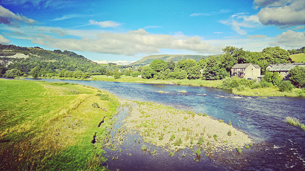
The delay had cost me an hour and the doubts about being able to fit in my little extra addition grew stronger but so long as the tyre help (spoiler: it did) I could at least get back on my way. Thanking my kind helper I loaded the bike back up and headed down the valley towards Brecon. The 10 miles from the gateway I had holed up in for the past hour into the town were fairly straightforward along the Usk valley with the last couple of miles following the canal straight into the centre of the town.
I found a bike shop, secured a couple of replacement inner tubes (ditching a couple that I chose not to trust any longer) and asked if they would be able to take a quick look at my front derailleur. Unfortunately they were already busy with a number of bikes already booked in. However as I stood outside the shop using my phone to try and locate any other shops in the area they had a change of heart and very kindly offered to give a quick look at the bike. They weren’t able to completely resolve the issue but they did manage to improve the gearing and send me back on my way.
By now it was lunchtime so I stopped for a rather ropey sandwich from a branch of Greggs. It wasn’t great but it did the job and now well behind schedule I headed out of town towards Talgarth. By now the day had got hot and I was sweaty and had to strip off a layer. The LLC route out of Brecon is one of those sections that is on nice quiet roads rather than the neighbouring A438 but is a lot more hilly with a nasty little climb near Llanfilo. It wasn’t helped by the road being very green and slippery under tree cover and I had to get off and push as I was losing control in places. Almost as soon as I’d made the top it started to drop back down the other side and a couple of miles further on I had reached the decision making cross roads just beyond Felindre.
The main downside of the Cardiff start point seems to be that you don’t get to have the fun of the Gospel Pass in the Black Mountains. I had worked out that it might be possible to add a 10-15 mile detour by heading up a ‘short cut’ close to the summit and then drop back down and through Hay-On-Wye. This always felt rather ambitious and the morning’s delays had already made me feel that this was going to be a no go. However I didn’t want to be deterred and was still very much in two minds when I reached the crossroads at which I had to make the decision. I stopped for a break there, and looked through the maps again and made a decision. I’d give it a go. Perhaps
I gave myself the caveat that I’d start the climb but if it looked like it would be a struggle I’d back out. I couldn’t afford to be spending an hour or two pushing the bike the four miles up towards the top of the hill. I set off. I made it about half a mile. A ridiculously steep section of hill loomed in front of me. I thought better of it and turned around! Gospel Pass will have to wait for another day.
I was soon feeling more comfortable with the decision as the route from Glasbury to Builth Wells turned out to be deceptively tough riding. This section follows the B4567 and as well as being one of the busier stretches of road along the whole trail, it was also into a headwind – one of those ones which whilst not overly strong just never lets up. I overtook a couple on the way who were much more heavily laden with paniers etc. than I and felt their pain as they slogged their way along. The scenery here is pretty enough but I found this to be the least enjoyable section of the whole ride.


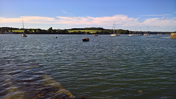
I eventually rode into Builth Wells at just gone half past five. Original plans to have a nice break in a tea shop were scuppered as they had all sensibly closed and instead I ate a Spar burger and a bottle of Lucozade on a bench next to the main road. Not exactly finest dining but needs must and it did a job. Back on the riverside path I met the couple that I had previously overtaken just parking up. We had a quick chat. They were not only riding Lon Las Cymru, but they had started from their home in Rennes. They were looking for somewhere to camp for the night but the closest campsite appeared to be a few miles out of town in the wrong direction so I agreed that they would probably be fine to pitch up for the night where they were; a nice riverside park with a handy toilet block a short walk away. I hope that they had a good nights rest and a good trip. I thought of them and their heavy bags a few times as I hit the mountains the next day.
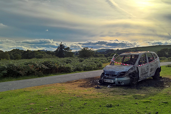
For me however this was not the end of the day. I still had 20 miles or so (give or take a possible diversion to the Elan dam) to get to Rhyader which was to be my overnight stop. From the town there was a pleasant climb up on to some open land above the river valley and some gorgeous few miles riding across to Newbridge with just the odd burned out car on the way.
Another climb out of Newbridge along some quiet lanes brought me onto the old coach road section. The old coach road was a couple of miles of rough track riding but with beautiful views and the evening light was just gorgeous. I had been a bit unsure about taking my bike along this section but was very glad that I had.
Coming into the small village of Llanwrthwl I had the chance to make an early decision about whether to divert to Elan or not. I had originally thought of continuing a couple more miles and then doing a there and back ride along the main route to the damn from Rhyader. However in the village a tempting sign pointed in two directions both of which said ‘Elan 4’. I realised that I had a chance to make a loop out of the diversion and took it.
I definitely chose the harder of the two roads but it was worth it for a few miles struggle. The road was constant bursts of sharp ups and downs slowly climbing higher each time. The climbing was such that rounding a corner and glancing through the roadside woodland I spotted Elan village down in the valley below me.
Elan village was built to house the workers building the dams that still provide water directly into Birmingham via an aqueduct running all the way from here to the city. There are 3 or 4 separate dams climbing up the valley. I would have liked to have seen more but the day was now drawing in and I had to be content with seeing the remains of the village and the bottom most dam. And I was content. I wasn’t done riding for the day but, after the early set backs which seemed an age ago now, I’d made a good days riding.


Dusk was properly setting in as I headed down the valley towards Rhyader and the excellent Horseshow B&B. It was 9.30 when I finally rolled up and booked in feeling rather tired and jubilant. After a quick shower I headed into town in search of food. I was too late for most options but just before 11pm I managed to persuade an Indian restaurant that was just about to close up to serve me a Lamb Rogan Josh, some rice, and a pint of Cobra.
Day Two Stats:
- Distance: 80.0 Miles
- Ride Time: 7 Hours, 28 minutes and 20 seconds
- Maximum Speed: 33.1 mph
- Average Speed: 10.7 mph
- Ascent: 4,947 feet
- Strava: https://www.strava.com/activities/655712013
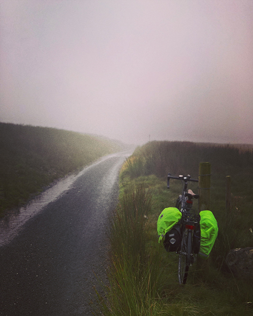
Mountains
If day two was my longest day in the saddle, day three was scheduled to be the toughest: Mountain Day! It also happened to be my birthday. What a sucker for punishment.
Over an excellent breakfast I wrote up my diary for the previous day and read through some nice birthday greetings that were waiting for me on text messages and Facebook. I walked into the town to get some supplies from the local Spar and then back to the Horseshoe ready to depart. What is it with Wales and Spar shops? Certainly in the South East corner of England where I live I can’t remember the last time I saw a Spar shop; Happy Shopper, One Stop, Co-op etc yes but not a Spar. Here in Wales there seems to be nothing else.

Right on cue the rain started. It didn’t look like it was going to be too short a shower and I didn’t want to hang around so I dug out the wet weather gear and pulled out of town up the hill for the first leg of the journey along some gorgeous lanes above the upper Wye Valley.

The rain came and went but the clouds never left. Things were good though and I was happy in my riding. I got held up for a bit by a farmer leading a lame bull along the track. I had a bit of a chat and he eventually got me to a place where I could go past and onwards; though before long I came across the rest of the herd of cows headed back in the other direction.


After a short stop to get water at the village shop in Llangurig I readied myself for what on the maps looked to be a tough climb towards Llanidloes. This fairly short stretch marks the swap from the Wye to the Severn valley and I had heard that the ride up to the watershed could be tough going but it was actually fine and I was soon by the, at this point in its journey, small Upper Severn river. As well as crossing into the next valley, the junction where the route turns to follow the Severn also marks the join between the Sustrans North and South maps – so surely this must be half way!?
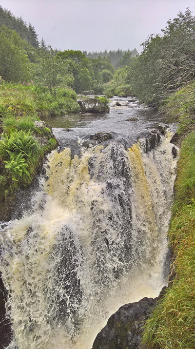
The next few miles was a fairly long slog in some strong drizzle climbing ever up alongside the river. The weather was poor but I was enjoying the ride. I took a break to look at the ‘Severn Break-Its-Neck’ waterfall and then stopped again at a picnic stop in the Hafren forest near the top of that particular climb. A wet lunch chatting to some visiting Americans (an older couple having a whale of a time and their children who were most definitely unimpressed with the weather) was refreshing and soon I was gliding back down towards the hamlet of Staylittle.
With the Machynlleth mountain pass next up I used the opportunity to dive into the village post office to top up the water levels. They also had a coffee machine and chocolate. Which was nice. The shop keeper was very friendly so chatted with him for a bit (I don’t imagine that he gets kept very busy).
The climb up on the pass was fairly tough but steady. I stopped for a breather a couple of times but made good progress. I would like to claim that the stops were to admire the views but almost as soon as I turned onto the pass road I was in the clouds. I imagine the views are breath taking. I however have no way of confirming this.
After a quick celebratory stop at the summit came the descent. I would have loved to have just let myself go but I don’t know the road and the visibility was poor. Not fancying coming off or into an oncoming truck I rode down fairly heavy on the brakes. Even so there were a couple of hairy moments on corners before the road levelled out on the more sedate drop for the final five miles into Machynlleth.
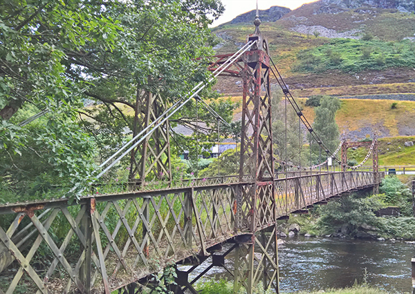
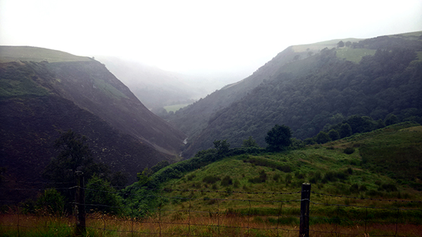
Another brief fuel stop (and a check on the state of my brakes) went quickly and soon I was over the lovely Millennium Bridge crossing the Dovey. Being on the North bank of the Dovey signals that you are now entering Snowdonia National Park. Naturally, so started the toughest climb of the tour.
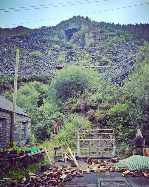
The first few miles is one of those sections which looks easy enough on the profile in the Sustrans maps. They show only the average though. Not all the short sharp ups and downs that make the ride like going along sharks teeth. From Corris the road is more even for a couple of miles into the old slate mining village of Aberlefenni where the climb proper begins.
The hills here are riddled with holes into the slate mines that must be fun to explore. An OS map printed on a board in the village shows a number of attractive looking walks here. It would be a grand place to stop for a day to explore if you have the time. The Sustrans map does not really show where the summit of the climb is so i used the OS map to get an idea. It didn’t show the whole road up but i did get the impression that the top would be by the end of a treeline marked towards the edge of the map.
At the end of the village a 90 degree turn indicates the start of the climb. The first few hundred yards weren’t too bad along a slate fence lined section but i could see what was coming. The main climb was hard. It’s a relentless slog. I had to stop for a few breathers and walked a couple of the toughest sections.
Eventually i saw the tree line that would mark the summit. Exhausted I pushed on delighted to be almost there. I would like to think my swearing upon reaching the tree line only to see the hill continuing up even steeper than before as far as I could see into the clouds could be heard back in Machynlleth. The reality is much more likely that with exhausted lungs there was no audible noise at all.


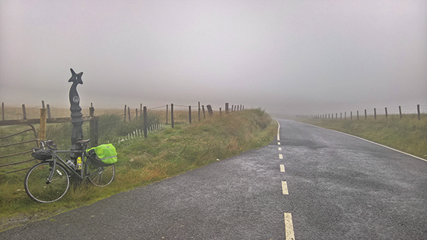
On the open hill out of the trees the cloud was thick and wet. The road had become a rough track; still tarmac but badly worn. Sheep came out of the clouds to stand on the road and mock like some nightmare Welsh version of a Tour de France mountain crowd. Fortunately though, however awful this was and however close to broken the false summit had left me, it was less than a mile to the actual, real, genuine summit.
Still encased firmly in thick clouds. Sweaty; legs burning; head down i barely paused to celebrate. The ride down to start was even not bringing much cheer at first. I could still not enjoy the view; the track was rough with loose gravel, and the sheep were still insistent on standing in the way of my progress.
After crossing the A487 the route is back into a mix of dedicated cycle paths and country lanes. Back down out of the clouds and with easier going I started to get my cheer back just in time to drop down into the centre of Dolgellau. I stopped on another town centre bench for food and rest before the final, flat, ten miles into Barmouth.

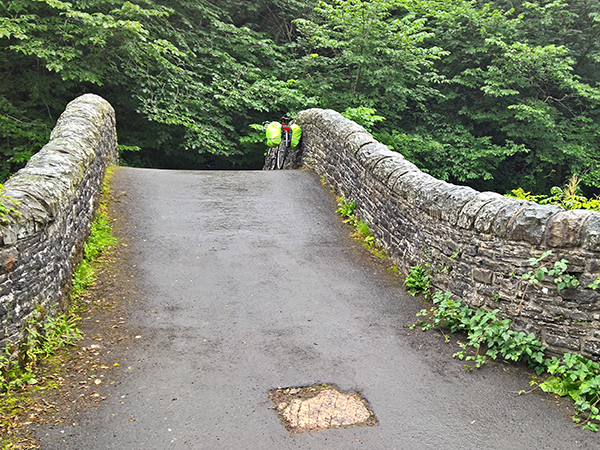
There is quite a marked difference in the ten miles either side of Dolgellau. From rough mountain tracks the next section is on an old rail bed. A moderate headwind wasn’t enough to make the Mawddach trail feel anything but glorious. From the old station and picture post card bridge at Penmaenpool the route follows the south side of the wide open valley with lots of remains of the old train line to entertain a certain type of geek (i.e. Me).

Tired and into the wind this was slow going for such an easy trail but I was happy again and getting ready for food and a beer.
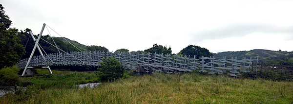
Stopping for a celebratory selfie I crossed the famous Barmouth Bridge and soon found myself parking up at the Tal Y Don Hotel. An immediate shower and pint later I was freshened up and waiting in the bar for the arrival of a couple of friends.
Rick and Tam happened to be vaguely in the area on a long camping weekend and insisted, rather marvellously, on driving out to take me for a birthday meal and drink. Apart from one incident where Rick instead on squeezing my thigh to see how tight my legs were (beyond very, apparently, as my scream indicated) it was a fantastic end to a long and tough but ultimately satisfying day. Rick. Tam. Cheers x
Day Three Stats:
- Distance: 63.2 Miles
- Ride Time: 6 Hours, 37 minutes and 47 seconds
- Maximum Speed: 39.4 mph
- Average Speed: 9.5 mph
- Ascent: 5,396 feet
- Strava: https://www.strava.com/activities/656646070
Castles
Day four broke and the first thing I noticed was the stench in my bedroom. I’d noticed it a bit the previous night in Rhyader but there was no escaping it today. My damp cycling shoes were disgusting; and still wet. I left the windows open whilst I went downstairs for a decent enough breakfast. I can’t say the smell had completely vanished by the time I got back to my room and packed the bags ready to start the next day. Looking out of the hotel window the weather wasn’t showing any signs of allowing the shoes to get properly dry today.


It was a wet drizzly start to the days ride. If yesterday was about the two mountain passes either side of Machynlleth, today was to be a day for castles. After a short stretch along Barmouth sea front the route joins the main A496 coast road for a few miles. Despite being a main road it wasn’t overly busy and the riding was pleasant enough with just enough ups and downs to get the legs moving again. In order to fit in enough time for masonry I stuck on the main road between Dyffryn and Llandanwg rather than stick to the official route. A back road from there led me into the middle of Harlech and right next to the Castle entrance.
Harlech Castle has a new visitors centre at the entrance with shiny new bike racks so I happily locked the bike up and, even better, the very nice lady at the ticket desk was happy for me to leave my paniers with her. I love Harlech Castle. I could have spent hours there but wary of the time I kept myself to a rationed time limit – after all I didn’t want to miss out on the other castles ahead of me.

The weather was still gloomy at this point which gave me an easy answer to one dilemma. The official LLC route does not actually pass through Harlech, but there was no way on earth I would pass within a mile of the castle without a visit. Upon leaving I therefore had the choice of whether to drop down and back onto the main coast road or climb a steep lane up the hills behind the town to re-join the official route on its way to Porthmadog. The weather made the choice easy. The reason for the official route would be the views. There weren’t likely to be any this morning so I headed for the main road.

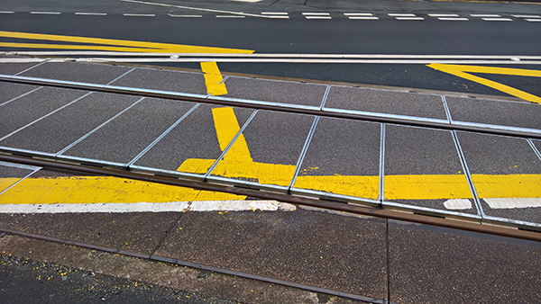
WARNING: To anyone riding this way be wary of the level crossing by Harlech station. The tracks cross the road at enough of an angle to look safe, but not so much as to prevent a wheel falling into the rail bed. My rear wheel got stuck straight in and without realising it I was arse about face on the side of the main road with my feet still locked into the peddles. Fortunately the main damage was pride. Other than a minor scrape on the knee I was fine. A kindly lady stopped her car to check I was OK. I was; but how was the bike? My bell was dented and I had lost a piece of plastic that protects a gear indicator. There were also a few holes in the handlebar tape but otherwise things looked ok and fortunately the wheels had escaped unharmed. Phew! My luck was in and so gathering up my dignity from the road I got back on the way before too many more people might notice.
Once moving again the next few miles were glorious easy flat riding most of the way into Porthmadog. A charming little town with a pretty harbour and a couple of steam railway lines radiating out this is another town where those with time to spare might break a day or two taking the train towards Snowdon before hiking to the summit. For me though there just the time for a pot of tea and a slice of cake in the station café and a quick look around one of the trains which would soon be headed for Caernarfon; as would I.
Having already deviated some way from the route already this morning I chose to continue to avoid some of the extra miles of the official LLC and followed the A497 into Criccieth. This was a pleasant enough diversion; the road wasn’t busy and had a good mixed use path along most of it. Descending into the town the castle wasn’t hard to spot. The bike was soon locked up by a tree and again the kindly Cadw staff allowed me to leave my panniers by the ticket desk.


I’d somehow never been to Criccieth before. Even though it is a much smaller castle (originally one of Llewellyn’s Welsh Castles before being taken and strengthened by Edward I) I spent as much time looking around here as I had done at Harlech. I was particularly pleased to see the pictures of the excavations at Dolforwyn Castle featured on boards in the visitor centre and although I wasn’t on any of them myself, a good number of friends are pictured. The Dolforwyn Castle excavations were where I spent my university summers as a part of my Archaeology degree and I’ve been going back almost every year since with friends; even though the excavations finished years ago.


Leaving Criccieth I kept with my diversions and followed the B4411 on a more direct route towards Bryncir. A rolling upwards road was nice and easy going and I was soon in the village where I finally re-joined the cycle route as it follows another old railway line which slowly continued to rise for a couple of miles before beginning a lovely smooth descent back down towards the coast. The final few miles the railway line from across the mountains runs alongside the cycle path. Just short of Caernarfon the train I had seen at Porthmadog came alongside and past me.


Coming into Caenarfon I noticed an unseemly rattle developing from the rear of the bike. A quick look indicated that one of the screws holding the rear rack in place had worked itself off (I’ve had trouble with that before). A friendly LBS just near the end of the railway line were able to get me a replacement screw and I also added a cable tie to make sure, and then I wheeled my way to the majesty that is Caernarfon Castle.

I could write a whole separate piece on just how great a castle it is and how it was probably the greatest castle ever completed in the UK (Beaumaris might have been better had it ever been finished). I’ll spare you the details here.


Another friendly castle gateman allowed me to leave my bike in a garderobe next to the ticket office thus allowing me a good wander around the castle. The sun was out quite strongly now and everything was right in the world. It had been about 5pm when I arrived and the castle was closing at 6 so my time did have some limits; so a short time before closing I recovered the bike and left. The cafes of the town had shut by now so I ate a Babybel and a handful of Jelly Babies and set straight off on the last few miles towards Bangor; the end of the day’s ride.
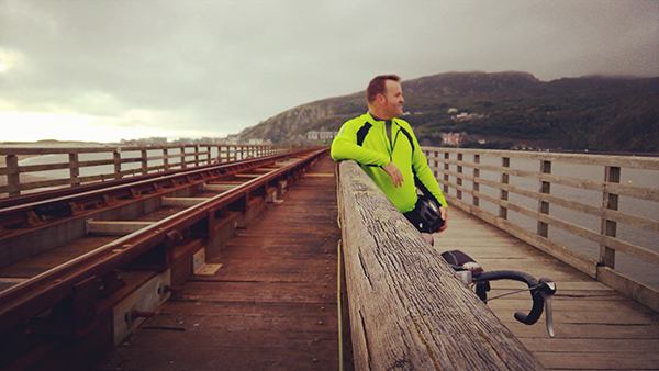
Most of this stretch was nicely along old railway lines and other easy going tracks following the Menai Strait. Y Felinheli was particularly pretty although from there I followed cycle paths next to the main road into the centre of Bangor.


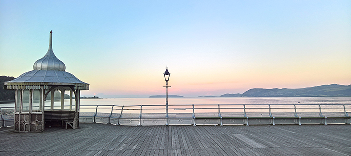
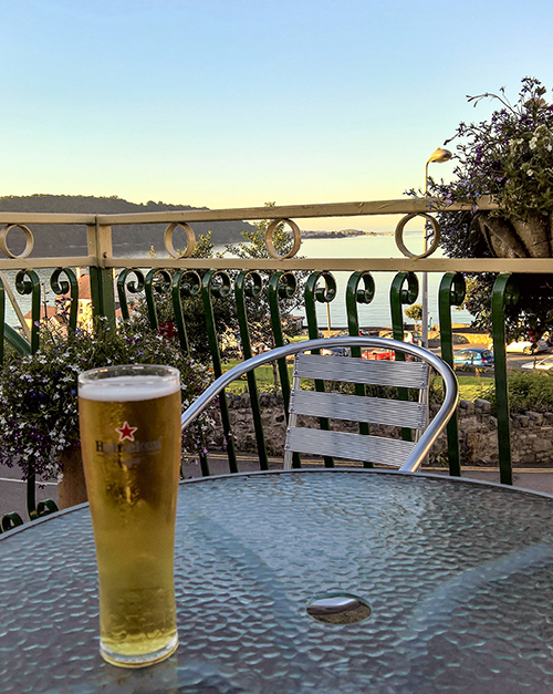
My hotel was located close to the pier which was easy to find and worth a visit. After a quick look around the pier I checked into the Eryl Mor hotel, had a hot deep bath and a lasagne from the hotel restaurant before heading back to the pier. I stayed there to watch the sun go down over the finally visible mountain tops including the summit of Snowdon. I stayed on the pier until it closed at around half nine and then went back for another beer and then to bed (in a room which was already talking on the unpleasant wet feet smell I’d left behind in Barmouth that morning)
Day Four Stats:
- Distance: 55.1 Miles
- Ride Time: 4 Hours, 55 minutes and 0 seconds
- Maximum Speed: 32.7 mph
- Average Speed: 11.2 mph
- Ascent: 2,093 feet
- Strava: https://www.strava.com/activities/657652177
Anglesey
The final day started with both familiar and unfamiliar sensations. The unfamiliar being bright sun shining through the window on the first sunny morning of the ride; the familiar being the stench of my damp cycling shoes.
Today was to be only a half days riding and the distance should be easily achieved in time. However having now got the hang of the slower riding speeds when fully laden I didn’t want to risk missing my booked train back home (due to leave just before 2pm). Breakfast started at eight so I got up at seven to make sure that I was fully packed and loaded and ready to set off straight after eating. As such I was on my way by half past eight.
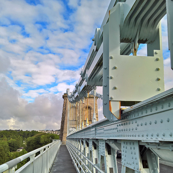
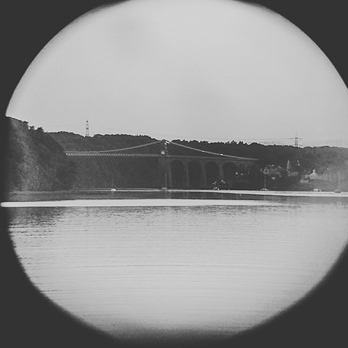
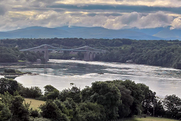
I headed out of the town towards Telford’s Menai Bridge. Crossing it, the cycle path on the outside edge of the bridge felt a little wobbly but the crossing didn’t take too long and I was soon onto Anglesey.

Just as I did around Harlech, I chose to follow the main road rather than the official cycle route at first. As such I followed the old A5 north west towards the opposite corner of the island. Between the Menai and Britannia bridges a small climb opens up to afford some lovely views back across the bridge and the strait. The road crosses under the new A55 road at the northern end of the new bridge. The fast, dual carriageway A55 is the reason that cycling along the A5 is a much more pleasant experience than one might expect of riding on such a numbered road.
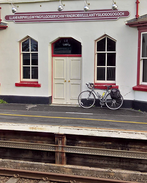
Immediately after the new bridge one enters into Llanfair PG. I managed to miss the famous station first time but doubled back for a few more classic tourist photos. Sadly I must confess that the opportunity for this photo was a major reason that I had abandoned the official route immediately upon entering Anglesey as route 8 skirts around the north side of the village. Just outside of Llanfair I picked the route back up and would remain following it for the rest of the journey into Holyhead.
From here the route is back on to quiet county lanes (with the occasional foray into marginally less quiet B roads). I probably saw about twenty cars between Llanfair and the outskirts of Holyhead (I’m excluding a short section where the A55 could be spotted to the side of the cycle route).
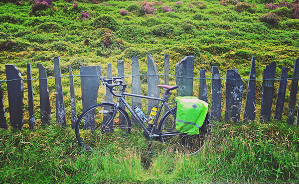
Anglesey is largely flat compared to the rest of the route although there was still roughly 1000 feet of climbing over this 32 mile ride so it wasn’t entirely level.

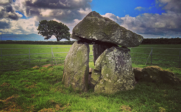
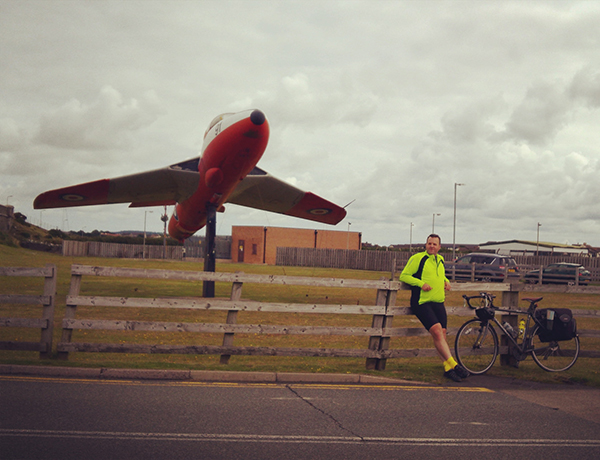
The highlights included the Bodowyr burial chamber which sits in a field just a few yards from the route; a telephone box at about the mid-way point across the Island. Now out of use someone has replaced the BT phone with an old fashioned handset purely for show; and the Valley air base. I stopped for a picture here mostly to see how long it might take before I was moved on. Interestingly it took upwards of fifteen minutes. Prince William had stopped working here a few months previously. I’m guessing that were he still here that time may have been a lot shorter. On the approach to Holyhead I had been considering a detour to the South Stacks but whilst i was making good time I didn’t feel that I had enough spare minutes to be sure not to miss the train. Therefore i was soon crossing the causeway onto Holyhead Island.
Just as the first few miles out of Cardiff are no indicator of the beautiful quiet trails ahead of you; the final two miles in Holyhead start to prepare you for a return to the real world. The route passes through some estates on its way towards the docks which are a far cry from the what has come before. There is one final short rise which would normally barely register but knowing the end was so close and with less scenic surroundings it felt like a drag; the consolation being that there was one final downhill glide to the docks and the end of the ride.
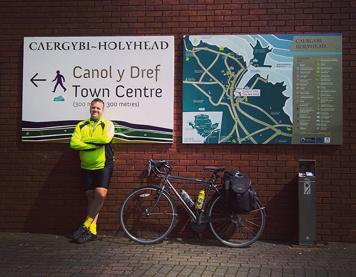
Just as there is no formal marker of the start in Cardiff nor does there appear to be one at the end. This is something of an oversight that I hope Sustrans might look to rectify. Whilst Cardiff does at least have the landmark Assembly Building as a surrogate marker there is no such location at the North end. Instead, having established that the maps indicated that I had definitely reached the end, I took a celebratory photo next to a town map and fag bin. Unlike the C2C ride I had no inclination to dip a wheel into the sea so instead wheeled the bike over towards the town centre in search of some food. I did have just over an hour so had plenty of time to walk the length of the high street twice; ascertain that there was nowhere worth stopping at, and return straight back to the station. The direct train to Euston was already waiting at the platform so I made the most of the time to get the bike secured, get changed in the toilet, get some food from the buffet car which was already open and serving, and then settle in for the journey home at the end of a most grand adventure and one that I would heartily recommend.
FOOTNOTE: If Holyhead was supposed to prepare me for the real world it clearly failed. Arriving at Euston I got back on the bike for the short ride to St Pancras. Avoiding the main road I navigated the back streets around the rear of the stations. The ride was easy enough but still in touring mode I managed to freak out a couple of other cyclists by (completely without realising what I was doing) giving them a cheery wave and a hello.
Day Five Stats:
- Distance: 31.9 Miles
- Ride Time: 2 Hours, 45 minutes and 37 seconds
- Maximum Speed: 33.8 mph
- Average Speed: 11.6 mph
- Ascent: 980 feet
- Strava: https://www.strava.com/activities/658322770
Overall Stats:
- Distance: 267.8 Miles
- Ride Time: 25 Hours, 19 minutes and 26 seconds
- Ascent: 15,336 feet