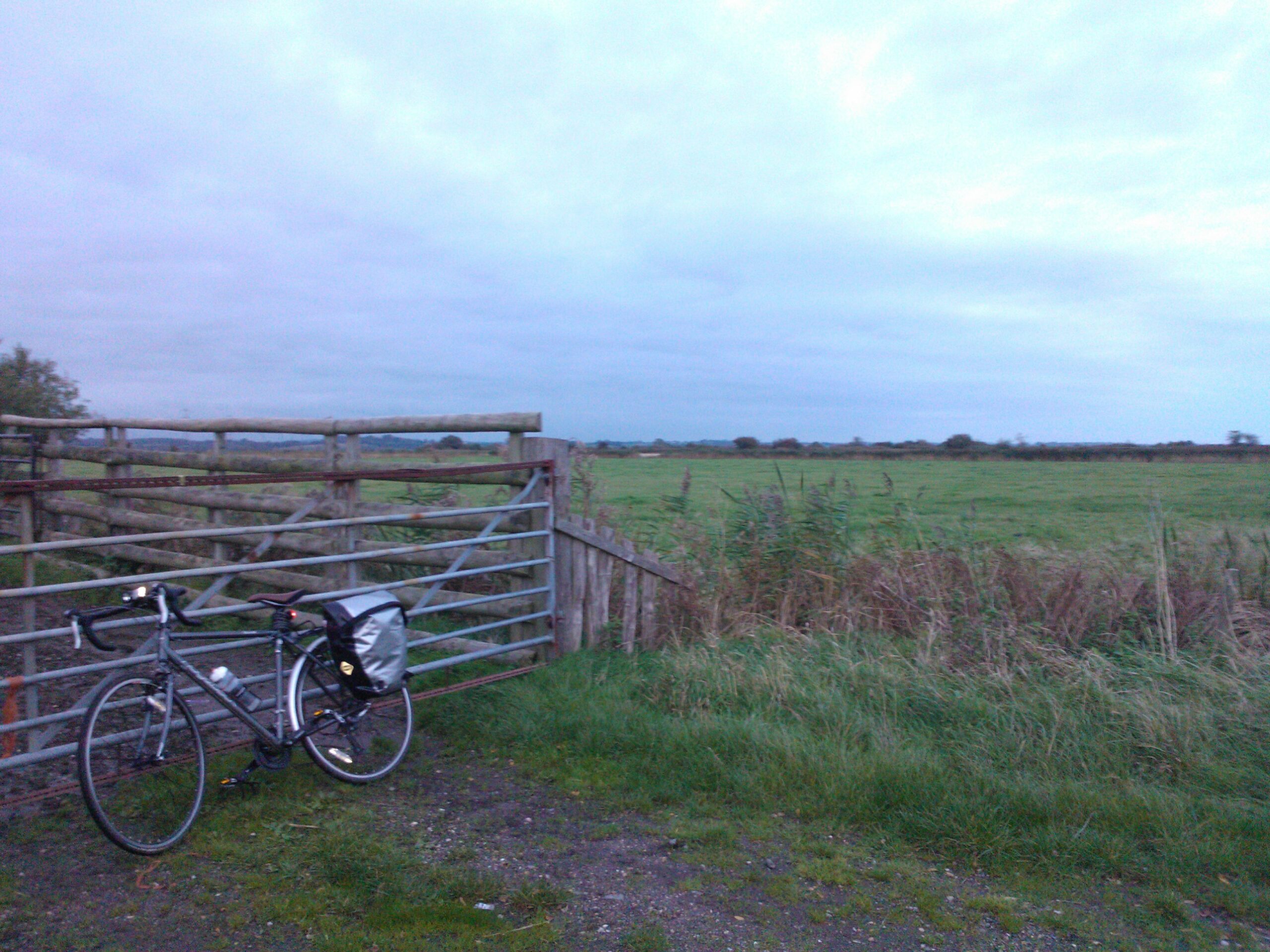
To France – and don’t spare the pedals
Back at the end of July, after getting the idea after seeing a guidebook advertised on the Sustrans website, and after a fair bit of planing and looking at maps, I had made my plans and was ready to set off on the Avenue Verte London to Paris cycle route.
Having already done 95% of my packing on the night before, and having left a couple of panniers and some cycle gear laid out in the spare room before I had gone to bed, I got up early on the first day (Saturday 26th) and had breakfast. After doing some final packing and making my final checks on the bags and bike I cycled the short downhill ride to Hastings Station to get the 07:50 train into London (I didn’t count that mile as a part of the ride).

The train journey was blissfully uneventful and I spent it reading the Saturday newspapers in order to avoid wasting much needed phone battery. I was using my Lumia 1020 phone to record my route via GPS and also to monitor my heart rate throughout the ride as well as using it’s excellent camera for making a photo record as well as the GPS one. I had packed a couple of spare battery packs but with the GPS tracking running throughout the day I was likely to need them. We got into London Waterloo East at about 9:30 and then I had the more awkward task of navigating the bike through Waterloo station and down the steps by the Shell building towards the start of the route.
The starting point of the official Avenue Verte route is at the London Eye so I rocked up close to it and took my ‘starting point’ photos before getting ready for the off. The actual starting point itself is a rather random bit of road about 100 yards back from the Eye. That means you don’t get the chance to be waved off by thousands of cheerful tourists(!) but I did set off pretty much dead on 10:00 under the watchful eye of a couple of policemen in an unmarked car next to me.

The ride started fairly easily but slowly through central London. The first section follows the Thames, crossing the river twice at Westminster and then Chelsea Bridges. Crossing past the power station the cycle path becomes a little less friendly through Battersea and Clapham but the riding was uneventful and before long it climbed slowly upwards onto and across Clapham Common, which gave a nice bit of open land after the more oppressive stretch along Queenstown Road. On the other side of the Common I got my first of many minor queries about the route leading to a minor detour and double back. On the whole the cycle route is well signed, although there are not many Avenue Verte signs on the English side (mostly relying on you knowing which of the ‘NCN’ routes you need to follow instead). These are mostly clear and frequent but it only takes one missing sign at the wrong place, or for some wag to have turned one around (there were a few of those along the route) to get led astray. However I also soon realised that some guerrilla cyclists had also been along putting up a series of stickers on posts pointing the correct way and these often turned out to be more useful than the official signs in some key places.

After that short diversion I was soon back on track and into familiar territory as I passed Wandsworth Prison and down onto my old stamping ground along Magdalen Road and into Earlsfield (where I played rugby for several years for Bec Old Boys) whilst living down the road in Tooting. One quick crossing of Garratt Lane and I was soon onto the Wandle Trail.
The Wandle Trail runs alongside the River Wandle on various qualities of path for the next few miles. The mix of surfaces and regular road crossings along with a number of other cyclists and dog walkers kept the pace fairly slow but it was easy going. After passing the back of Merton Abbey, the Wimbledon dog track and the rather bland looking flats that have finally taken over the derelict space that previously housed Wimbledon FC’s old Plough Lane ground, we opened out into the rather lovely Morden Hall Park. With the first 10 plus miles done and a nice open space I choose to have my first break here. Although lovely it wasn’t actually the most comfortable (no benches) and I managed to mess up my GPS recorder and lose the tracking up to this point which was a bit of an irritation; after a handful of crisps and a couple of squares of chocolate I saddled up and got back on my way.

At the top of the Wandle Trail there were a few more moments of confusion, map gazing, and doubling back as the route heads through a range of residential back streets and inter joining cycle paths to Carshalton, before heading into the first patch of real open country leading up onto the first stretch of downland. This really did feel like being out in the country, if only for a couple of miles, before dropping back towards suburban London and then back up into the busy and rather lovely Three Oaks park which had the first vaguely serious climb of the day. At the top of the climb though was a nice rewarding café with benches. I bought a bottle of 7up (and got the staff to kindly refill my water bottles) to wash down some of my provisions and I took another short rest.
After Three Oaks the route was again a bit more on road and less pleasant (though with some off road sections to break things up) but it did pass by a rather magnificent Lavender field before dropping down into Coulsdon where we had to follow some one way streets through the town and negotiate some cycle lanes around a couple of busy roundabouts before the next big climb.

This really was the first climb proper and in the top six climbs of the whole tour. What’s more by the now the day was hot. I was liberally applying sun cream to the outside of the body and water to the inside as I began the long and hot but gorgeous slog onto Farthing Down. It is remarkable to think that not only is Farthing Down still within London, but that its actually under the care and management of the City of London Corporation. The landscape is a mix of open grazing land interspersed with some lovely patches of woodland and a couple of quiet villages. It really couldn’t feel further from the City that owns it. At one of the villages, Chaldon, I took another short diversion and had a break at the church. A very pretty, small and squarish church; as well as being lovely from the outside and with a nice bench to rest up and refresh on, it also houses a remarkable 11th – 12th century mural occupying almost one whole wall. Depicting purgatory and hell the mural is reportedly the earliest English wall painting and one of the finest in Europe. Why it is not more widely known amazes me. More information can be found at: http://www.surreycommunity.info/chaldonpc/history-of-chaldon-church/


Whilst taking a break at the church I took the opportunity to call an old friend living in Redhill, and whose house I would be passing very close by, to check that he was in and to make him the very generous offer of having the opportunity to make me a cup of tea. Chris confirmed that they were (and would remain) in and so I got back onto the bike and made the final exit out of London. It was easy to mark leaving the Greater London area as I shot down off the North Downs and across the M25 into Surrey.

From here the first real sequence of cycle paths and country lanes lead me past village pubs with quaint duck ponds, and village greens with cricket matches being played (surely placed there especially for any French cyclists coming the other direction) before coming into Redhill and making the short (but very hilly) diversion to Chris and Gill’s house where I whiled away a lovely hour with a cup of tea sitting in the garden getting occasionally showered by their children who had taken control of a hosepipe. Refreshed, and cheery, and with water bottles filled I was back on my way.
The route now varied between residential streets and some surprisingly hidden little cycle tracks; small industrial estates and farms; through Horley and Crawley passing by Gatwick Airport. The route passes right by the end of the runway and so I took another short break there for some silly photos and then carried on through the Crawley suburbs before joining up with the first really excellent piece of the route – the Worth Way from Crawley to East Grinstead.

The Worth Way follows the route of the old railway line linking the two towns and, with the exception of a couple of minor diversions where housing now sits on the route, took me all the way into East Grinstead. The line does mostly climb up out of the Aran Valley and as such I found the section lovely but slow going. By now the legs were weary and I was beginning to really feel the additional weight in my panniers. Whilst I am fairly used to using panniers I had never done such a distance with them so fully loaded. However, other than a small stop to break into the grounds of the disused Rowfant station, I soon found myself on the edge of East Grinstead and after a quick check of the map soon found my way to the Cranston House B&B which was to be my base for the night.

A proper old style English B&B, it provided comfortable and functional if not remarkable accommodation and the owner was used to accommodating Avenue Verte cyclists and was very friendly and helpful. After freshening up, the evening took me into the town centre, which was surprisingly nice – a proper English market town (although there did appear to be too many vacant office block buildings hinting that it was experiencing a bit of a downturn). Dinner was in the glamerous surroundings of the local Pizza Express and consisted of a large meaty pizza, with desert and a large beer before I wandered back to the B&B and going easily to sleep in a big comfortable bed.

Day One Statistics:
- Distance: 50.68 Miles
- Ride Time: 4 Hours, 34 minutes and 3 seconds
- Maximum Speed: 35.3 mph
- Average Speed: 11.0 mph
- Average RPM: 57
- Revolutions: 15,620
- Ascent: 1,881 feet
- Strava: http://www.strava.com/activities/173197637