26 October 2024
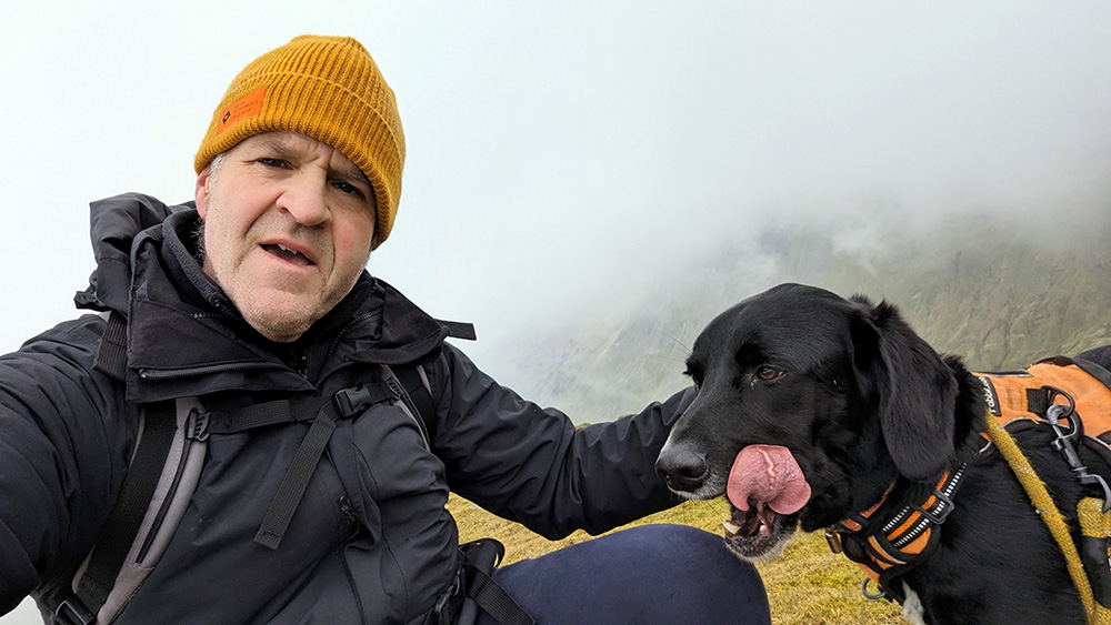
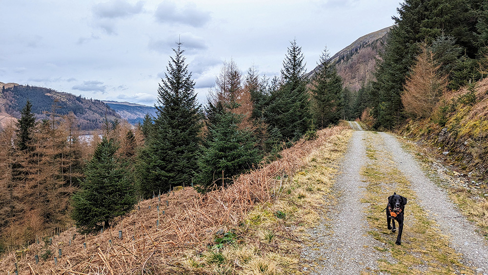
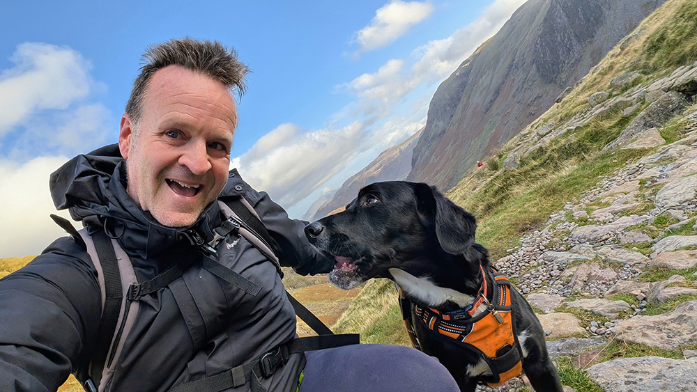
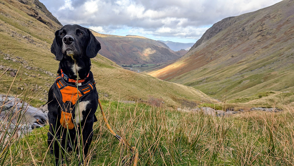
It’s October 2024 and Henry asked if he could go up a big hill again. A proper big one this time. Who am I to argue with a dog? With that request in mind, I decided that we should give the big one a go.
We set off early on the Saturday morning have packed a rucksack the night before, and drove across the A66 to the Lake District. Through Keswick and then south to Seathwaite. There were already a number of cars lining the road but we headed into a farmers field and handed over £5 for a day ticket. Farming in this part of the world isn’t easy and I’m more than happy to help farmers find new ways to be able to continue maintaining their farms and the land.
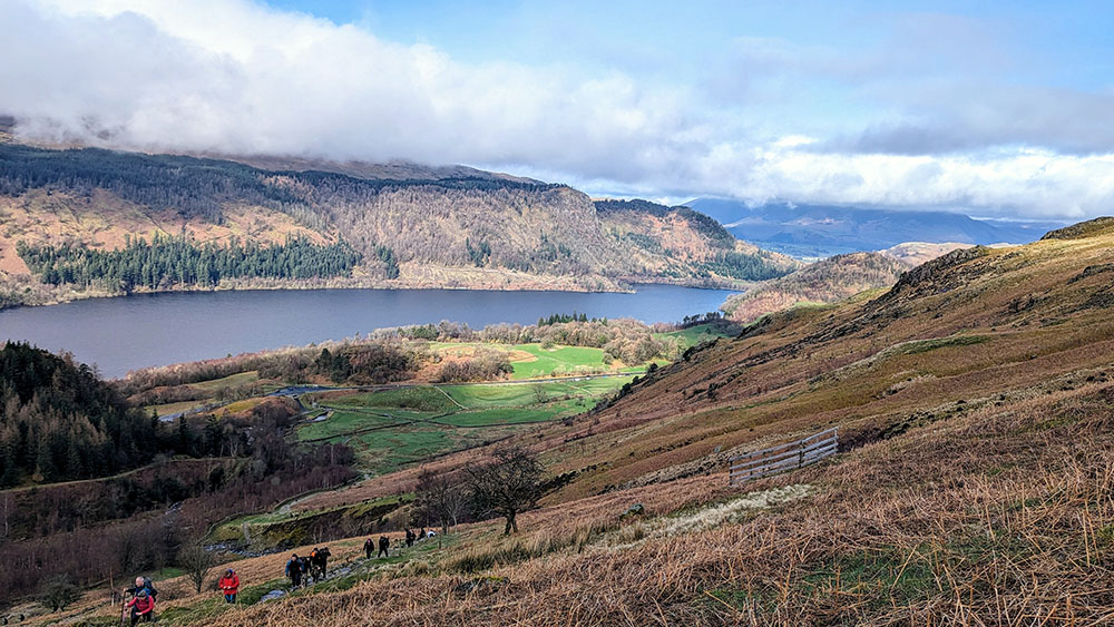
Seathwaite Farm is almost entirely surrounded by some of the highest hills in the country; though the highest of them remains hidden from view for now. It’s a beautiful setting for the start of a monster walk.
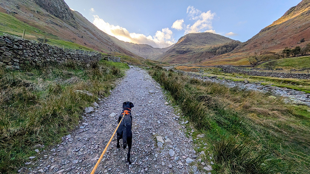
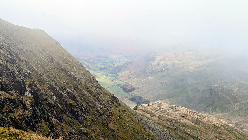
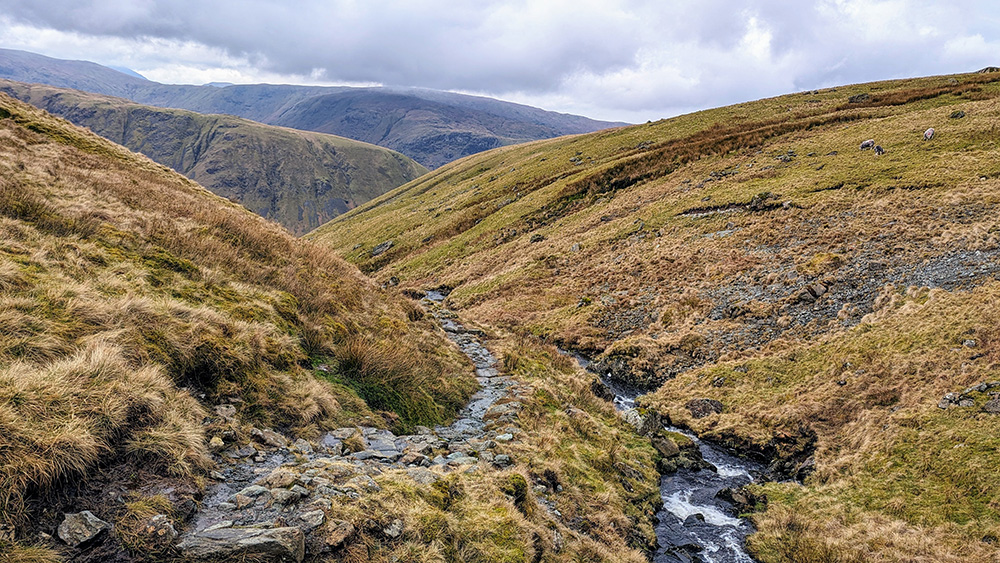
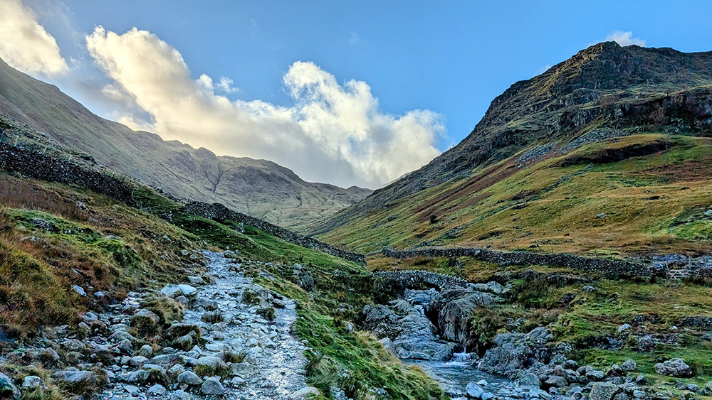
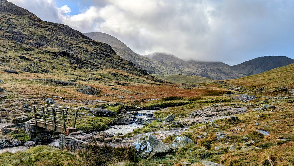
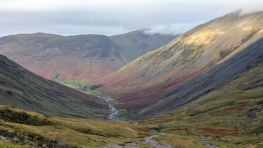
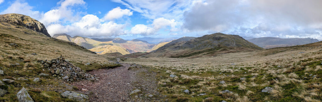
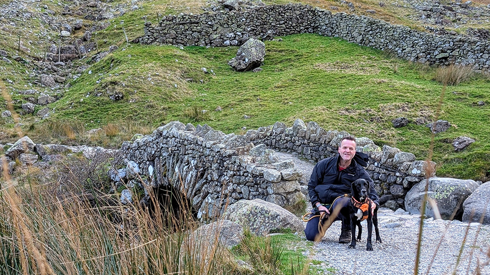
We set off with an easy first mile following a good path alongside Styhead Gill as far as the pretty Stockley Bridge. For the first part of the ascent we would be following the gill. Crossing the bridge brings the start of the proper climbing up onto Greehow Knott and then following the gill up towards Styhead Tarn. The views are already breathtaking at this level (less than half the way up) and we stopped a few times to make the most of them.
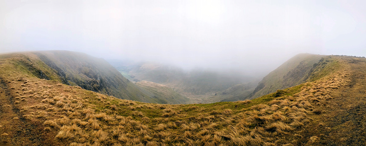
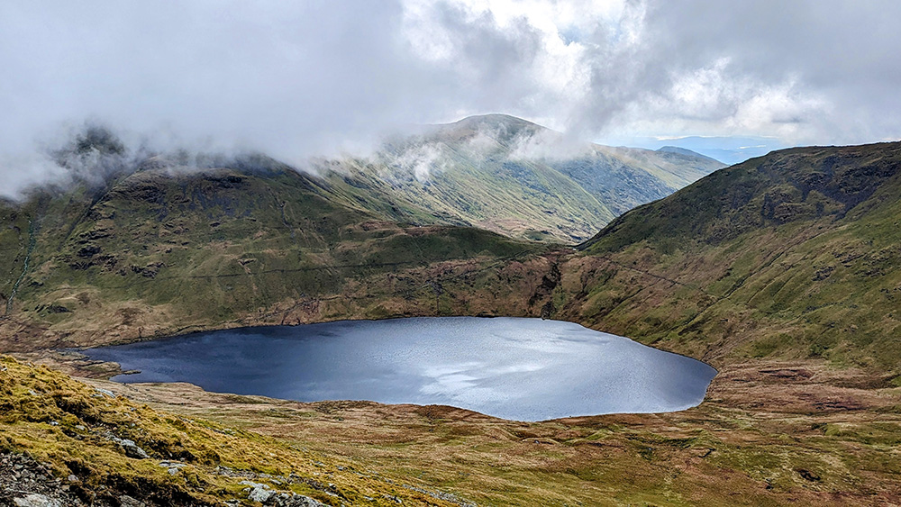
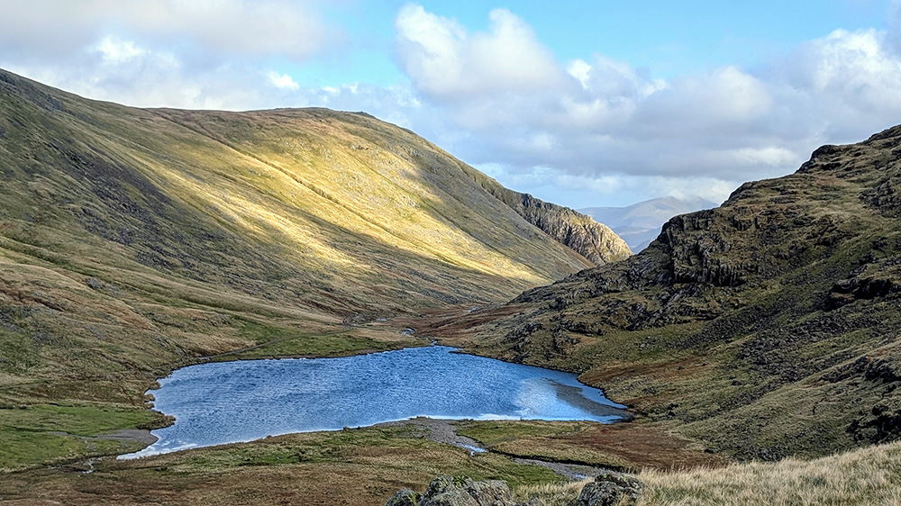
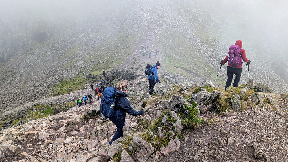
As beautiful as it was, we didn’t linger at the Tarn despite it looking like an inviting location to pause. Rather, we continued on to Styhead, passing the Mountain Rescue Equipment Store, and then turned to the east following a path heading towards Sprinkling Tarn, and from there up and onto Great End. Not that we were to be heading all the way to either of that lake or hill. Instead, we could see the path that we were to take, snaking its way around, and up, the side of the hill to our right. This is the famous “Corridor Route”.
We could make out a couple of other people some way along the corridor, but it was a lot more empty than the other routes. The start was easy. We follwed the contours up and around, with a stunning view down Wasdale below us.
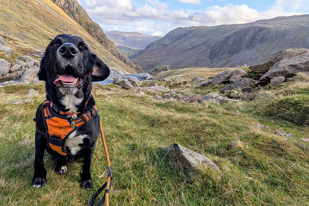
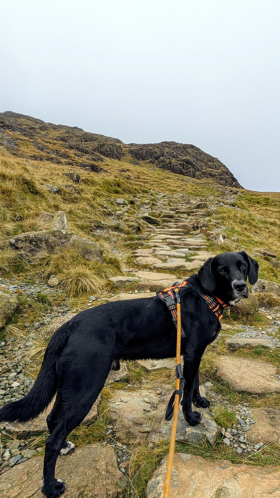
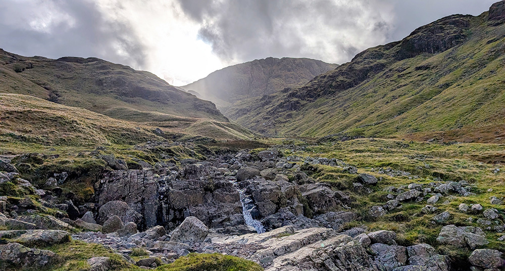
The first tricky part of the corridor was at the crossing of Skew Gill. There is nothing particularly difficult about this section of the route, however crossing the gill includes a drop into, and then a scramble back out of, a small gulley. Going down was easy enough and the scramble up was straightforward for me – but for a small dog the clamber up had the potential to be a bit more hard work. I needn’t have worried about it though. The Springer part of our cut-and-shut Springador made short work of it.
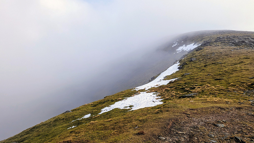
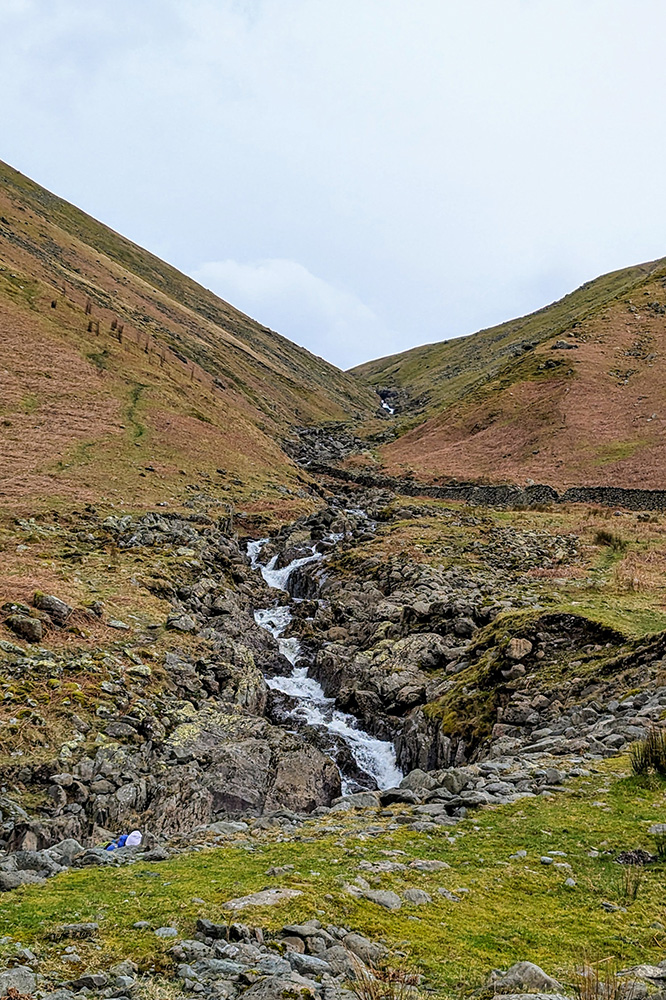
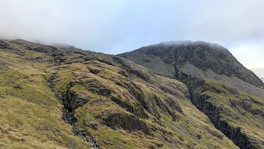
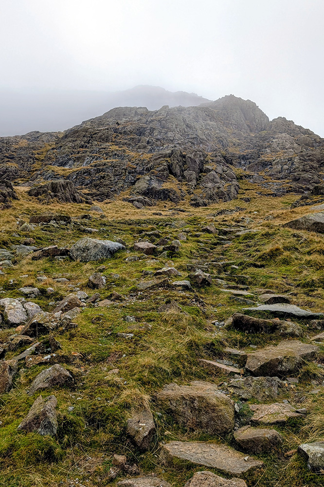
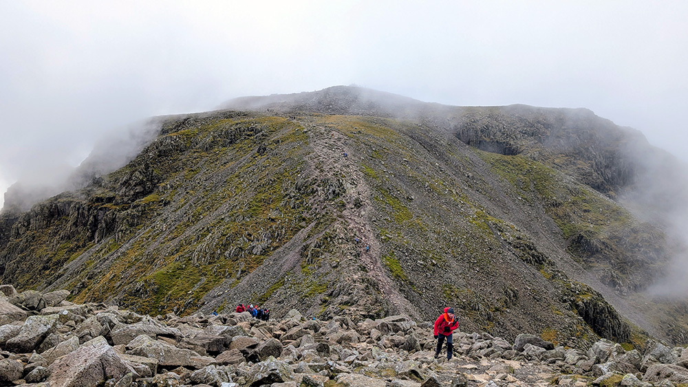
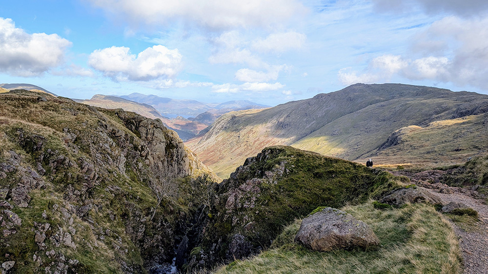
The path then continues along and upwards. For the most part it is straighforward with just a few points where you need to hold onto a rock or two to assist you. That is until you get near to The Bad Step. There is a build up across an increasingly stony part of path until you get near to Greta Gill where everything gets a lot more rocky – both immediately in front on the path, but also all around you. There is something of a drop off the side of the corridor route in places, and ahead the scar of Piers Gill cuts an impressive sight into the hillside. And then you get to the Step; a drop down a part of the rock face of about 20 feet.
Again, this isn’t too difficult a section, although it might be an extra level of interesting when the rocks are wet and slippery. It wasn’t so much fun for Henry though. He normally likes to be in front at all points on our walks but as we decsended here he was happy to follow my lead and settled behind me. For most of the decsent we just needed to take some short measured steps down; however in a couple of spots (most notably right at the last drop down back onto the path again) there is one bigger drop which requires a scramble down making as many points of contact as possible. I climbed my way down and then helped Henry down – lifting him and lowering him down beside me. We were all good and ready to continue on our way.
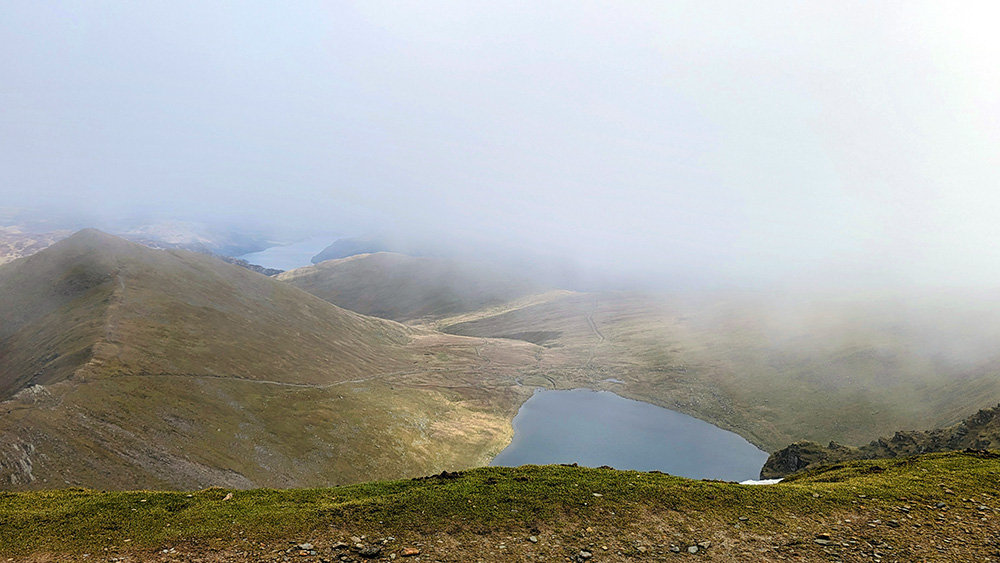
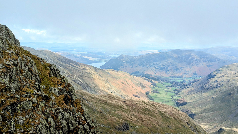
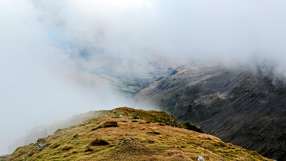
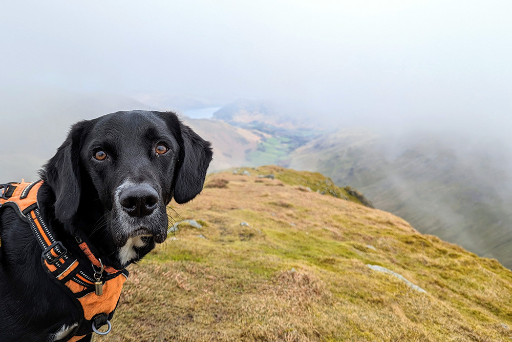
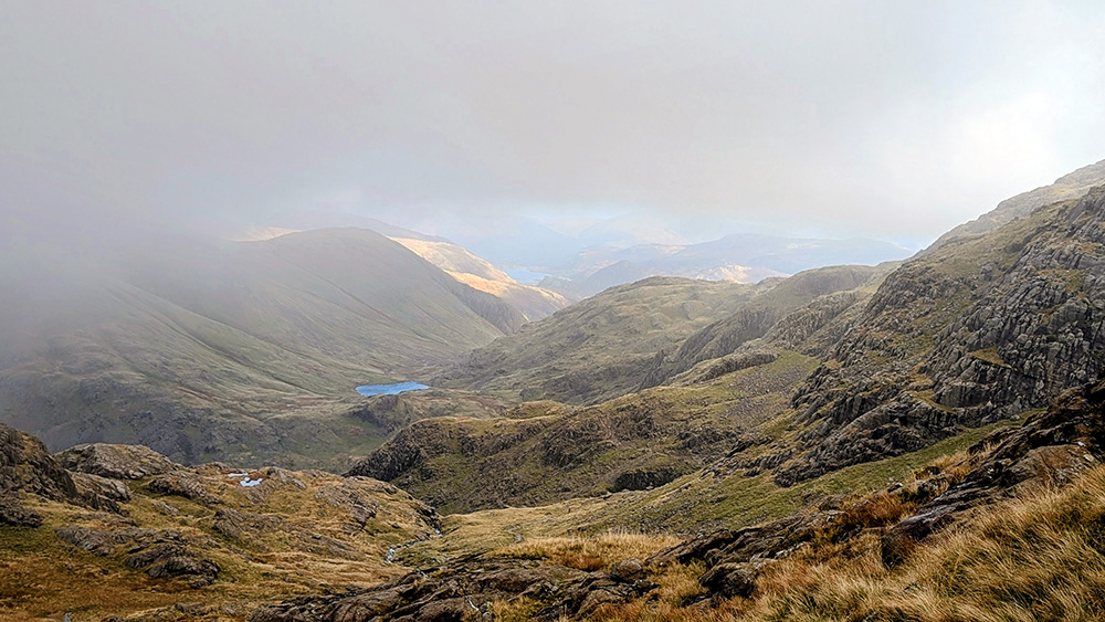
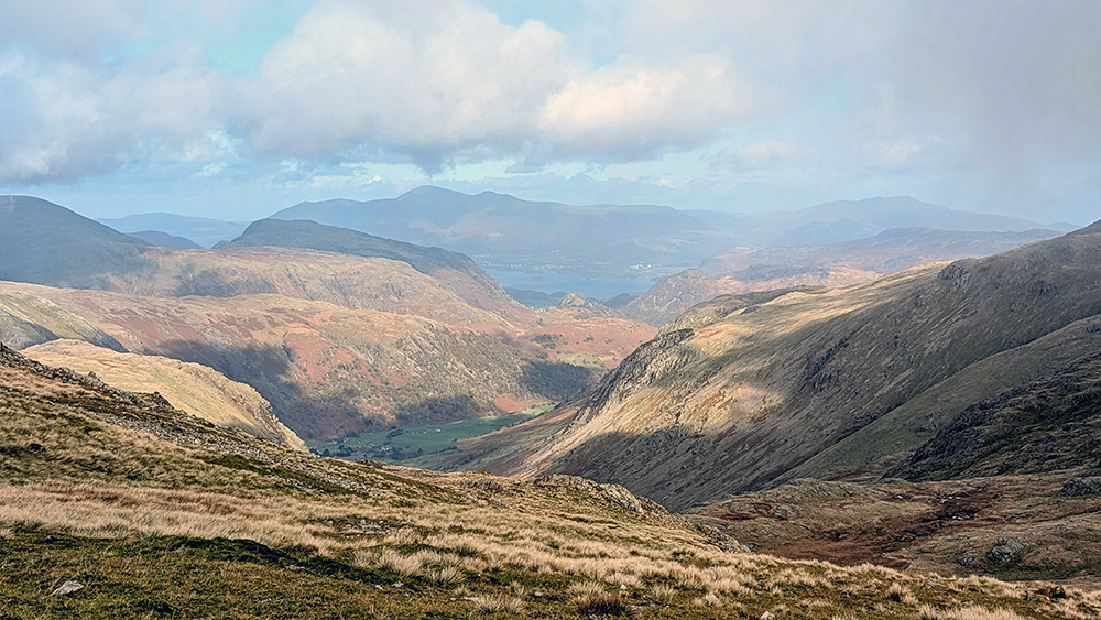
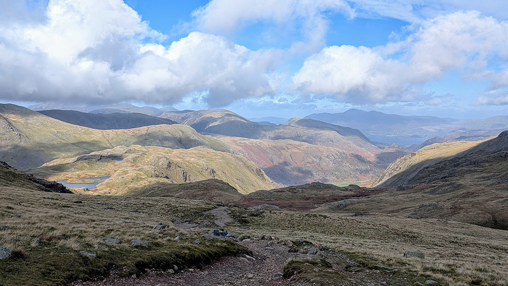
Once down from the Bad Step we were back on our way along the corridor. Despite this section still including some quite steep climbing, the path was easy enough going and the next half mile or so only really comes to mind for the great views from it to the West and South.
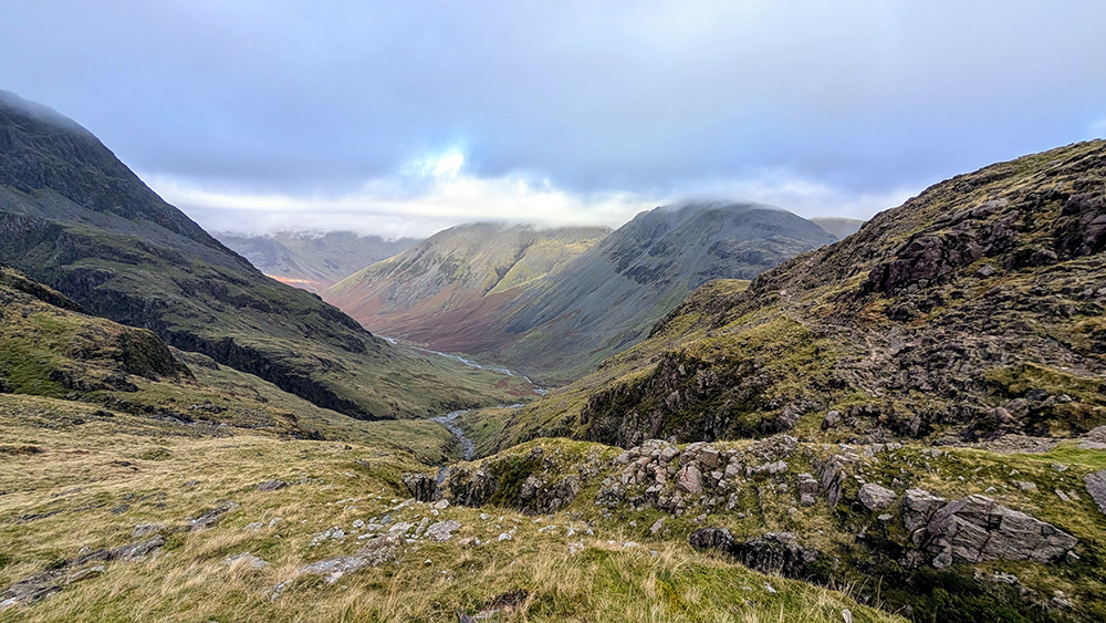
When reading up in preparation for the walk, I’d managed to miss the note that one should continue on the corridor route until meeting the path coming up from Wasdale Head over Brown Tongue (stop sniggering). Apparently the distance added is more than made up for by the easier final approach. We, however, took the more immediate route up following a path that runs between the summits of Broad Crag and Scafell Pike.
As we started along it, this looked to be a reasonable decision. Although steep, there was a decent path to follow and we could start to see the summit appearing above us to our right. As we progressed things got a little less “easy” however. The upper part of this path is a rough scramble up a scree slope. It was increasingly rough going each step seemed to be on looser ground. It is also a narrow path. We weren’t the only ones stupid enough to be coming this way. For the first time since nearer Skew Gill there were other people; all descending. We had to take it in turns to progress at a number of places. The forced opportunity to grab a breather was welcome!
Eventually we made it up. Not to the top, but up. The top of the scramble brings you out to meet the much more well trodden path from Broad Crag and Ill Crag, and we found ourselves amongst a whole new set of people approaching from various other routes. After an hour or two of near solitude we were suddenly in amongst a whole lot of people.
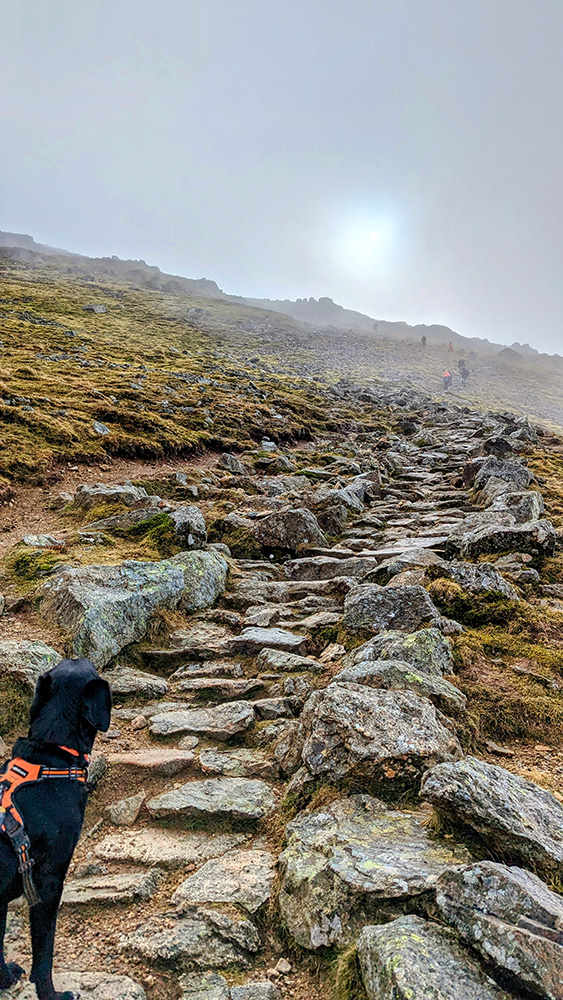
We turned 90 degress to our right and onto the final approach to the summit of Scafell Pike. There was probably only another quarter mile of walking to go from here, but it included another 100m of ascent in that short distance; all over rocky ground.
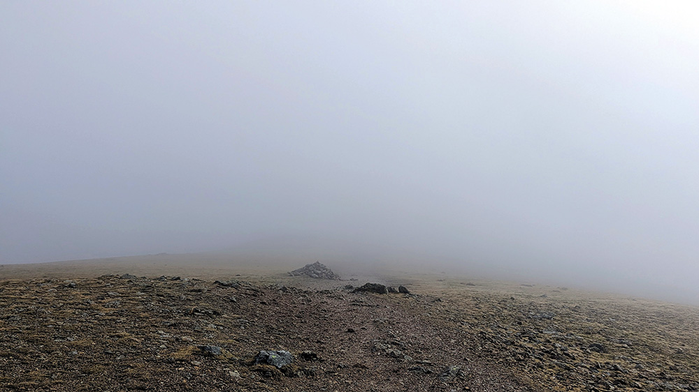
There is little or no grass on the summit (nor the approach) here. Wainwright describes the top of Scafell Pike thus:
“The surrounding area is barren, a tumbled wilderness of stones of all shapes and sizes, but it is not true, as has often been written and may be thought, that the top is entirely devoid of vegetation: there is indeed a patch of grass on the south side of the cairn sufficient to provide a couch for a few hundredweights of exhausted flesh“
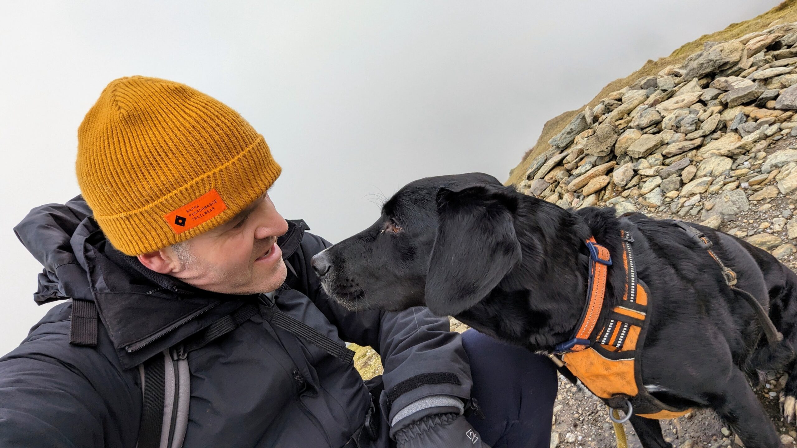
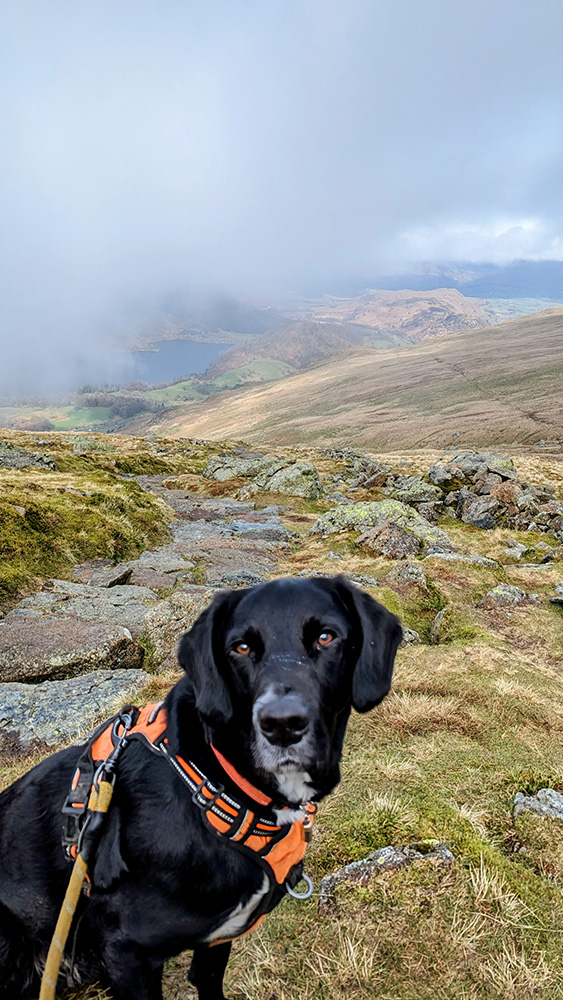
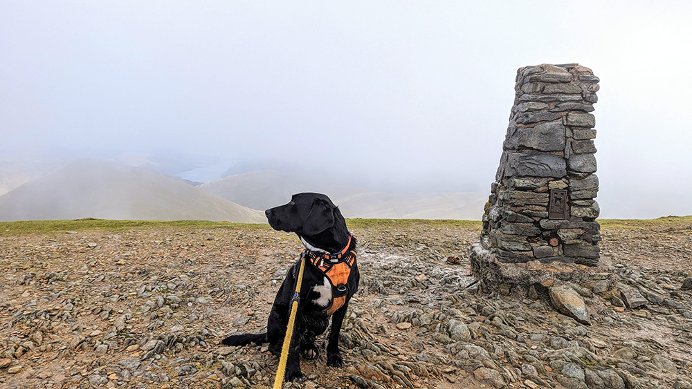
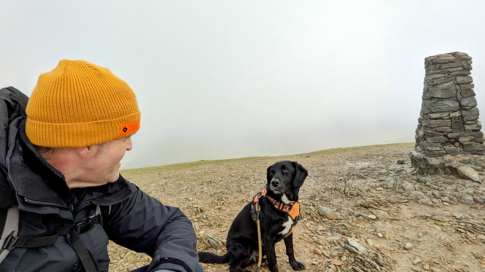
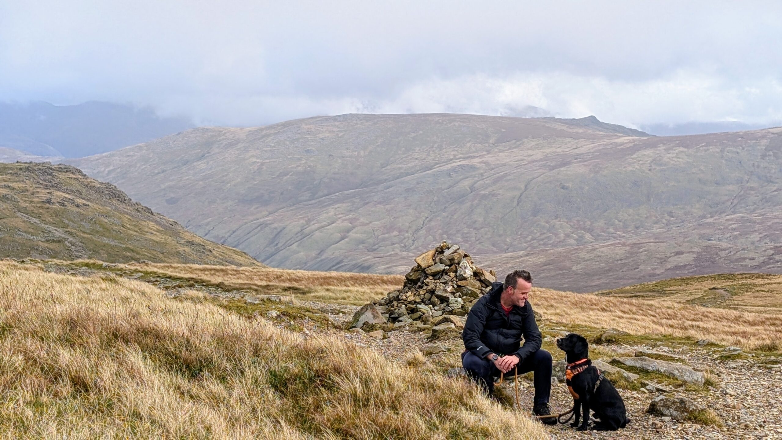
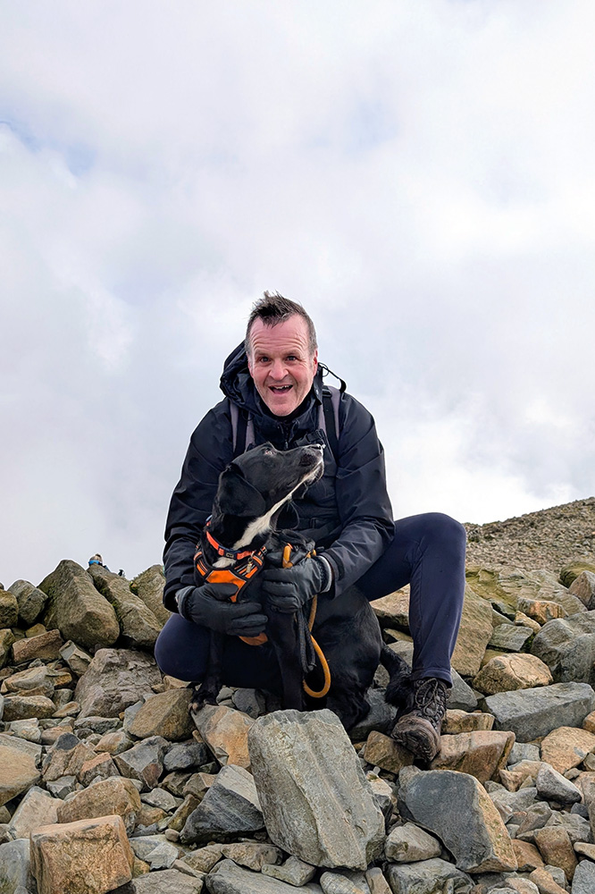
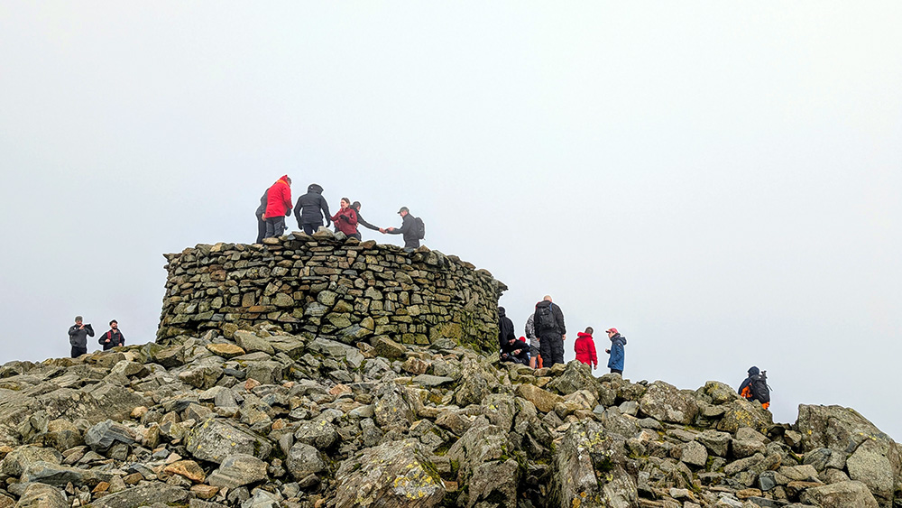
As on the way up, we were taking it in turns on some sections as we waited for others to descend the narrow sections of “path”. It was tough going but eventually the slope levelled out and the cairn and trig point hoved into view. We scrambled our way to the top. There was a lot of people up here; mostly approaching from Wasdale Head, but we got to the cairn and took our pictures at the trig point and the summit cairn (and had some taken for us). Our heads were in the clouds now literally and metaphorically. What’s more a glance around confirmed things. At this time, Henry was the Highest Hound in the Whole of England!
We were definitely due a bite to eat by now so we wandered away from the cairn to find one of those patches of grass that Wainright promised, and got ourselves refreshed. We had made it. Now all we had to do was to get back down; via a few other summits.
We started off initially by retracing our steps. It was going to be a while before we were on a proper path. I’ll hand back over to Wainright again:
“It is an exaggeration to describe walkers’ routes across the top of Scafell Pike as paths, becuase they make an uneasy pavement on angular boulders that are too unyielding ever to be trodden into subjection”
This is the terrain we would be trversing for a while. We dropped back down to the bottom of the V shaped drop between Scafell Pike and Broad Crag. However this time rather than turning off the V and dropping back down the scree to the Corridor, we continued on our slow way over the boulders up towards Broad Crag. It was tricky going with a dog who still had too much energy and wanted to bound from rock to rock whilst I carefully watched where I was placing my feet. It also wasn’t always immediately obvious the best approach to take and there were a few times we headed back and forth on the way up Broad Crag.
As for Broad Crag itself. Did we strictly hit the top? No, I’ll be honest here and say we didn’t quite reach the summit. I got so carried away with trying to find a path that I somehow managed to avoid the very top by a few metres. I’m still claiming it though! It doesn’t properly count as a Wainright anyway: Broad Crag and Ill Crag (which I also traversed without standing on its highest point) were marked by him as being a part of what he called the Scafell Pikes (plural).
The rocky road would continue off from Broad Crag and across the northern side of the “top” of Ill Crag. It was only as we dropped off from that hill, and leaving the Pikes behind us, that the path started to return to grass.
I took a small diversion a short way up Great End with a possible view to hitting the summit there; though the legs were starting to feel tired and there was quite a way ahead of us still. So we chose to leave that for another day and continued to drop back down the hill towards the cairn at Esk Hause pass.
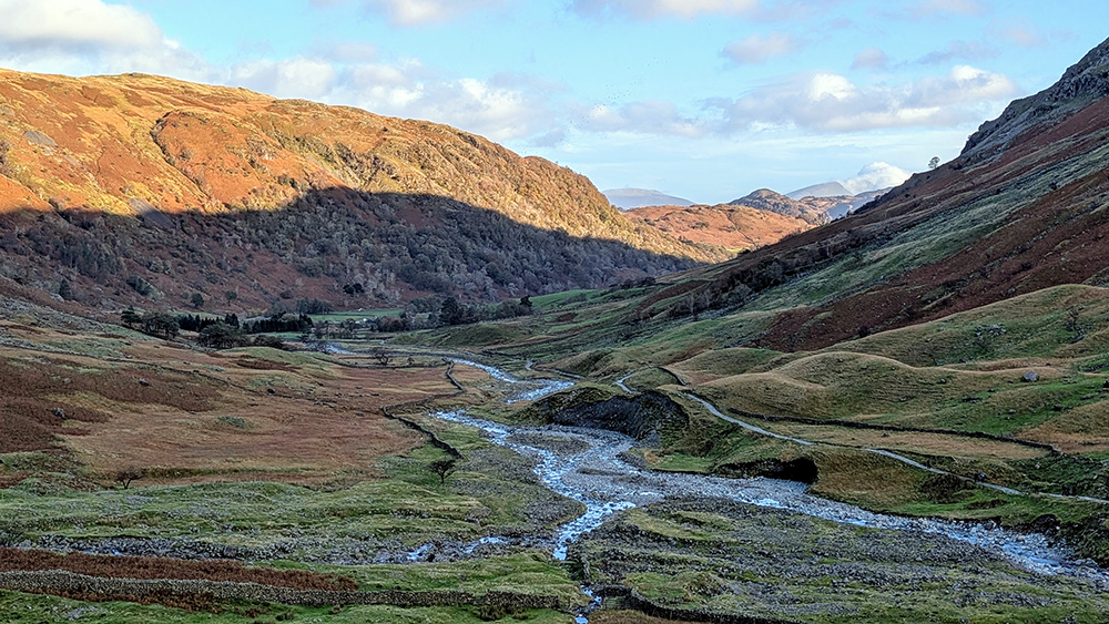
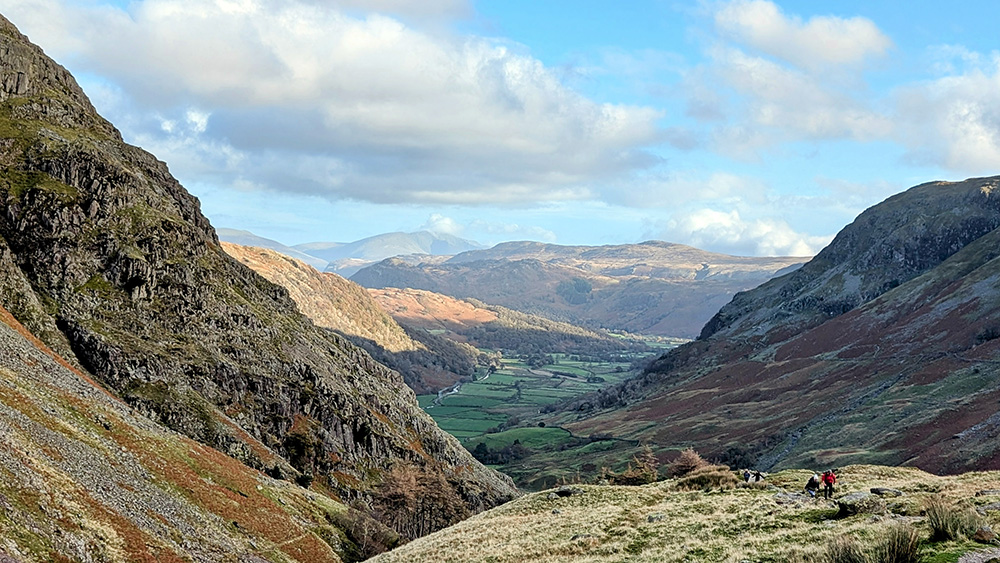
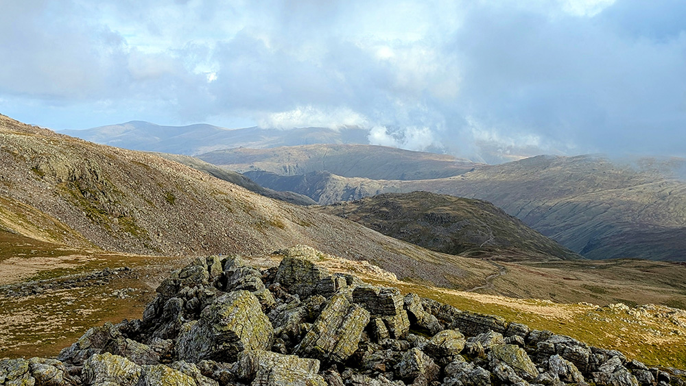
The rest of the descent was beautiful walking with the typical array of stunning Lakeland vistas; each turn in the path provides changes in the landscape in front, and each one is as welcome as the last.
There was still another three miles or thereabouts from to go from Esk Hause and as I’m sure you’ll know, whilst leaving you less breathless than climbing, descending has its own difficulties and can be very tiring and slow going. We stopped a couple more times for a few more snacks.
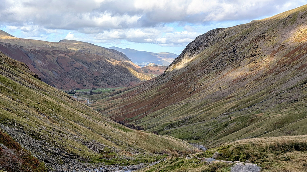
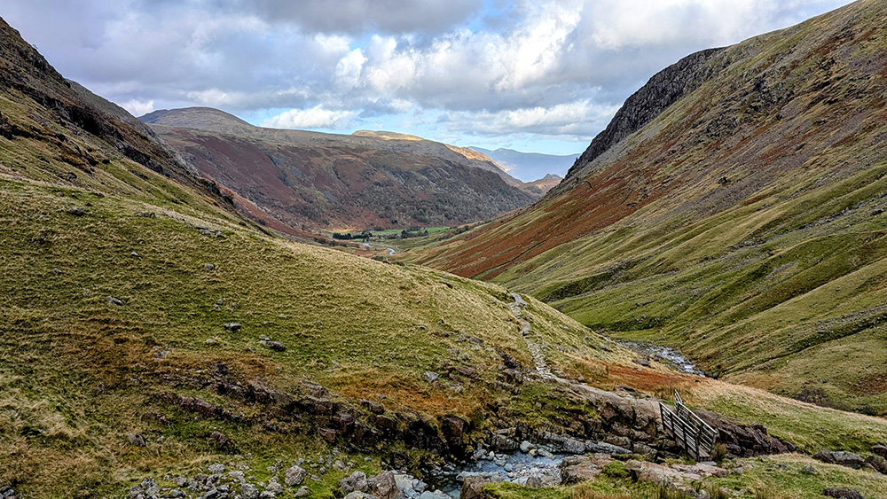
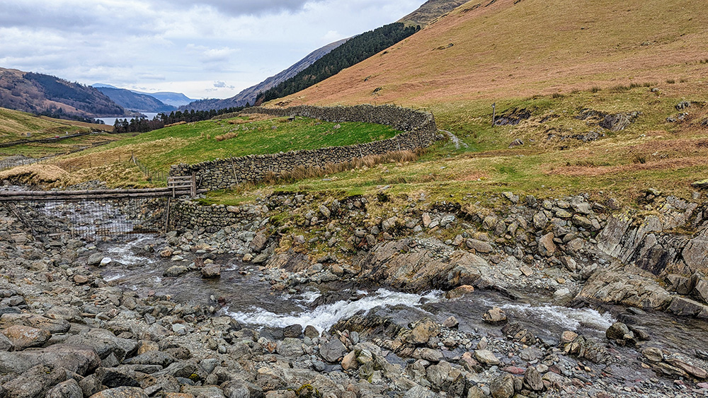
After a while, with Sprinkling Tarn just visible to the side, we turned to follow first Ruddy Gill and then Grains Gill on the final drop back towards Seathwaite. Finally we could see Stockley Bridge in front of us. We had completed the loop up and around; now we just had that final, tiring and soul battering final mile back to the car.
What an adventure. I was incredibly proud. Both for myself but mostly for my little companion. According to my Fitbit, which had been recording our progress, we had been walking for 5 hours and 27 minutes over 9.84 miles with a total of 24,174 steps (presumably at least double that for my four legged friend) and with a total elevation gain of 3,386 feet. Exhausted we got back into the car and headed home. We both slept that well that night.