All Points North Day Two – 15 August 2017

Go (North) West Young Old Man – Avoid the Sheep

I woke up at 6am. Once again I was awake before my alarm went off but I managed to rest until half past when I got up, had a shower and packed up my bags (including a few items still damp from yesterday). I was downstairs in the restaurant area of the Lairg Highland Hotel by 7.30 for a reasonable breakfast of sausage (still no sign of a Lorne sausage on my tour), bacon, black pudding, potato cake and fried egg – everything I needed to get me going. Satisfied, I returned to my room to gather the rest of my kit, then checked out, and loaded the bags onto the bike.

Briefly stopping at the bottom of the Main Street to take a ‘leaving Lairg’ photo by the reservoir I turned right, heading North again. I was starting off along the main A836 towards Tongue and sill following national cycle route NCN1. The road here is of a proper width and there was a surprising amount of traffic.

Leaving Lairg

After just a couple of miles however the roads got smaller and quieter. At the top of Loch Shin the main road splits in two; the A836 (and with it NCN1) continue northwards; however I took the left hand fork, turning in a North Westerly direction along the A838 bound for Durness. At the junction both roads drop down to single track carriageways. These might be ‘A’ roads but that is mostly because they are ‘a road’ – pretty much the only ones in the area.

A Road, or a road

If yesterday’s ride was to be easy due to my merely following the NCN1 signs, today’s ride would be simpler still. Start on the A836 for a couple of miles. Then the A838. Stick with that all the way to Durness! For the next 35 miles I just had to follow the road to the West Coast at Laxford Bridge. I knew that there would be no worrying about checking maps and missing turnings.

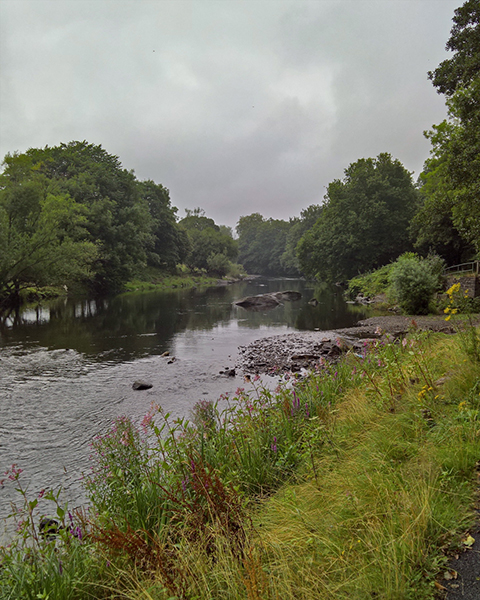
Normally cycling along A roads is something that I avoid where possible. The A838 however is a road made for pedalling along. My chain was still slipping; however it was very irregular and wasn’t causing concern, so I let the smile fill my face and I took in the gorgeous scenery alongside Loch Shin. Although the road does slowly climb alongside the loch as it follows it inland towards the watershed somewhere near Kinloch, at no point are there any climbs of note. Instead the road winds along the loch side; itself an incredibly open feeling body of water.  The hills here rise slowly away from the water’s edge before climbing into some beautiful low mountains. A number of small islands are sprinkled across the Loch and the banks are dotted with small trees and shrubs.

Loch Shin

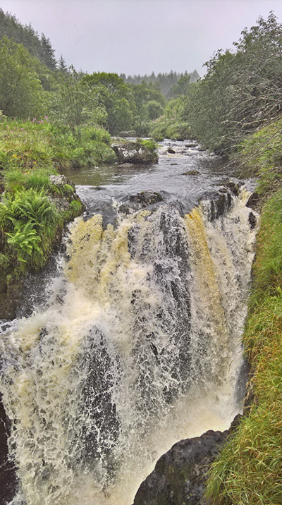
A number of rivers and streams cut across the road under bridges and culverts; many of them crashing down over rocks on their way to meet the Loch. Doubtless in wetter months they bring those same rocks crashing down with them but for now the stones just make obstacles for the rivers to dance over before settling calmly in the deep loch below. Further ahead of me I could see that the hills were starting to rear up higher and steeper, making the landscape to come look even more magnificent than that in front of me here.

Rocky River

I didn’t have the road as much to myself I had suspected that I might. I had been slightly concerned that out here would be wild and remote; however there was a steady stream of cars and vans along the road. I was often having to pull in at the passing places to let them go on their way. A large number were clearly heading into work elsewhere as the volume of traffic did drop off after 9am leaving mostly vans and even the occasional lorry heading past me. The motorists might not have been out in the open as directly as I was, however they were all clearly equally enjoying the road with not a vehicle passing without a wave and a smile. One thing that did puzzle me was the percentage of cars I saw that had odd fixings on their bonnets and roofs. I couldn’t fathom their use but a lot of cars had them; antennae for some much needed radio system perhaps?

I was also surprised by the number (not a big number admittedly, but a number none the less) of new houses along the loch side; including a couple of new ‘estates’ of 3-4 houses that seemed to be totally empty. I also saw the unexpected sign of an air conditioning service van parked up by one newer farm house; it didn’t strike me that air-con would be a major concern in the North of Scotland and I couldn’t help feeling that there are some scams going on here; please feel free to put me right!

I was making good progress but did not ease up. Although Durness was not too many miles away I wanted to make sure that I continued to tick the miles off. One of the ‘points’ I was hoping to tick off on my ‘All Points North’ ride was Cape Wrath. The most north westerly corner of the U.K. mainland, Cape Wrath was one of the main reasons I had chosen to come this way rather than just follow NCN1 towards Tongue. I was hoping to be able to join ‘The Cape Wrath Fellowship’ – a club open to those who cycle their way to the lighthouse at the end of the road. Access to Cape Wrath however is not simple. The only road crosses the Kyle of Durness with access only possible using the very small and weather dependant Cape Wrath Ferry. There are many variables that determine whether the ferry will be running; most notably the weather and the Ministry of Defence who use the land as a massive, out of the way bombing range. As such, detailed information on operating times for the ferry are scarce. I wasn’t even sure if it would run at all in the afternoons but had calculated that to stand any chance of making Cape Wrath today that I would need to be at the ferry by 2pm to give myself 3 hours for a round trip. I would be staying overnight in the neighbouring town of Durness. As such I had a back-up plan for another attempt tomorrow morning; and a couple of route options for the next two days depending on when, or if, I would get to the Cape.

I had mentally broken the route down into a 35 mile section from Lairg to Laxford Bridge and then the subsequent (and more hilly) 20 miles to the Kyle of Durness. As such I had a good idea of what times I needed to be where and, whilst I was making good progress, I didn’t want to risk letting those timings slip.

Glad I’m not cycling up there

As the miles ticked by the bigger hills got closer but the road was still largely on the level with only the occasional small rise. Despite the number of times I stopped to take a photograph and generally smile and enjoy being out here, I was increasingly on my own.  I was still ticking off the miles at a good pace. Eventually Loch Shin gave way to the much smaller Loch Merkland and at the top of that the road climbed up relatively sharply. At the top I stopped for a small bite to eat.

At the watershed looking East

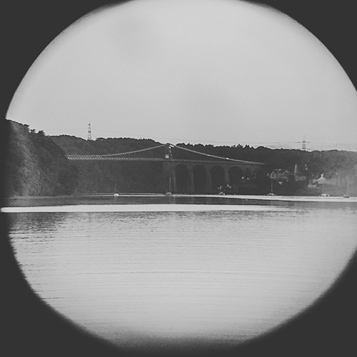
At this point I was at a watershed that you don’t often get to experience. Behind me, the water headed back the way I had come. It flowed through Lairg. It would go on to rush full speed over the Falls of Shin providing a stern test for those salmon heading upstream to calmer waters I had witnessed yesterday evening. It would continue underneath the Invershin viaduct into the Dornoch Firth and out along the Scottish East Coast into the North Sea. However at the point I was now standing it would be possible for two drops of rain to fall from the sky together, land side by side, but then teeter off and take quite different paths. A slight landing to the west and instead the water was bound to follow its way through Loch More and Loch Stack, along the River Laxford and into Loch Laxford. Finally it would find itself on the West Coast where it would become a very small and seemingly insignificant drop in the Atlantic Ocean. It was my turn to also follow that path (although hopefully without ending up in the ocean).

At the watershed looking West

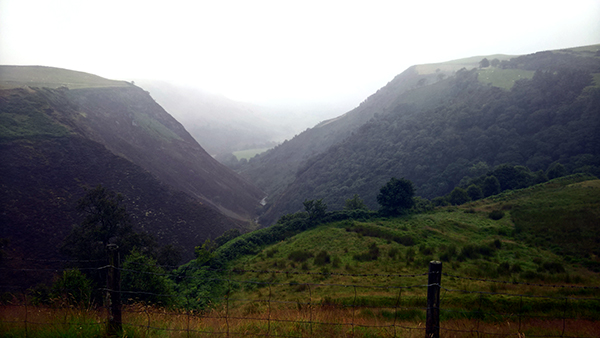
As if to mark the change from East to West the wind suddenly got up and I could see a squall of wind and rain heading up the valley from the west to greet me. I quickly finished my food but made a judgement that the weather might not last and so left my wet weather gear in the panniers. The initial drop from here to Loch More was in a deep and windy valley. Although the wind was suddenly strong in my face I had the hill on my side. I engaged high gears, lowered my head, threw my hands onto the drops of my handlebars, and powered my legs to take me as quickly as possible through the wet and windy ravine. My judgement proved sound and within a minute or two the landscape opened back up as I reached the shore of Loch More. The rain immediately eased off to welcome me to my new surroundings.

There is a marked difference between the lochs on this side of the country and those I had just passed alongside to the East. The hills are much higher and steeper and dominate the landscape more than those I had ridden past before. The hills were already climbing up here but were still growing taller the further west I went. Directly ahead of me I could see Ben Stack, and to the North the twin ‘race horses’ of Foinaven and Arkle. Having made it down to the Lochside I paused to admire the scenery. High above me on the hills immediately adjacent I could hear the cries of a bird of prey. I looked up and could see a magnificent large shape soaring above me. I could not say with 100% certainty though I am convinced from the size, shape and screeches that I was witnessing the flight of a Golden Eagle. I watched it disappear from view and, rather struck with awe, took my stupefied grin back to where I had propped up the bike and headed back down along the loch.

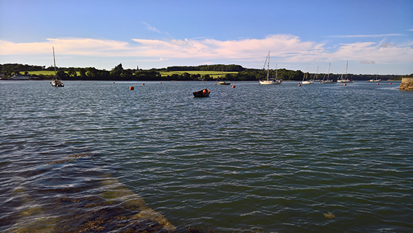
At the west end of Loch More is the small settlement at Achfary. There are only a few houses but I was struck with how picture perfect and immaculate the village is. Perfectly manicured lawns and brightly painted white stone houses and barns. It felt slightly surreal and I rode through in something of a daze. Just past Achfary the water cascades down in a river from Loch More to Loch Stack and here I passed a few cars parked up whilst their inhabitants stood in the waters, fishing. It was both a beautiful sight to behold and also a small eureka moment as I realised that the attachments on the car bonnets were for holding fishing rods (yes, I did have to see a rod still in situ on a car to come to that realisation).

Ben Stack and Loch Stack

Loch Stack was different again from the others lochs before it. This time the south side (that I was cycling along) is very steep rising immediately up almost 700m to the summit of Ben Stack.  To the north there is a wider, greener, shore before a gradual start to the rise up the slopes of Arkle (which do then also become very steep and rocky). The beauty of the landscape was slightly marred by the stronger wind that was now blowing sharply along the mountain side into my face and slowing my progress. At the bottom end of the loch a beautiful but derelict lodge house sits almost as if it is just trying to be the most picture perfect little house possible; albeit left to slowly decay.

Lochstack Lodge

The final few miles of this first stretch of the day are through another type of landscape again. The mountains give way to lower rocky outcrops and the road winds it way up, down and around them with the river just off to the side. Although the river crashes its way easily downstream the road is not able to directly follow it and rises and falls around the rocks before eventually joining the river again just in sight of Laxford Bridge which marks the end of the first ‘half’ of today’s ride; and also the completion of the ride across country to the West Coast.

Laxford Bridge

At the bridge the A838 appears to come to an end at a T-Junction; although in boring road number spotting terms I would be continuing on the same road as this marks the end of the joining A894. I was, however, turning off from the quiet local road and joining the route used by the ‘North Coast 500‘ – a circular touring route that takes in 500 miles around the north of Scotland. The first marker that I was now on this trail was a sign immediately past the junction which gave my first indication that I was on the right road for John O’Groats. I took a walk over the bridge and had a quick conversation with a couple of salmon fishermen and then began again in earnest to head towards Durness.

Heading for John O’Groats

A short way further on, and just before starting to climb for the first time properly today, the road opens out by Laxford Bay. Here was my first sign of the West Coast proper. In the global scheme of things it was no great achievement but it felt magical to have traversed the width of the country in what amounted to less than a day’s riding, and so far from home (at least in terms of the British Isles!). I didn’t stop long though. I could see the road rising in front of me and knew from my route planning that I had a number of miles of climbing to get behind me.

The West Coast

For the first few miles of the climb the road gave me some false suggestions of what lay ahead of me. A big sign indicated that European funding had paid for the widening of the road here. For the first time since leaving Lairg, the road now had two distinct carriageways and traffic could pass without hindrance to me or them. The road rose steadily making progress much slower than the morning ride; although it was by no means difficult going. The occasional short downhill stretch allowed me to look around a bit better and admire the views of the mountains from a different angle.

West Coast Hills

Another short downhill led me into the small village of Rhiconich. This turned out to consist of little more than a hotel and a police station which seemed to suggest that the hotel may not attract the finest clientele! It does also, however, have a nice little stopping point and magnificent views over Loch Inchard; more of a fjord than a loch! I stopped here to have another quick bite to eat and make the most of looking over the west coast.

Rhiconich Police Station and Hotel

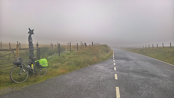
Leaving Rhiconich my optimism about the new wider roads was immediately knocked away. I was back onto single track road with passing places, only now I was on the busy tourist route with a lot more traffic to contend with and pull over for. Most people on the road were either on motorbikes or driving massive motor homes. I’d heard some cyclists moaning about the bikers using the North Coast 500 as a race track but all the riders who passed me were enjoying the touring and most of them waved in acknowledgement to me. The motor home drivers though seemed to be in their own bubble and very few were thanking me when I got out of their way. This did rather spoil some of the joy that the earlier road had bestowed on me. The road continued a long and steady climb for the next few miles. Minor frustrations caused by motorists lack of manners aside, the views were opening up as I got higher and I couldn’t stay annoyed with the drivers for long. I was soon in a state of mind where I wasn’t expecting acknowledgement and was therefore filled with unconfined joy when it did come my way.

At Rhiconich Bay

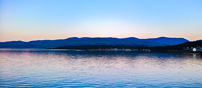
Eventually I could see the hill levelling out and without any proper pause at the top it immediately started to drop back down again. Ahead of me I could see the beautiful azure waters of the Kyle of Durness. With only 7 or 8 miles left until I would reach the ferry slipway and with about 550 feet of hill to drop down over that distance I relished the chance for some fast miles.

At the top of Strath Dionard

With clear views of open road and no traffic in front of me I opened up and accelerated down the hill. My trusty cycle computer was soon registering speeds above 40mph. I was whooping and singing and thoroughly loving the liberation that long open downhill roads afford the cyclist.

Gliding down to the Kyle of Durness

There may not have been vehicles on the road. However there were sheep. Up on the hill to my left I could see an ovine family of three (mother and two almost full grown lambs) making their way to cross the road. It didn’t take any great skills in trigonometry to work out that we were going to meet in the middle of the carriageway. One downside of bikes is that, unlike cars, your average cantilever brake system does take a while to slow you down (well, that is assuming you don’t apply them so hard that you just fly over the handlebars). Even slowing the bike as much as I could I could still see trouble. I continued slowing; I rang my bell, I shouted at the sheep; but they kept coming. I slowed enough that the ewe and first child passed safely in front of me but I was still on a collision course with child two. Fortunately at the last minute the lamb acknowledged my presence and altered course. It wasn’t going to be enough to avoid a collision entirely but did mean that we had merely a light glancing blow off each other. I managed to stay upright and come to a halt. Looking back the lamb was completely unfussed and had re-joined the family unit who were all eating the, much greener, grass on the other side of the road.

Kyle of Durness

Satisfied that all was well with all parties I continued on my way; although I chose to not push to full speed from here on and instead cruised down to the bottom of the hill at the head of the Kyle of Durness. A few minutes later I was pulling up at the slip way by the ferry. I had made it. My plan to be here by 2pm had been fulfilled. Indeed I had a good 5 minutes to spare! Any jubilation was short lived however. The ferryman was in his car at the top of the slip way. he told me that there would be no more sailings today. The wind was picking up and it was going to become unsafe very soon. Indeed he said that he was waiting to pick up a returning group before calling it a day; however if they were not back soon he might have to leave them on the other side. There was to be no Cape Wrath for me today. I would have to resort to plan B and try again in the morning. The ferryman then told me that he was also not optimistic about the chances for the following day either, having listened to the weather forecast.

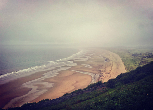
So here I was just a few miles from the end of my day’s ride at a much earlier time than I am used to on such trips. I headed on towards Durness; but rather than heading directly to the Youth Hostel I was staying at, I took a small detour to the beach at Balnakeil. The day was at its best by now and I spent a lovely hour sitting in the bright white sand dunes overlooking the glorious azure waters. I spent the time checking through my photos and writing some of the notes from which I base this blog and also looked around the ruins of the old church before deciding that I might as well head on to the hostel anyway.

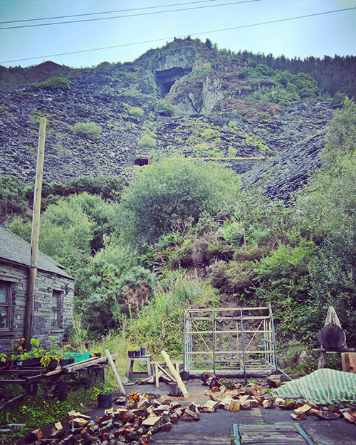
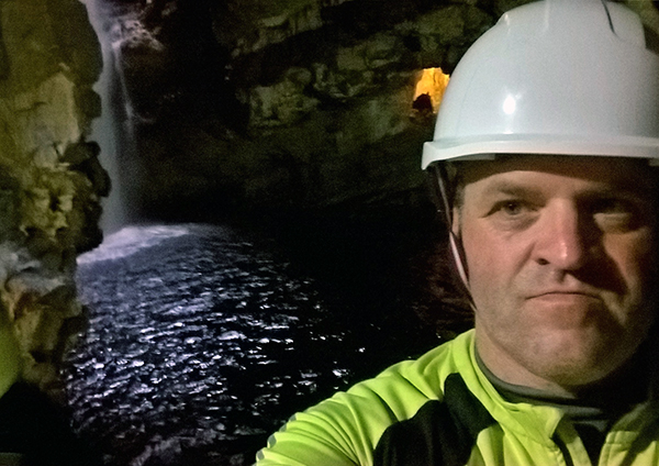
I parked the bike up in the unlocked bike shed, and dumped my panniers inside the main door by reception. There was nobody here at this time of day so instead I took a short walk the few yards to the entrance to Smoo Caves. I had read about the caves and was intent on visiting. I was soon made to be glad for my early arrival in Durness. The local caving society were running tours into the caves today. There were only two tours remaining and both were marked as being full. However a white board listed the names of the people booked on and a quick calculation showed that there was one fewer person booked onto the penultimate tour than was registered for the final trip. I therefore managed to persuade the lady controlling the tours to allow me to join that one and within minutes I was riding on a little dinghy with seven other adventurers across the waters flowing through the cave. A river crashes down through a big crack in the rocks, forming a wide open cave before running out to the sea. A network of other caves then wind their way deeper inland behind the main fissure and a short tour of these passages were where we were taken by Colin, the leader of the caving team, for an excellent tour that I cannot recommend strongly enough.

Caving
Smoo Caves
Inside Smoo Caves
Smoo Caves Entrance

After making the most of the caves I returned to the hostel which was now coming to life. I showered, bought a beer and a youth hostel ‘heat it and eat it’ curry before getting a second beer and venturing back to the caves to ease down, and write the rest of my diary, before heading back to my dorm to bed down for the night.  It has been many, many years since I last slept in a big shared dormitory.  I wonder how I would get on.

Durness Youth Hostel

Day Two Stats:

Next Post: Into The Wilderness

All Points North Day One – 14 August 2017

Black Isle and Leaping Salmon

Each summer for the last three years my other half has taken two weeks on a busman’s holiday working on the Ness of Brodgar excavations in Orkney. I’ve taken that as my queue to take off myself for a week and do a short tour on the bike. So far I’ve ridden Avenue Verte, Coast to Coast (and back) and, last year, Lon Las Cymru. This year I fancied doing something a bit different and not following an established route. I spent some odd moments considering some possibilities; maybe a nice easy ride along one of the German or French rivers? A tour around Belgium and N.E. France perhaps? But then a pleasant idea struck me – why not go and meet her in Kirkwall?

And so it was that after a bit of advance planning and a few changes of route, that I finalised the idea of ‘All Points North’. A planned detour to take in more of the North Coast was coupled with a realisation that I didn’t have the time and funds to add an extra two days riding from Aberdeen (which would have been almost exclusively done with the idea of getting to the phone box at Pennan – if that doesn’t mean anything to you look it up. If that still doesn’t mean anything to you watch the film). I therefore prepared to start riding from Inverness.

Leaving Home

After loading my panniers on the Saturday night, I was up early (way too early – I didn’t want to miss the train from Kings Cross) heading from home on the English South Coast. I squeezed my bike onto the, not very well designed for luggage let alone bicycle, HS1 train to St Pancras. That left me having about two hours to kill before getting onto my first class seat headed for Inverness (I’d booked early enough to get the first class ticket at a good low price). I did feel a bit guilty having hung the Ridgeback up in the luggage compartment; but not for long as the coffee and food started arriving at my seat.

The train journey was comfortable and largely uneventful save a half hour delay due to some trespassers on the line at Darlington. Sadly we were not able to make up the time. I had discovered that a couple of old friends of mine I’d not seen for far too long were making the return journey South on the Sleeper train. Had things been running on time we might have had 20 minutes to say hello in Inverness station. Instead we had to wave at each other’s trains as we passed about five miles outside the city.

Speeding Through the Cairngorms

Eventually arriving in Inverness over 12 hours after leaving home I got on the bike and rode the very short way across the river to the B&B I had booked into. With the bike secured in the back yard of the Eskdale Guest House and bags dumped in my room, I headed back out to get a pre ride feed up of pizza and a couple of beers at the Inverness branch of Bella Italia before heading back and getting my head down on the pillow.

Inverness at Night

I woke up early to a grey and damp start to the day with no obvious sign of improvement. I got up, showered, and walked into the city centre, getting some supplies for the day ahead and taking a walk up to the Castle and around the old church yard. I was back in time for an 8am breakfast appointment and, well fed and ready to go, I started my ride North.

In terms of navigation, today should be easy. Find Route One and follow it. The Sustrans route runs right through the centre of Inverness so I started off by heading back to the river and took a ‘start of ride’ photo with the Castle behind me. Then I easily found and followed the signs out of the city, through some industrial estates near the football club, and onto the Kessock Bridge to cross the Beauly Firth. There are doubtless some lovely views from the bridge both back across Inverness and also out to the open sea. Today everything was just grey.

Kessock Bridge

The first few miles north of Inverness do not make for inspiring riding as Route One takes a perfectly safe but disappointing ride alongside the busy A9. A briefly exciting interlude under an amusingly graffiti lined underpass leads to a major change of scene; the route follows the carriageway on the other side of the road instead…

Nessieland

However despite those moans only a few short miles had passed before the route veered away onto some minor roads running parallel to the A9 prior to hitting the Route One split point six and a half miles after setting off. Route One has two options here. The main route heads around the north side of the Cromarty Firth and through Dingwall. The alternative route which I was aiming for cuts across the middle of the Black Isle and takes in a crossing on the seasonal Cromarty Ferry before the routes meet up at Tain. I was keen to see the Black Isle and as the ferry was due to be running I turned right into the farming lands with its famed dark rich soil.

Sadly the weather wasn’t showing the landscape in its best light but I was getting a feel for land that felt more Welsh or Yorkshire than Scottish Highlands. The Black Isle is far from flat (my highest single climb of the whole tour was just a few miles in front of me) but nothing like the amazing mountain landscapes I had passed through on the train South of Inverness. That was largely the attraction though.   I would have a few days ahead of me in that type of terrain so I was keen to see something different this morning.

The first few miles followed a river down towards the village of Munlochy and along this stretch the farming was mostly of wet and miserable sheep. I passed several fields of rather fine looking black, horned sheep, however it appeared that all of them were too pissed off to agree to be photographed; they all turned away as soon as I tried to stop the bike and take out my camera phone.

From Munlochy the roads rose up onto rolling open downland and I had a few glorious miles enjoying the view between the raindrops. At the hamlet of Killen I turned off from Route One to take a diversion to Fortrose and Chanonry Point. A poster on the Cycling UK web forums had recommended this as a chance to see Seals and Dolphins. Sadly however I only got to see one distant Seal head bobbing out of the water and some acrobatic flying by a few small birds darting around the car park. I had a quick bite to eat but the wind and rain was taking effect. I could feel the cold starting to creep in from my the ends of my cycling mits and so, having given up on the dolphin community, I got back on the bike and headed inland.

Chanonry Point Lighthouse

As soon as I turned back I could see that I had some climbing to warm me up. The hills so far had been some fairly short (but mildly sharp) 150-200 foot climbs; nothing strenuous at all (although as always, the first few hills on a fully laden bike feel much different to how they might on an easy day ride without any baggage). After joining the main road at Rossmarkie the first bigger climb started. Just through the village began the slow rise which would continue gradually for 600 feet over the next 5 miles. I must admit that I’ve rather grown to love climbs like this. There was no great pain, indeed no real pain at all. A good constant effort such as this makes one feel like you are properly working. Also, the views gradually open up as you climb and I thoroughly enjoyed these slow going miles. Eventually the hill topped out (after one false summit and a very short drop immediately prior to the final 50 feet of hill) next to some massive TV antennae.

The Black Isle

The road at the very top of the hill is tree lined on both sides so I dropped about 100 feet before I could gain any sight of the Cromarty Firth below. Despite the continuing rain and grey skies I glided happily down into Cromarty singing to myself as I went. In Cromarty village I diverted down to the pretty old harbour to admire the tiny fishing boats in front of the massive oil rigs all lined up in the Firth.

Cromarty Harbour

A sign by the harbour pointed me in the direction of the town bakery where I sourced a coffee and a sausage roll before rolling back down to the sea to find the Cromarty to Nigg ferry.

Oil Rigs in the Cromarty Firth

A man walking a dog gleefully told me that the ferry wasn’t running. As I could see it loading up a couple of cars at the Nigg side in the distance I chose to ignore his knowledge. I drank my coffee and ate my sausage roll at the quayside; feeling rather guilty as it turns out that there is a nice looking coffee shack right next to the ferry. Had I known (tip to the owners; put a sign up next to the one for the bakery) I would have visited there instead. A German family pulled up in a camper van. The dog walker gleefully told them the ‘bad news’ also. I quietly pointed the ferry out to the Mother of the party and we waited for it to make its way over.

The ferry arrived laden to its maximum capacity; three bikes and two cars. The cars had to reverse up the slipway and turn around before we could load up. The ferry was full with only the camper van on it so it was as well that nobody else has turned up. The crossing was a little rough in places (I should have listened for the shipping forecast; I believe that they cover this area) but before long we were docked at Nigg. This side of the Firth there is a bus shelter for people to wait in.  The rain was falling harder now so I decided to use the opportunity to have a bit more food in the (mostly) dry (some rain was getting driven in) shelter. I topped up my water bottle from the new portable two litre bag I had got in readiness for the trip. I can get through quite a lot of liquid on a full day’s ride and I wasn’t confident that there would be too many opportunities to readily fill up over the next few days so had got this bag as a way to more than double my available fluid.

Sheltering in the Nigg Ferry Shed

Once fully refreshed and fuelled, I set off on the next section of the ride crossing between the Cromarty and Durnoch Firths.   A couple of miles beyond the ferry I met a small group of cyclists heading in the opposite direction. They were glad to hear that they were on the right road for the ferry. They were looking tired and still heading for Inverness which would be the end of a week’s touring and camping for the three of them. After a short chat we wished each other well and set off in our different directions. This next section was fairly uneventful. I decided to get my head down and tick these miles off a bit more quickly and catch up some time. I did stop a couple of times to look at a) the most over the top road side egg salespoint in the country and b) a quick stop to look at a cross slab just outside the brilliantly named village of ‘Hilton of Cadboll’ (I didn’t actually venture across the field to look at the slab after reading that the one on display was a modern replica).

Before long I was riding into, and through, Tain stopping only to refill my water supplies at a garage on the edge of the town. Upon leaving Tain the route joins the A9 for a couple of miles. Although down to single carriageway and less busy here than it was back by Inverness, this time the cycle route is on the main carriageway and as such would prove to be the least pleasant few miles of the entire tour. I sped past the Glenmorangie distillery (time was ticking on and the panniers were already loaded) towards the roundabout at the southern side of the Dornoch Firth Bridge. From here I still had about twenty five miles to go.

Egg Shack

NCN Route One leaves the A9 to cross the Firth here whilst it ventures instead onto the much less intimidating A836 following the Southern side of the Firth. Until the opening of the new bridge in 1991 this was the main road North as it sweeps inland before crossing the Firth at the older Bonnar Bridge. A ‘Pictish Trail‘ road sign on the approach to the village of Edderton encouraged a quick stop at the church. Unlike at Hilton of Cadboll the Cross Slab here is still the original one and well worth stopping to admire.

Edderton Cross Slab

Back on the bike the road continues to follow the line of the Firth, although any views across it are limited by the trees lining most of the route. An old AA box at the junction with the high road to Dingwall is a reminder of older days of motoring when such boxes existed to house telephones to help stranded motorists call for assistance. In Ardgay village the main road turns to cross to Bonar Bridge and the North side of the Firth. A note for other cyclists heading this way. It is possible to continue following the road over the bridge and then turn left along the A836 rejoining the main cycle route at Invershin. Its probably not as pretty a road to follow as the one I describe below. but it might just be more practical in avoiding the viaduct – particularly if your bike is heavy and well laden.

AA Box at Fearn Lodge

Instead I followed Route One as it carries on along a peaceful country lane for a few miles until just past Culrain station. The rain was still coming down, although it was less strong by now. At this point the cycle route leaves the road and follows a path alongside the railway line. The track surface is fine however the pathway was overgrown with brambles and nettles sticking out into the narrow pathway. The track then comes to the Invershin Viaduct carrying the train line that winds its way to the far North of the Country. There is no spare space on the main bridge; instead a footbridge has been bolted onto the side of the structure about two thirds of the way up its height. A couple of flights of steep metal steps had to be negotiated – not easy with a heavy bike – and then across the stable, but none the less terrifying bridge. I stopped to take a couple of pictures which I instantly regretted doing; convinced that I was going to drop my phone, or something equally important, through the hollow metal floor into the river far below. I didn’t. However I did have to negotiate more steps at the other side of the bridge.

With a bit of nervous relief I stopped to devour some Jelly Babies and to get my breath back sitting on a concrete bollard by the side of the road. I seem to be good at picking unromantic places to stop and this was one of the less savoury.  I had taken a look at a potentially lovely river side spot nearby only to find it full of midges and a bit smelly, so the bollard was actually just fine.

Back on firm ground and refreshed I made myself ready for the final leg. The cycle route to Lairg ignores the sign that said the town lays straight ahead and instead takes a turn  left in the unlikely direction of Lochinver. However a short way onwards the route turns right again along a small road following the west bank of the very pretty Shin valley for the final few miles. The river runs with some power in the valley a way below the main road and the ride here is glorious. Even though the day was starting to feel old and I was running out of puff I could do nothing but admire the natural views. Half way along the road is a big car park for the Falls of Shin waterfalls.

Falls of Shin

On a spur of the moment decision I parked the bike at the side of the road and followed the path to the water falls crashing their way over some steep rocks. I stood transfixed watching the power of the water forcing its way down hill and then spotted movement. A salmon was trying to make its way against this great force of nature up the falls. I stood and watched for a while longer and eventually managed to get a short slow motion video of another fish making an attempt up the falls.

Thrilled to have spotted this magnificent sight I made my way back up the path to my bike and back on for the final few miles. However whilst getting back up to speed and working my way up the gears the chain came off the front ring. I stopped and got it back on easily enough but soon found that the chain to be slipping. I took a quick look but couldn’t spot any immediately obvious issues. The slipping was worst in the higher gears so having established that I was only 3.2 miles from the end of the day I made my way slowly and steadily in a low ratio for the last few miles up the valley; finally making my way into Lairg just as the rain eventually stopped.

Lairg Highlands Hotel

The Highland Hotel, my base for the night, is easy to find. I parked my bike around the back of the hotel. A quick look at the chain still didn’t show any obvious signs of damage so I worked the links to try and ensure that they were all smooth and moving freely. I was too tired and wet to spend too long examining the bike and instead locked it up and checked in to the hotel. The staff very kindly took my stinking wet shoes and put them into a drying room whilst I went upstairs to get myself even wetter with a long hot shower.

Sunset at Lairg

Having been warned that the hotel restaurant might be busy due to lots of farmers coming into town for the Lairg Sheep Sales the next day I headed downstairs for a big bowl of Pasta Bol and Sticky Toffee Pudding. I took the legs back outdoors for a stretch by walking heading down to the reservoir to watch the beautiful sunset over the water. One last pint of 80′ in the hotel bar later and I was ready for bed.

Lairg Sunset

Day One Stats:

Next Post: Go (North) West Young (Old) Man

Hants, Wilts and Dorset

With another big multi day ride looming in a few weeks I had booked a Wednesday off work with the aim of spending it in the saddle getting in some practice. After my previous successful trip around the Isle of Wight I was up for the idea of spending another day where I get up early and drive out somewhere in order to be able to take in some sights other than my regular Kent and Sussex sites.

I had a couple of possible routes in mind; one around the New Forest and another starting in that area but taking in a wider circuit around Wilts and Dorset as well as Hampshire. With the intention of getting in a fair bit more than 100Km I plumped for the latter option, having determined a route of about 135km starting and ending in Ridgewood and taking in Salisbury, Shaftesbury, Blandford Forum and Wimborne Minster.

As I had done on the Isle of Wight trip I prepared everything in advance. My pannier was packed and loaded along with the bike into the car the night before so that I could get up and be on the road nice and early. However one thing was not fitting to plan so well. The previous Saturday I had been into Brighton to see the return after almost 20 years of one of my favourite “Brit Pop” bands, Sleeper. The gig, in the small and crowded Haunt venue was excellent; however it became apparent that someone close to me was spreading germs in the environment as by Tuesday evening I was beginning to feel quite rough with a summer cold.

I chose to ignore it on Wednesday morning though, and by half five I was in my car and heading West. I grabbed some breakfast on the way. The Isle of Wight trip was on a Saturday when the early morning roads were much less busy. Also, although I would be starting at a similar time, the drive to Ringwood was quite a bit further than that to Portsmouth which I had done previously.

Still, the drive was largely uneventful and I rolled into Ringwood and parked up on a quiet residential road at just gone half past eight. As the weather forecast had promised, as I had headed west the weather had got wetter and the rain was quite solid by the time I crossed into Hampshire. I therefore took my time in getting the bike out of the car and ready to roll but I was on my way before 9am.

Getting Ready – a Romantic Start

The rain was still solid, though not torrential, a I headed out of Ringwood towards the minor road running northwards along the western side of the New Forest National Park. I didn’t have far to travel before making my first route alteration of the day. At a lovely triangular junction just inside the park, I stopped to smile and take a picture at the road sign pointing towards the excellently named village of Mockbeggar. It later transpired that I should in fact have followed the sign and ridden through said village; instead I veered off towards the right heading for Linwood. After a few lovely miles across the forest I began to realise that I hadn’t apparently come into either North or South Gorley so I stopped to look at the GPS and realised I was heading eastwards across a part of the New Forest where I was not supposed to be.

The turning to Mockbeggar

Sticking my maps apps into satellite view mode I had to choose between doubling back to the Mockbeggar sign or trying some cross country footpaths to bring me back onto my planned route close to Frogham. From the satellite the tracks looked good so I decided to head across the heath. On the whole it made for quite a pleasant, if slow, diversion. However it turns out that the New Forest includes some large patches of very sandy soil which necessitated walking the bike in places – my 32mm tyres can cope with some loose ground, but not that loose.

Cutting corners across the New Forest

Despite having to push the bike across the worst of the sandy sections and the persistent rain it was nice to be out in the open countryside which I had entirely to myself. Just before re-joining some proper road surfaces I came across a family of New Forest ponies which also helped to make my ‘short cut’ worth the while. It wasn’t much further until I re-joined my original planned route close to the amusingly named ‘Sandy Balls’ campsite in Godshill.

New Forest Ponies

From there I was back onto following a series of minor roads. There was a short sharp climb onto Castle Hill and then a long straight drive and a drop down into Woodgreen. From here I followed the Avon Valley into Downton. In Downton, a very pretty little town centred around some old mill buildings on the Avon, I had the choice of a couple of possible routes. Having lost some time and having established that the roads in the area seemed to be quite quiet I elected to follow the A338 towards Salisbury. Although there was a fair amount of traffic here the road was flat and open and it was good to be making some proper progress and catching up on some lost time.

Before long I was at Nunton on the edge of Salisbury. From here the original plan was to head into the city centre and along to Wilton before dropping back South West towards Shaftesbury. Instead however, after a good check of my maps, I decided to make a change of plan. I know Salisbury very well; it’s a city I grew up visiting and also worked in for a number of years. It would have been nice to ride around the meadows by the Cathedral; however it was not really a must do part of the ride. I was also feeling the effects of my cold a bit and didn’t fancy the stop-start riding that cities inevitably invoke.

Instead I headed west from Nunton and followed the minor road through Odstock, Homington and Coombe Bissett. I was glad that I did. The villages in the Ebble valley are all very pretty. Also, although not flat I was avoiding a climb out of Wilton up past Salisbury race course. Before Bishopstone I re-joined the original planned route and continued on through some more pretty villages rolling up and down the valley side.

Homington Church

I was starting to get low on water so stopped at the lovely village stores in Broad Chalke. The well stocked community shop has been fitted into an old chapel and is an excellent asset to the community. I resisted the temptation to get a coffee as well although it was sorely tempting.

Having been re-evaluating my plans for the day in light of the weather (both of the rain and the ‘feeling under the…’ varieties) I made a phone call. Well I would have done but there was no signal so I pushed on.

Somewhere beyond Fifield Bavant (a tiny hamlet with a fantastic little church hiding just beyond the few houses) my phone started beeping at me indicating that I had a signal. I pulled over to the verge on what had been right until that moment an almost unused road. Immediately upon using the phone there was suddenly an apparently non stop stream of traffic. It didn’t make for the best place to have a conversation but I managed a couple of calls anyway. One call was to my parents who live in the area to see if they fancied meeting me for a coffee in Shaftesbury. The other call was to tell me that I’d been successful in getting a promotion at work; but that’s incidental to this story.

Fyfield Bavant Church

A few more wet, pretty, but uneventful miles brought me past Berwick St John and up to the A30. As I had done earlier, I elected to follow the main road for a few miles rather than add a detour around some minor lanes. Other than a short climb out of Ludwell it was another good and easy choice and I was soon pulling up at the town hall in the centre of Shaftesbury.

Having made it a good twenty minutes before my parents said that they would be there I wandered around to look at the famous Gold Hill. I didn’t ride up it, nor did I put on a random Yorkshire accent (the hill was famously used in a Hovis bread advert that gave the impression that the hill had been relocated 200 miles north).

Gold Hill

I locked the bike up, met my parents and we headed into the local Costa Coffee for a sandwich and drinks. It was nice to catch up with them and though I had now decided that I was going to be cutting up to 20 miles from the ride I wasn’t feeling great and so it felt like the sensible decision. After a little over an hour’s break we said goodbye and I got back under way.

The original plan had involved heading due south towards Blandford Forum and then heading back from there towards Ringwood via Wimborne Minster. Instead I now elected to take the direct route back across Cranborne Chase. I’d be following a busier road (the B3081) but as before I had suspected (largely correctly) that it wouldn’t be too busy.

Doubling back out of Shaftesbury the way I had entered I was heading for a road infamous in my childhood growing up in the area; but one that I had never cycled.

Over the roundabout at the edge of the town I hung a right initially towards Melbury Abbas but then took a left before entering that village. I had an easy couple of miles to prepare me for what I knew was coming. I let the legs warm back up after lunch and then before long there it was.

I was at the bottom of “Zig Zag Hill”. The name is a giveaway. It marks the climb up onto the chalk downloads of the Chase that straddle the Wiltshire and Dorset border. The hill (or its neighbouring climb onto Spread Eagle Hill) were staples of childhood summer days out to the south coast. We always cheered Dad on to push the car faster up the winding climb.

Coming to the hill for the first time under my own steam therefore felt like a big thing. At the bottom of the hill I dropped into a lower gear and eased myself into climbing mode.

Apparently it turns out that zig zag hill isn’t as awful as memory had it and the last few years living near, and riding over, the South Downs has prepared me for worse. The road surface wasn’t great but the nature of the zig zags themselves meant the ride was actually quite easy. I’m not going to claim to have flown up the hill, it just wasn’t a patch on my mental image of it. The climb from Hastings sea front to my house is worse and i do that happily several times a week.

Heading back into Wiltshire at the top of Zig Zag Hill

The hill continues up beyond the initial zig zags but it is still a simple climb and once out of the tree lined zig zags there is a great view across Wiltshire from the top of the downs.

View over Wiltshire

Once on the Chase proper the riding was largely lovely rolling countryside with fantastic open views. A few miles over the hills I stopped to try and help another cyclist. He had problems work his gears and also had a flat. I would have offered him a spare tube but his tyres were much thinner than my 32s and I had to leave him there. He told me he wasn’t far from home so hopefully he managed to get enough air in to get him back.

From that point the road started to drop back down a bit into the lovely village of Tollard Royal. The road into and through the village is narrow and winding so I was in the great position of being able to pass through much quicker than the motorists behind me. They soon overtook as the climb back out of the village started though.

It wasn’t much of a climb but was certainly slower than the ride into the village. Despite that I was soon back onto the open hills. Some more rolling roads and I was passing through Sixpenny Handley, across the main Blandford – Salisbury road, and onto the south east section of the Chase.

Sixpenny Handley

By now the weather had improved and the rain had finally stopped. However I was feeling the effects of riding when not 100%. The final miles across the Chase were easy enough as they slowly dropped downhill.

‘Matissa’ photo over Cranborne Chase

I left the main road at the edge of the Chase and dropped down into Edmondsham, a small and pretty village with a nasty little climb at its far end (well it probably wasn’t nasty bit i was getting fatigued now).

Edmondsham Pump

Before long I was on the edge of Verwood and within about five miles of the car. It was also now rush hour and the ride from Verwood towards Ringwood was pretty unpleasant as a lot of cars passed by too close to be enjoyable. However once underneath the A31 the final miles into Ringwood were some of the nicest; following a disused rail line and so very shortly I was back in Ringwood, back at the car, and ready to drive home.

Old Ringwood Railway

The weather and my cold had reduced the pleasure of the day a little but it was still a lovely ride across some beautiful countryside and was a great way to spend a day off work.

Stats:

Around the Isle of Wight

To date all of my longer (100km or more) one day rides have never taken me too far. I have kept firmly within Kent and East Sussex. They might not all started or finished at home, but at worst have only involved a short train ride or drive at the start or end of the day.

However a few weeks back, after getting a bit of inspiration from some cycling forum sites, I found myself making some tentative plans for something a bit different. Before I knew it the plans were finalised and maps bought (I never need an excuse to spend some money with the Ordnance Survey). With my other half being away for a weekend a date (the Saturday in question) was fixed..

On the Friday night I made sure that everything was packed and loaded into the car, including the bike. I went to bed stupidly early for a Friday night ready for the day ahead.

HMS Warrior

The alarm went off at 5am. I got dressed into my cycling gear and then straight up and into the car which I pointed west along the South coast. I Stopped briefly in Chichester for a healthy McDonalds breakfast and to fill up with petrol. Back under way and with the roads being nice and quiet at that time of the morning, I was soon parking up in the car park at Gunwharf Quays in Portsmouth. I got the bike out, checked it over, put on the rest of my kit and rode across to the harbour station. With a bit of time to spare I took a quick spin around the harbour before getting my ticket and preparing to board the 8.15 ferry to Ryde to begin a circuit of the Isle of Wight.

Portsmouth Harbour

It was a beautiful clear morning and the Solent was mostly still so I stood on the top deck of the Catamaran admiring the views all the way across to the Island. The Portsmouth to St Malo ferry was following us out of Portsmouth and the Solent Forts were clearly visible to the port side of the ferry. I got ready to disembark as we docked up alongside Ryde Pier.

There were a couple of other cyclists on the boat as well who were also doing circuits of the Island. They both looked like they were going to be riding faster than me (expensive bikes; thin wheels; no paniers; probably just going heads down rather than taking a good look at the countryside around them) so I let them go in front of me off the boat. They were both well gone before I had taken a photo at the starting point and triggered up my GPS.

Ready to set off at Ryde Pier

The route I would take would be largely following the main ‘Around the Island’ route but not entirely so. Although I was sure that there would be good reasons (hills, busy roads, etc.) it struck me that the main route did not follow the coast quite as much as one might expect for a round an island route. I had guessed (correctly, fortunately) that a Saturday in March would not be the busiest day on the Island which also helped my plans.

The main route bypasses Ryde entirely so I had to make my own way out of the town. A short climb out of Ryde warmed the legs up and then I turned onto the B road headed towards Nettlestone. A lovely winding road with regular ups and downs gave a good indication of what would be mostly ahead of me for the day. From somewhere near to Nettlestone I picked up the main route which I would be using for a miles now so I followed it through St Helens and Bembridge and along the side of Culver Down; all of which were lovely early miles in the fresh morning air. I had already stopped early somewhere around St Helens to remove my coat and stuff it into a bag – I could quite happily have left it at home but never mind; it doesn’t take much weight.

At a roundabout a few yards after passing the road to Bembridge Fort (which was not open today; saving me some extra feet of climbing as I would not have been able to resist) the route goes straight ahead. Instead I bore left heading into Sandown from where I could follow the coast through to middle of Shanklin.

Living as I do in a seaside town that is doing an excellent job of rejuvenating itself and giving itself a new lease of life, it was slightly sad to see that both Sandown and Shanklin are looking quite faded. I should imagine that they will pick up at some point; however much of the island shows a lack of recent investment. The coast and beaches are glorious so they should thrive, but buildings such as the Grand Hotel at the entrance of Sandown and the sorry looking state of its pier (a whole day’s fun in one apparently) were not too welcoming.

Between Sandown and Shanklin I followed the sea front prom; a shared cycleway/footpath. There were quite a number of people making use of it and I can understand why. The path is lovely. It follows the beach directly underneath the cliffs. Carefully dodging past people I made slow but steady progress. I was more than happy to reduce my speed to make the most of this stretch; something that those on the main round the island route will not get to experience.

Between Sandown and Shanklin

Coming into Shanklin I ignored the cycle route sign pointing me into the town; purely because it involved a steep but brief climb up onto the cliffs. Instead I rode on a short way along the prom before checking the map and realising that I should have followed the signs. Still, I had got to see a bit more of Shanklin prom including the cliff lift which was closed when I visited; I hope that was just seasonal. The climb up was fine as it turned out and, with my selected route, I knew I was going to be climbing soon enough anyway.

Shanklin Cliff Lift

Out of Shanklin I joined the main A road and rode sharply out of the town towards Ventnor. After a short stop near the top to admire the view back from where I had come (not just to take a breather. Oh no!) the road winds nicely around before dropping back down into Ventnor; a place I previously only knew of as a stop by the Irish band Ash on their ‘A-Z’ tour a few years back; a poster for which we have in our hall at home.

Danger!

From Ventnor I would suggest that not following the main cycle route is definitely a good idea. A roadslip a few miles past the town closed the main road a few years back and the signs are that it will never be reopened. Instead the traffic is diverted along B roads further uphill whilst the former main road (Undercliff) is now a lovely quiet glide around the cliffs about half way up them. After a couple of miles I came to the area where the road had been lost. It now comes to a stop; however a narrower piece of footpath and cycleway has recently been opened thus allowing for easy and unhindered riding. The lack of repair to the road shows further evidence of a wider lack of investment in the island but it does make for a nice cycle route.

Undercliff Land Slip

Towards the end of the Undercliff road a short but easy going climb back up to the cliff tops bring you into Niton and back onto the round the island cycle way. The route follows the main road again here for a few miles as it climbs up onto Blackgang Hill. I stopped at the viewing point here and had considered a walk up onto the hill top to look at St Catherine’s Oratory. It was further off the road than I had anticipated however, and I didn’t want to carry the panniers or leave them unlocked on the bike in a busy car park. Instead I just admired the views and had a chat with a local cyclist who tried to encourage me to come back in a few weeks for the Round the Island Randonnee ride. That was certainly tempting but I’m not able to do so; though reading about the ride and realising I couldn’t make the date were major reasons as to why I was there today.

Looking along the Military Road from Blackgang Hill

After dropping down from Blackgang Hill the main route heads inland a short way onto quieter roads, but as the traffic was still looking pretty light I decided to stick with the main road; the military road running along the cliff tops and the seafront from here to the village of Freshwater.

One of the main tips I had received was to choose whether to ride clockwise or anti clockwise depending on the direction of the wind along the exposed military road. Today was a windy day and though riding clockwise would mean heading into the north easterly wind for the final quarter of the ride I could see the benefit of the decision (though the wind was as much across me as behind so it wasn’t a total “breeze”). Folk I saw riding the other direction certainly looked like they were struggling at times.

The stretch along the military road is one of the longer bits of road on the island and at over 10 miles it is certainly the longest straight on this ride. It isn’t arrow straight but feels quite like it. I was grateful for the slight push from the wind as the miles gradually ticked by. The day was getting warm and my legs starting to tire. I pulled in to the car park at Compton Chine where an ice cream van sold me a couple of bottles of water from I which I filled my bike bottles. Pulling out of the car park the road starts to climb as the steady cliffs of the south side of the island transform into the steeper chalk hills of the west part around the Needles.

Compton Chine Cliff Fall

At the top of the cliff the road levelled out for a bit, rather too close to the cliff edge in places, before a sharp descent into Freshwater Bay. I made the most of the open road, recently resurfaced, and clocked up 42mph just before entering Freshwater.

At Freshwater the round the island route heads north cutting off the corner heading instead towards Yarmouth. For me though it didn’t seem right to tour around the island and not head towards the iconic Needles headland. I therefore hung a left on the way out of the village and began a long and arduous climb up the hills. The actual ride up isn’t probably too bad but by now I was tired. I had passed a nice looking café in the village and was regretting not having stopped. I should have listened to my legs rather than the stupid part of my brain telling me I needed to push on to the Needles before lunch. I admit I struggled in places but eventually made progress.

Top Secret Rocket Launching Site

The Needles itself is one of the island’s main attractions and for the last mile I joined the main road to it and a busy line of traffic heading to the car park. From there, however, cyclists are allowed to continue where cars are not on the path towards the headland and the old ‘battery’ sites. Aiming for the better views I followed the road around up a couple of mountain pass style hairpins before almost collapsing in a heap by the upper battery site.

Climbing up the Needles Headland

I parked up, took some snacks from the panniers and wandered the final yards to the viewing point from where I could get my glimpse of the famous chalk stacks. The day was totally glorious now, if still windy. Despite being shattered it was worth the effort. I also took a look around the ‘secret rocket test’ site before getting back in the saddle.

The Needles

Despite my hunger I chose to pass by the tourist cafes by the car park and continued on the largely (but by no means only) downhill road back the way I had come towards Freshwater. There I found my way back to the café that I had passed earlier. The Piano café was popular and full and with good reason, but I ordered some food and propped myself at the bar with a long cold drink until a table became ready where I could eat a lovely chicken wrap and salad. I would certainly not hesitate to recommend the place to anyone doing the round the island ride. My only regret was that I should have stopped here when passing the first time as, welcoming though the food was, I could tell that I should have had it sooner as my legs were quite drained and I was still only a little over half way through the day.

Lunch at the Piano Cafe

However I was refreshed and ready to continue so, having again filled my bottles, I headed back on my way. From here on I would be following the main route all the way back to Fishbourne, where I would finally leave it in order to head back into Ryde.

The route to Yarmouth follows an old train line alongside the River Yar. It makes for a nice few flat miles and allowed me to get my legs warmed back up a bit. Yarmouth Old station is now a café/restaurant and looks as though it would have been a nice place to stop had I not already been to the Piano Café.

Yarmouth Old Station

From Yarmouth the route turns East and so I started heading back into the wind. From here I was onto some quiet country lanes but tiredness and the wind started to take their toll. I was finding keeping a steady rhythm difficult but managed to keep the miles ticking over through Wellow and Newbridge. From Newbridge the route starts to bear north easterly as it points towards Cowes.

Newtown Estuary

After crossing a pretty creek the route passes into the tiny hamlet of Newtown and past the ‘town hall with no town’. Newtown was started in the 13th century and was planned to be a major port town. It started to thrive but soon declined again and now only a handful of houses remain.

Newtown Old Town Hall

The next five miles were a bit more of a drag; though the scenery was lovely, rolling up and down the hills before riding down into Gurnard Harbour on the western edge of Cowes. I was hoping for a flat ride through the town now but there was another up and down before hitting Cowes Esplanade. Further along the front I followed the cycle route signs. I might suggest to others that they might wish to reconsider. Rather than follow the seafront the route suddenly dived back up inland and up some more steep hills. The route makes a variety of twists and turns and drops and climbs before finally heading down to the Cowes chain ferry. I am sure that there must be a more friendly way to get to it.

Gurnard Harbour

At the time that I was on the island the main chain ferry was out of action. It was in the process of being replaced with a new one and the slipways are also being improved to house the larger boat. However a small passenger (and bike) ferry was doing the trip instead. Throwing the bike onto the small but high sided boat wasn’t easy but I was soon across and getting off at East Cowes.

Temporary Cowes Ferry

I had planned on a coffee and cake stop but didn’t spot a single establishment so instead started the next climb up from the river side along the main road headed out of the town past Osborne; Queen Victoria’s House. Half way up the hill my legs almost completely gave up the ghost and my left thigh cramped up. I had to throw myself off the bike and massage my leg. I feared the worst at this point but strangely the cramp seemed to help and once I’d sorted myself out I felt a lot better.

Danger!

The next five miles to Fishbourne went well and I got my mojo back for the final push. At Fishbourne I left the round the island route to head back into Ryde. I turned towards the car ferry and just past it a turning to the right takes you onto a well surfaced footpath and cycle way for the final two miles to the edge of Ryde. The route passes the old and new Quarr Abbeys. The first of the Abbeys is the current Benedictine monastery (it has a tea shop but was closed by the time I came by and I was close enough to the end anyway) and just beyond are the ruins of the medieval Cistercian Abbey. From there a short ride across a golf course brought me to the western edge of Ryde.

A final few streets dropped me down through the town and there was Ryde pier in front of me. Riding along the pier felt great. The sun was dropping (the clocks were to change the next day) and the sunset was stunning.

The final leg as the sun goes down

I was proud to have finished the ride. It was by no means the longest I have undertaken and not the hilliest but it was still a tough 100km whilst still carrying my post Christmas bulk.

Made it!

I had about half an hour to wait for the ferry and grabbed a welcome coffee and a bun from the Costa Coffee at the ferry terminal. The sailing back to Portsmouth was as smooth as the way out but it was now dark and getting cold so I stayed inside the boat.

Leaving the Island

Back at Portsmouth I rode the short way back to the car park, loaded the bike into the car, got changed and walked back into Gunwharf Quays. Back in warmer clothes I made the most of the weather and settled for some food at an outside table at Wagamama. One Katsu Curry later and I headed back to the car and the drive home. What a great day.


Stats:

Kent Triangular Ride

Until now I’ve only used this blog for writing about my multi day touring rides but never for any of my longer single day journeys.  I like to do a few rides each year where I take a day off work and just spend it in the saddle.  These rides are usually somewhere down here in the South East although not always directly from home; I sometimes use the car or train to give alternative start and/or end points.  Having just completed such a ride around the same sort of time as I got around to writing up my ride along the Lon Las Cymru, I thought that maybe I could write up about some of these longer day rides after all; so here am I.

My riding from November through the winter had been fairly limited. Though I have been slowly getting back up to speed and fitness levels since the new year, I found myself at the tail end of February not having done a full day’s ride in a good number of months and still in pretty poor general condition.  I had therefore set myself a moderately challenging 100km ride between Ashford, Canterbury and Dover (and back to Ashford).

Ashford Train Works

I was up fairly early to have a light breakfast, load the bike into the car and drive over to Ashford.  My other half works away three days a week and I normally collect her from the station there on a Friday evening so it made sense to use the town as a base.  I parked up next to some new flats next to the old train works.  The shell of the train works still remains; it looks as though it is going to be converted into more flats; the broken bits of asbestos roofing lying around so close to the new flats was a bit worrying though.

Ashford Train Works

I parked up in a space next to a bench which I parked myself on whilst putting on overshoes etc. and was on my way a touch before 9.30am.  Ashford isn’t the prettiest of towns but is quite well provisioned with bike lanes and I was soon on a fairly familiar route out of the town and headed for the village of Wye on the way to Canterbury.  I’ve done this route a few times before; though on all bar one occasion in the opposite direction.  Some nice quiet country lanes lead you through the Great Stour valley below the escarpment of the Kent Downs into the pretty village of Wye.

Just outside the village tucked into some woods behind a wall lies the remains of what is shown on the OS map as being “Government Offices”.  I can’t be 100% sure but looking at the overgrown remains of these post war office buildings it is highly likely that this was the centre for some form of nefarious government experiments.  I didn’t get any photos as high vis Lycra didn’t seem the best garb for undercover photo shoots in top secret weapons labs so you’ll have to take my word for it.

Beyond Wye I followed the roads along the valley ignoring the turning off that heads up onto the downs. The NCN route used to head up into the hills out of Canterbury before diving steeply back down here but recently a new route has been opened up along a bridleway that cuts out most of the surplus climbing. The new route starts just north of Godmersham.  There are a couple of short sharp rises and much of the track, which is loose gravel but fine to ride along, is in the trees lining the side of the hill.  There are some breaks in the trees with views across the valley to Chilham Castle.

I was doing the ride the day after ‘Storm Doris’ had hit Britain.  The winds had mostly gone now but her visit was evidenced by a large number of small branches littering the track.  There was also one larger branch.  Let’s be honest; it was a tree, blocking the entire trail. I had no option other than to lift the bike over the blockage. I did tweet the image below to Sustrans. I’ve not heard back but hopefully they have cleared it by now.

In the wake of Doris

The cycle way rejoins the road network on a quiet lane just before gliding down to Chartham from where the last couple of miles into Canterbury follow the riverside trail.

The Stour valley here is truly beautiful despite some busy roads and trains running nearby.  The river itself is gloriously clear and inviting as it flows quickly into the city centre as I also did on the neighbouring track.  There were a few dog walkers with free roaming pooches to navigate around but before long you realise you are coming up to the inner ring road.

The inner ring road runs right next to the city walls and coming in along this route brings you through them next to Canterbury Castle.  I’ve been to the city many times but never looked around the Castle so was happy to have the opportunity to finally take a look.  However on pulling up outside it became evident that it was shut.  Clearly the castle is in trouble – the walls do not look to be well conserved and I could see why the castle had been fenced off.  Having since looked around on the internet I can’t find any evidence that there is any work planned; rather it almost looks as though the council have shut it up and walked away.  I sincerely hope not but things do not look good.

Canterbury Castle

After a therefore truncated stop I headed back along the cycle route in towards the city centre; following the city walls and paying a visit to another landmark I’ve not previously been to; the monument on top of the possible castle motte mound in the Dane John Gardens.  The next stop on my itinerary was to visit the church of Saint Martin; the oldest church in England having been originally founded during the Roman period.  It still maintains some bits of Roman building material within its structure although evidently these materials have been reused in later (although still very early) rebuilding.  The interior of the church is closed on Fridays; the day I was visiting; however I was in luck.  Some workmen were repairing the church organ and they kindly let me in to look around the inside of the church.

The day was now turning out nice, although it was still a bit cold so whilst I did stop for a sandwich in the churchyard I didn’t hang around.  I had planned that I would visit the church and then work out how to get myself onto cycle route 16 bound for Dover.  As it turns out the church is just one short road off the route so upon leaving I was immediately on my way out towards Patrixbourne.  Patrixbourne has a lovely church but I’ve stopped there before (riding from Folkestone to Canterbury on route 17) so carried on and instead turned off onto unfamiliar territory where routes 16 and 17 part ways just outside the village.

Ford at Patrixbourne

After a pretty ford on the edge of the village the route started a climb up onto the Kent downs along a series of small lanes heading up and down (but mostly up) the rolling hills.  The route passes through the small village of Barfrestone.  The village itself is pretty although nothing too remarkable; however its church is a true marvel and definitely worth a visit.  It is a very rare example of Normal architecture with an incredible number of carvings all the way around it’s outside. Oh, and as it doesn’t have a tower, its bell is in a tree outside.  I spent a fair bit of time marvelling at the church, had some food whilst propped up on the church wall, and then set off again.

A few more county lanes led towards Dover. The route skirts around some villages to avoid main roads and eventually brings you past the Duke of York’s military school, and the remains of the Connaught barracks until you reach the edge of the town just opposite the castle.

Dover Castle

A sharp drop down into the town gave a good chance to set the top speed of the trip. The road is nicely surfaced but I was aware of traffic lights at the foot of the hill so got on the brakes in good time to avoid any calamities.

Dover itself is a pretty run down place so pausing only to buy a bottle of water I got through to the other side as quickly as possible.

After the steep downhill came a long climb (sharp in places) back up onto the downs on the other side of the valley. I made it up ok but by now the winter downtime was starting to tell and energy levels were getting low. Unfortunately there was no respite yet.

Another series of country lanes and a good measure of drops and climbs passed  the time as I headed past Folkestone on the hills above.  I had hoped to stop for a drink and a sandwich in the Cat and Custard Pot pub at Paddlesworth but it was closed for the afternoon when I was passing. Instead I made do with some of my snacks on a bench outside it and looked around the little church next door.

From here I was mostly making my own route back towards Ashford. I continued along the ridge of the downs for a few more miles. The legs were getting pretty empty by now so I decided to head down off the hills a few miles earlier than I had originally pencilled in on the map. The ride to the valley floor was lovely, however just before entering the village of Smeeth were a couple of climbs at least as bad as the ones on the downs. A few stops, starts and some tears and swearing later I was through Smeeth, across the M20, and on the final push to Ashford.

Sunset on the Kent Downs

Fortunately the last few miles proved to be mostly flat. The sun sank beyond the horizon in front of me as I crossed over a foot bridge above the ring road, through the outskirts of Sevington, and back to where I had parked the car that morning.

Ride Stats:

Lon Las Cymru Day Five – 30 July 2016

Anglesey

The final day started with both familiar and unfamiliar sensations.  The unfamiliar being bright sun shining through the window on the first sunny morning of the ride; the familiar being the stench of my damp cycling shoes.

Today was to be only a half days riding and the distance should be easily achieved in time. However having now got the hang of the slower riding speeds when fully laden I didn’t want to risk missing my booked train back home (due to leave just before 2pm).  Breakfast started at eight so I got up at seven to make sure that I was fully packed and loaded and ready to set off straight after eating. As such I was on my way by half past eight.

Crossing Telford’s bridge by bike on the outside

I headed out of the town towards Telford’s Menai Bridge.  Crossing it, the cycle path on the outside edge of the bridge felt a little wobbly but the crossing didn’t take too long and I was soon onto Anglesey.

The Menai Strait

Just as I did around Harlech, I chose to follow the main road rather than the official cycle route at first.  As such I followed the old A5 north west towards the opposite corner of the island. Between the Menai and Britannia bridges a small climb opens up to afford some lovely views back across the bridge and the strait. The road crosses under the new A55 road at the northern end of the new bridge. The fast, dual carriageway A55 is the reason that cycling along the A5 is a much more pleasant experience than one might expect of riding on such a numbered road.

Looking back at the Menai Bridge

Immediately after the new bridge one enters into Llanfair PG. I managed to miss the famous station first time but doubled back for a few more classic tourist photos. Sadly I must confess that the opportunity for this photo was a major reason that I had abandoned the official route immediately upon entering Anglesey as route 8 skirts around the north side of the village.  Just outside of Llanfair I picked the route back up and would remain following it for the rest of the journey into Holyhead.

Llanfair…… you know the rest

From here the route is back on to quiet county lanes (with the occasional foray into marginally less quiet B roads). I probably saw about twenty cars between Llanfair and the outskirts of Holyhead (I’m excluding a short section where the A55 could be spotted to the side of the cycle route).

Bodowyr burial chamber

Anglesey is largely flat compared to the rest of the route although there was still roughly 1000 feet of climbing over this 32 mile ride so it wasn’t entirely level.

Half way across Anglesey

The highlights included the Bodowyr burial chamber which sits in a field just a few yards from the route; a telephone box at about the mid-way point across the Island. Now out of use someone has replaced the BT phone with an old fashioned handset purely for show; and the Valley air base. I stopped for a picture here mostly to see how long it might take before I was moved on. Interestingly it took upwards of fifteen minutes. Prince William had stopped working here a few months previously. I’m guessing that were he still here that time may have been a lot shorter.  On the approach to Holyhead I had been considering a detour to the South Stacks but whilst i was making good time I didn’t feel that I had enough spare minutes to be sure not to miss the train. Therefore i was soon crossing the causeway onto Holyhead Island.

Valley airbase

Just as the first few miles out of Cardiff are no indicator of the beautiful quiet trails ahead of you; the final two miles in Holyhead start to prepare you for a return to the real world.  The route passes through some estates on its way towards the docks which are a far cry from the what has come before.  There is one final short rise which would normally barely register but knowing the end was so close and with less scenic surroundings it felt like a drag; the consolation being that there was one final downhill glide to the docks and the end of the ride.

At the end of the Lon Las Cymru route

Just as there is no formal marker of the start in Cardiff nor does there appear to be one at the end.  This is something of an oversight that I hope Sustrans might look to rectify.  Whilst Cardiff does at least have the landmark Assembly Building as a surrogate marker there is no such location at the North end.  Instead, having established that the maps indicated that I had definitely reached the end, I took a celebratory photo next to a town map and fag bin.  Unlike the C2C ride I had no inclination to dip a wheel into the sea so instead wheeled the bike over towards the town centre in search of some food.  I did have just over an hour so had plenty of time to walk the length of the high street twice; ascertain that there was nowhere worth stopping at, and return straight back to the station.  The direct train to Euston was already waiting at the platform so I made the most of the time to get the bike secured, get changed in the toilet, get some food from the buffet car which was already open and serving, and then settle in for the journey home at the end of a most grand adventure and one that I would heartily recommend.

An inglorious end to the journey for my bike

FOOTNOTE: If Holyhead was supposed to prepare me for the real world it clearly failed.  Arriving at Euston I got back on the bike for the short ride to St Pancras.  Avoiding the main road I navigated the back streets around the rear of the stations.  The ride was easy enough but still in touring mode I managed to freak out a couple of other cyclists by (completely without realising what I was doing) giving them a cheery wave and a hello.

Day Five Stats:

Overall Stats:

  • Distance: 267.8 Miles
  • Ride Time: 25 Hours, 19 minutes and 26 seconds
  • Ascent: 15,336 feet

Lon Las Cymru Day Four – 29 July 2017

Castles

Day four broke and the first thing I noticed was the stench in my bedroom.  I’d noticed it a bit the previous night in Rhyader but there was no escaping it today.  My damp cycling shoes were disgusting; and still wet.   I left the windows open whilst I went downstairs for a decent enough breakfast.  I can’t say the smell had completely vanished by the time I got back to my room and packed the bags ready to start the next day.  Looking out of the hotel window the weather wasn’t showing any signs of allowing the shoes to get properly dry today.

It was a wet drizzly start to the days ride.  If yesterday was about the two mountain passes either side of Machynlleth, today was to be a day for castles.  After a short stretch along Barmouth sea front the route joins the main A496 coast road for a few miles.  Despite being a main road it wasn’t overly busy and the riding was pleasant enough with just enough ups and downs to get the legs moving again.  In order to fit in enough time for masonry I stuck on the main road between Dyffryn and Llandanwg rather than stick to the official route.   A back road from there led me into the middle of Harlech and right next to the Castle entrance.

Towards Harlech

Harlech Castle has a new visitors centre at the entrance with shiny new bike racks so I happily locked the bike up and, even better, the very nice lady at the ticket desk was happy for me to leave my paniers with her. I love Harlech Castle.  I could have spent hours there but wary of the time I kept myself to a rationed time limit – after all I didn’t want to miss out on the other castles ahead of me.

Harlech Castle

The weather was still gloomy at this point which gave me an easy answer to one dilemma. The official LLC route does not actually pass through Harlech, but there was no way on earth I would pass within a mile of the castle without a visit.  Upon leaving I therefore had the choice of whether to drop down and back onto the main coast road or climb a steep lane up the hills behind the town to re-join the official route on its way to Porthmadog.  The weather made the choice easy.  The reason for the official route would be the views.  There weren’t likely to be any this morning so I headed for the main road.

Harlech Castle

WARNING: To anyone riding this way be wary of the level crossing by Harlech station.  The tracks cross the road at enough of an angle to look safe, but not so much as to prevent a wheel falling into the rail bed.  My rear wheel got stuck straight in and without realising it I was arse about face on the side of the main road with my feet still locked into the peddles.  Fortunately the main damage was pride.  Other than a minor scrape on the knee I was fine.  A kindly lady stopped her car to check I was OK.  I was; but how was the bike?  My bell was dented and I had lost a piece of plastic that protects a gear indicator.  There were also a few holes in the handlebar tape but otherwise things looked ok and fortunately the wheels had escaped unharmed.  Phew!  My luck was in and so gathering up my dignity from the road I got back on the way before too many more people might notice.

Harlech Level Crossing!

Once moving again the next few miles were glorious easy flat riding most of the way into Porthmadog. A charming little town with a pretty harbour and a couple of steam railway lines radiating out this is another town where those with time to spare might break a day or two taking the train towards Snowdon before hiking to the summit.  For me though there just the time for a pot of tea and a slice of cake in the station café and a quick look around one of the trains which would soon be headed for Caernarfon; as would I.

Having already deviated some way from the route already this morning I chose to continue to avoid some of the extra miles of the official LLC and followed the A497 into Criccieth.  This was a pleasant enough diversion; the road wasn’t busy and had a good mixed use path along most of it.  Descending into the town the castle wasn’t hard to spot.  The bike was soon locked up by a tree and again the kindly Cadw staff allowed me to leave my panniers by the ticket desk.

I’d somehow never been to Criccieth before. Even though it is a much smaller castle (originally one of Llewellyn’s Welsh Castles before being taken and strengthened by Edward I) I spent as much time looking around here as I had done at Harlech.  I was particularly pleased to see the pictures of the excavations at Dolforwyn Castle featured on boards in the visitor centre and although I wasn’t on any of them myself, a good number of friends are pictured.  The Dolforwyn Castle excavations were where I spent my university summers as a part of my Archaeology degree and I’ve been going back almost every year since with friends; even though the excavations finished years ago.

Leaving Criccieth I kept with my diversions and followed the B4411 on a more direct route towards Bryncir.  A rolling upwards road was nice and easy going and I was soon in the village where I finally re-joined the cycle route as it follows another old railway line which slowly continued to rise for a couple of miles before beginning a lovely smooth descent back down towards the coast.  The final few miles the railway line from across the mountains runs alongside the cycle path. Just short of Caernarfon the train I had seen at Porthmadog came alongside and past me.

Coming into Caenarfon I noticed an unseemly rattle developing from the rear of the bike.  A quick look indicated that one of the screws holding the rear rack in place had worked itself off (I’ve had trouble with that before). A friendly LBS just near the end of the railway line were able to get me a replacement screw and I also added a cable tie to make sure, and then I wheeled my way to the majesty that is Caernarfon Castle.

Caernarfon Castle

I could write a whole separate piece on just how great a castle it is and how it was probably the greatest castle ever completed in the UK (Beaumaris might have been better had it ever been finished). I’ll spare you the details here.

Another friendly castle gateman allowed me to leave my bike in a garderobe next to the ticket office thus allowing me a good wander around the castle.  The sun was out quite strongly now and everything was right in the world.  It had been about 5pm when I arrived and the castle was closing at 6 so my time did have some limits; so a short time before closing I recovered the bike and left.  The cafes of the town had shut by now so I ate a Babybel and a handful of Jelly Babies and set straight off on the last few miles towards Bangor; the end of the day’s ride.

Menai Strait from Y Felinheli

Most of this stretch was nicely along old railway lines and other easy going tracks following the Menai Strait. Y Felinheli was particularly pretty although from there I followed cycle paths next to the main road into the centre of Bangor.

My hotel was located close to the pier which was easy to find and worth a visit.  After a quick look around the pier I checked into the Eryl Mor hotel, had a hot deep bath and a lasagne from the hotel restaurant before heading back to the pier. I stayed there to watch the sun go down over the finally visible mountain tops including the summit of Snowdon. I stayed on the pier until it closed at around half nine and then went back for another beer and then to bed (in a room which was already talking on the unpleasant wet feet smell I’d left behind in Barmouth that morning)

Bangor Pier
Snowdonia at sunset from Bangor pier
Menia bridge from Bangor pier telescope
Ice cold in Bangor

Day Four Stats:

Next: The final leg across Anglesey

Lon Las Cymru Day Three – 28 July 2016

Mountains

If day two was my longest day in the saddle, day three was scheduled to be the toughest:  Mountain Day!   It also happened to be my birthday.  What a sucker for punishment.

Over an excellent breakfast I wrote up my diary for the previous day and read through some nice birthday greetings that were waiting for me on text messages and Facebook.  I walked into the town to get some supplies from the local Spar and then back to the Horseshoe ready to depart.  What is it with Wales and Spar shops?  Certainly in the South East corner of England where I live I can’t remember the last time I saw a Spar shop; Happy Shopper, One Stop, Co-op etc yes but not a Spar.  Here in Wales there seems to be nothing else.

Leaving the Horseshoe, Rhyader

Right on cue the rain started.  It didn’t look like it was going to be too short a shower and I didn’t want to hang around so I dug out the wet weather gear and pulled out of town up the hill for the first leg of the journey along some gorgeous lanes above the upper Wye Valley.

The Wye Valley above Rhyader

The rain came and went but the clouds never left. Things were good though and I was happy in my riding.  I got held up for a bit by a farmer leading a lame bull along the track.  I had a bit of a chat and he eventually got me to a place where I could go past and onwards; though before long I came across the rest of the herd of cows headed back in the other direction.

After a short stop to get water at the village shop in Llangurig I readied myself for what on the maps looked to be a tough climb towards Llanidloes.  This fairly short stretch marks the swap from the Wye to the Severn valley and I had heard that the ride up to the watershed could be tough going but it was actually fine and I was soon by the, at this point in its journey,  small Upper Severn river. As well as crossing into the next valley, the junction where the route turns to follow the Severn also marks the join between the Sustrans North and South maps – so surely this must be half way!?

At the half way point

The next few miles was a fairly long slog in some strong drizzle climbing ever up alongside the river.  The weather was poor but I was enjoying the ride.  I took a break to look at the ‘Severn Break-Its-Neck’ waterfall and then stopped again at a picnic stop in the Hafren forest near the top of that particular climb.  A wet lunch chatting to some visiting Americans (an older couple having a whale of a time and their children who were most definitely unimpressed with the weather) was refreshing and soon I was gliding back down towards the hamlet of Staylittle.

Severn-Break-Its-Neck waterfall

With the Machynlleth mountain pass next up I used the opportunity to dive into the village post office to top up the water levels. They also had a coffee machine and chocolate. Which was nice. The shop keeper was very friendly so chatted with him for a bit (I don’t imagine that he gets kept very busy).

Starting up the Mach Mountain Pass

The climb up on the pass was fairly tough but steady. I stopped for a breather a couple of times but made good progress. I would like to claim that the stops were to admire the views but almost as soon as I turned onto the pass road I was in the clouds. I imagine the views are breath taking. I however have no way of confirming this.

At the top of the Mach Mountain Pass

After a quick celebratory stop at the summit came the descent. I would have loved to have just let myself go but I don’t know the road and the visibility was poor. Not fancying coming off or into an oncoming truck I rode down fairly heavy on the brakes.  Even so there were a couple of hairy moments on corners before the road levelled out on the more sedate drop for the final five miles into Machynlleth.

About to cross into Snowdonia

Another brief fuel stop (and a check on the state of my brakes) went quickly and soon I was over the lovely Millennium Bridge crossing the Dovey. Being on the North bank of the Dovey signals that you are now entering Snowdonia National Park. Naturally, so started the toughest climb of the tour.

Millennium Bridge, Machynlleth

The first few miles is one of those sections which looks easy enough on the profile in the Sustrans maps. They show only the average though. Not all the short sharp ups and downs that make the ride like going along sharks teeth. From Corris the road is more even for a couple of miles into the old slate mining village of Aberlefenni where the climb proper begins.

The hills here are riddled with holes into the slate mines that must be fun to explore. An OS map printed on a board in the village shows a number of attractive looking walks here. It would be a grand place to stop for a day to explore if you have the time. The Sustrans map does not really show where the summit of the climb is so i used the OS map to get an idea. It didn’t show the whole road up  but i did get the impression that the top would be by the end of a treeline marked towards the edge of the map.

Flint Mine, Aberlefenni

At the end of the village a 90 degree turn indicates the start of the climb. The first few hundred yards weren’t too bad along a slate fence lined section but i could see what was coming. The main climb was hard. It’s a relentless slog. I had to stop for a few breathers and walked a couple of the toughest sections.

Flint Fence

Eventually i saw the tree line that would mark the summit. Exhausted I pushed on delighted to be almost there. I would like to think my swearing upon reaching the tree line only to see the hill continuing up even steeper than before as far as I could see into the clouds could be heard back in Machynlleth.  The reality is much more likely that with exhausted lungs there was no audible noise at all.

On the open hill out of the trees the cloud was thick and wet. The road had become a rough track; still tarmac but badly worn. Sheep came out of the clouds to stand on the road and mock like some nightmare Welsh version of a Tour de France mountain crowd. Fortunately though, however awful this was and however close to broken the false summit had left me, it was less than a mile to the actual, real, genuine summit.

Views from the summit above Aberlefenni

Still encased firmly in thick clouds. Sweaty; legs burning; head down i barely paused to celebrate. The ride down to start was even not bringing much cheer at first. I could still not enjoy the view; the track was rough with loose gravel, and the sheep were still insistent on standing in the way of my progress.

After crossing the A487 the route is back into a mix of dedicated cycle paths and country lanes. Back down out of the clouds and with easier going I started to get my cheer back just in time to drop down into the centre of Dolgellau. I stopped on another town centre bench for food and rest before the final, flat, ten miles into Barmouth.

Penmaenpool

There is quite a marked difference in the ten miles either side of Dolgellau. From rough mountain tracks the next section is on an old rail bed. A moderate headwind wasn’t enough to make the Mawddach trail feel anything but glorious.  From the old station and picture post card bridge at Penmaenpool the route follows the south side of the wide open valley with lots of remains of the old train line to entertain a certain type of geek (i.e. Me).

Penmaenpool Bridge

Tired and into the wind this was slow going for such an easy trail but I was happy again and getting ready for food and a beer.

Approaching Barmouth

Stopping for a celebratory selfie I crossed the famous Barmouth Bridge and soon found myself parking up at the Tal Y Don Hotel. An immediate shower and pint later I was freshened up and waiting in the bar for the  arrival of a couple of friends.

On The Mawddach Bridge

Rick and Tam happened to be vaguely in the area on a long camping weekend and insisted, rather marvellously, on driving out to take me for a birthday meal and drink. Apart from one incident where Rick instead on squeezing my thigh to see how tight my legs were (beyond very, apparently, as my scream indicated) it was a fantastic end to a long and tough but ultimately satisfying day. Rick. Tam. Cheers x

Day Three Stats:

Next: Castles

Lon Las Cymru Day Two – 27 July 2016

Beacons

When planning my attempt on the LLC day one was always supposed to be very much a gentle and easy introduction. I quite regularly ride 35 miles; I try to do at least one such ride a week in the summer months. Those rides are fairly easy though on a known route and without much in in the way of hills.

There hadn’t been too many climbs on the way from Cardiff to Merthyr and whilst it was an uphill ride along the Taff valley it had been slower going than I had anticipated. Once again I had found myself overlooking the pannier factor and just how much of a difference a couple of well laden bags can have on the average speed of a days riding. Though I had detoured to Caerphilly and had stopped quite a while at Aberfan cemetery I still arrived at the hotel a good couple of hours later than I had planned.

Today was to be a bigger day with 72 miles planned to Rhyader. I had even considered some extra detours along the way (which would involve a major climb). Time would have to tell if that would happen or not; but that was a decision that was only to be made a few hours into the day, once I had a better idea of my progress. Before then were more important matters to take care of; breakfast, bike check and get ready for the off. I was up at 7.30 for a so so breakfast in the hotel and was in the saddle not too long after 8.15. I warmed up with a short ride up the hill towards the Trevithick memorial which marks the start of the worlds first locomotive hauled railway journey. After a quick salute to Richard Trevithick I headed back down and found my way, via a stop for supplies in a local Spar shop, back onto NCN route 8.

At the north end of the town the trail passed down a narrow footpath, over a main road and then opened out onto another old train line which winds its way towards Brecon. This section of the ride is littered with the goodies that one hopes for on an old railway line; a lovely viaduct, some old remains of a station/sidings and just to the side, the entrance to the abandoned Morlais railway tunnel which still has a large and grand entrance albeit boarded up with just a big enough gap left to entice people in. Apparently the tunnel can be walked through but that was not for today. Soon afterwards cycle route 8 abandons the track bed as for the next few miles it is still in use by the Brecon Mountain Railway.

Morlais Tunnel Entrance

Its no immediate loss however as the route joins some quiet lanes down to, and around Pontiscill which, as is the case with most reservoirs, offers some beautiful scenery to admire as you pedal your way northwards and up. At points around the reservoir the formal route 8 diverts from the road and follows forest tracks instead. I had heard from a recent rider on a forum post that these tracks were badly churned up so I chose instead to continue following the road line instead for the next section down past the Talybont reservoir.

Pontiscill Reservoir

Having not ridden the tracks I can’t comment on how they might differ from the road; I can only tell you that whilst the road is nicely surfaced, I think that the gradients might be much more severe than the tracks. A little shortcut at the north end of Pontiscill has a very sharp drop and subsequent climb – the first proper hill I had experienced so far. Whilst not overly long it was tough. It was also at this point that I realised that my front gears were a bit knackered and I couldn’t drop into ‘granny gears’ without getting off and manually shifting the chain down. I did attempt some running repairs but these only made things worse. I did however, after a couple of stops to regain some puff, make it to the top and the watershed between the Taff and Usk valleys. The day was fairly cloudy but I still managed to enjoy the views before heading back down the sharp drop on the road towards the next reservoir.

The road was steep and winding and I was needing to apply brakes more than was ideal. I’m sure that probably contributed to getting the puncture I suffered coming down the slope. I attempted re-inflation and managed to keep air in the tyre so continued slowly down (I was off the worst of the slope by now) before realising at the head of the reservoir proper, that I would to make a fix.

Like most cyclists I have changed inner tubes and fixed punctures I don’t know how many times but for some reason today it just all went wrong. I had the new tube in fairly quickly having located the hole and having established that the tyre seemed good; only to get an immediate flat on the new tube as well. The next hour was spent with three more attempts to get a working tyre! I was beginning to lose hope. A kindly passing motorist visiting the area to show his son where the old family farm was before it was flooded, stopped to help. He used to run a LBS and gave me a hand with two of those fixes; he was equally perplexed. We patched tubes and tested them; made numerous checks on the tyre, and rubbed down several patches on the rim and eventually; thankfully the air stayed in.

The delay had cost me an hour and the doubts about being able to fit in my little extra addition grew stronger but so long as the tyre help (spoiler: it did) I could at least get back on my way. Thanking my kind helper I loaded the bike back up and headed down the valley towards Brecon. The 10 miles from the gateway I had holed up in for the past hour into the town were fairly straightforward along the Usk valley with the last couple of miles following the canal straight into the centre of the town.

I found a bike shop, secured a couple of replacement inner tubes (ditching a couple that I chose not to trust any longer) and asked if they would be able to take a quick look at my front derailleur. Unfortunately they were already busy with a number of bikes already booked in. However as I stood outside the shop using my phone to try and locate any other shops in the area they had a change of heart and very kindly offered to give a quick look at the bike. They weren’t able to completely resolve the issue but they did manage to improve the gearing and send me back on my way.

Looking back towards Brecon

By now it was lunchtime so I stopped for a rather ropey sandwich from a branch of Greggs. It wasn’t great but it did the job and now well behind schedule I headed out of town towards Talgarth. By now the day had got hot and I was sweaty and had to strip off a layer. The LLC route out of Brecon is one of those sections that is on nice quiet roads rather than the neighbouring A438 but is a lot more hilly with a nasty little climb near Llanfilo. It wasn’t helped by the road being very green and slippery under tree cover and I had to get off and push as I was losing control in places. Almost as soon as I’d made the top it started to drop back down the other side and a couple of miles further on I had reached the decision making cross roads just beyond Felindre.

Decision time

The main downside of the Cardiff start point seems to be that you don’t get to have the fun of the Gospel Pass in the Black Mountains. I had worked out that it might be possible to add a 10-15 mile detour by heading up a ‘short cut’ close to the summit and then drop back down and through Hay-On-Wye. This always felt rather ambitious and the morning’s delays had already made me feel that this was going to be a no go. However I didn’t want to be deterred and was still very much in two minds when I reached the crossroads at which I had to make the decision. I stopped for a break there, and looked through the maps again and made a decision. I’d give it a go. Perhaps

I gave myself the caveat that I’d start the climb but if it looked like it would be a struggle I’d back out. I couldn’t afford to be spending an hour or two pushing the bike the four miles up towards the top of the hill. I set off. I made it about half a mile. A ridiculously steep section of hill loomed in front of me. I thought better of it and turned around! Gospel Pass will have to wait for another day.

I was soon feeling more comfortable with the decision as the route from Glasbury to Builth Wells turned out to be deceptively tough riding. This section follows the B4567 and as well as being one of the busier stretches of road along the whole trail, it was also into a headwind – one of those ones which whilst not overly strong just never lets up. I overtook a couple on the way who were much more heavily laden with paniers etc. than I and felt their pain as they slogged their way along. The scenery here is pretty enough but I found this to be the least enjoyable section of the whole ride.

I eventually rode into Builth Wells at just gone half past five. Original plans to have a nice break in a tea shop were scuppered as they had all sensibly closed and instead I ate a Spar burger and a bottle of Lucozade on a bench next to the main road. Not exactly finest dining but needs must and it did a job. Back on the riverside path I met the couple that I had previously overtaken just parking up. We had a quick chat. They were not only riding Lon Las Cymru, but they had started from their home in Rennes. They were looking for somewhere to camp for the night but the closest campsite appeared to be a few miles out of town in the wrong direction so I agreed that they would probably be fine to pitch up for the night where they were; a nice riverside park with a handy toilet block a short walk away. I hope that they had a good nights rest and a good trip. I thought of them and their heavy bags a few times as I hit the mountains the next day.

Near Builth Wells

For me however this was not the end of the day. I still had 20 miles or so (give or take a possible diversion to the Elan dam) to get to Rhyader which was to be my overnight stop. From the town there was a pleasant climb up on to some open land above the river valley and some gorgeous few miles riding across to Newbridge with just the odd burned out car on the way.

In the remote wild lands of Wales

Another climb out of Newbridge along some quiet lanes brought me onto the old coach road section. The old coach road was a couple of miles of rough track riding but with beautiful views and the evening light was just gorgeous. I had been a bit unsure about taking my bike along this section but was very glad that I had.

The Old Coach Road

Coming into the small village of Llanwrthwl I had the chance to make an early decision about whether to divert to Elan or not. I had originally thought of continuing a couple more miles and then doing a there and back ride along the main route to the damn from Rhyader. However in the village a tempting sign pointed in two directions both of which said ‘Elan 4’. I realised that I had a chance to make a loop out of the diversion and took it.

Cabin in the Woods

I definitely chose the harder of the two roads but it was worth it for a few miles struggle. The road was constant bursts of sharp ups and downs slowly climbing higher each time. The climbing was such that rounding a corner and glancing through the roadside woodland I spotted Elan village down in the valley below me.

Old bridge across the Elan Valley to the village

Elan village was built to house the workers building the dams that still provide water directly into Birmingham via an aqueduct running all the way from here to the city. There are 3 or 4 separate dams climbing up the valley. I would have liked to have seen more but the day was now drawing in and I had to be content with seeing the remains of the village and the bottom most dam. And I was content. I wasn’t done riding for the day but, after the early set backs which seemed an age ago now, I’d made a good days riding.

Dusk was properly setting in as I headed down the valley towards Rhyader and the excellent Horseshow B&B. It was 9.30 when I finally rolled up and booked in feeling rather tired and jubilant. After a quick shower I headed into town in search of food. I was too late for most options but just before 11pm I managed to persuade an Indian restaurant that was just about to close up to serve me a Lamb Rogan Josh, some rice, and a pint of Cobra.

Day Two Stats:

Next: Mountains…

Lon Las Cymru Day One – 26 July 2016

Valleys

Having tackled London to Paris in 2014 and Coast to Coast and back in 2015 I had chosen the location for my 2016 summer holiday to be Wales – from bottom to top.

Lon Las Cymru is one of the longest and toughest of the major cycle routes in the UK. Having read about it and how some of the hills could prove quite tricky I thought I’d give it a go and so it was that on 26th July 2016 I found myself headed to Wales.

I’d done most of my packing the night before but gave a final check in the morning, made sure the house was safe and secure, had a little breakfast and then made the first short ride of the day down to the local station. I arrived in plenty of time and was soon on a train headed towards London. The train from Ashford International into St Pancras was full and I had to squeeze my bike in with three others and a lot of people. The three ladies with the other bikes were all headed towards East Anglia. They have been slowly doing the coast of Great Britain a piece at a time and this summer were off for a trip around the Norfolk coast. The idea of doing a very long route in several well defined and different trips sounds like a great idea.

On arrival in London; I had to get back into the saddle and ride from St Pancras to Paddington. I hadn’t left myself a huge amount of time but I still took the ride fairly easily (I upset a few cycle couriers by refusing to ride through red lights) and I got there quite happily and in sufficient time to get my bike into its pre-booked slot on the train to Cardiff. The train ride went nice and smoothly; I chatted to a few of my neighbouring passengers, and before long we were pulling into Cardiff Central and I was off having retrieved the bike.

Another short ‘commute’ style ride took me down to Cardiff Bay where Lon Las Cymru officially starts; although I couldn’t find any sort of official marker. Indeed; having taken some ‘setting off’ photos I got ready to start the ride proper and immediately got lost. What few signs do exist appear to point in contrary directions. The bay area was also very busy but after a frustrating couple of minutes trial and error in varying directions I eventually managed to find myself following some National Cycle Route 8 signs and heading back out of the bay and towards the Taff river.

Start of the ride – Cardiff Assembly Building

The start of the route winded around some parks and side streets before joining a riverside path close to the Millennium Stadium. The first few miles were quite slow riding as is the stop start nature of town centre trails but slowly the ride opened up more and more as I progressed through the suburbs northwards out of the City.

Millenium Stadium

The track crossed under the M4 close to Castell Coch (I decided not to go up to the Castle) and after crossing some busy roads near Taff Wells it finally swapped onto old disused rail lines. The track along this section is nice and easy going but, as many others have mentioned before me, infuriatingly dotted with a large number of gates and other obstructions; many of which are incredibly badly designed for cyclists (particularly those with panniers); which is something of a shame for a long distance cycle tour route.

At a point a couple of miles north of Taff Wells the track splits in two and at this stage I had chosen to divert off the main track and detour off to Caerphilly; after all what is the point of cycling through Wales if you don’t stop at a castle or ten? I had been to Caerphilly a few years before but was looking forward to a return visit and a two mile detour each way should be worth the diversion.

Ice Cream Van Only

Unfortunately, the lady on the Cadw desk at the Castle was about to turn out to be the one and only mean spirited ticket office person I would come across on my travels. She refused to either let me leave my paniers in the ticket office or lock my bike up the other side of the ticket gates. Unwilling to carry my bags around the castle or leave them on the bike on the public side of the gates I instead had to merely ride around the exterior of the castle. To compound things it duly began to rain. I had a small bite to eat sheltering against the external curtain wall and got into my wet riding gear before heading back towards where I had diverted off the main course at which point some more miles on roads, old rail lines and riverside paths brought me into Pontypridd.

Caerphilly Castle

At the short glance I afforded it, Pontypridd looks to be quite a depressed town. The ‘Pont’ itself is rather impressive but the town, or the parts that I cycled through at least, were quite run down. Working my way through the streets I stopped at a corner shop to get some Lucozade and water and then managed to get lost on the edge of the town whilst attempting to find the start of the Trevithick Trail.

Pontypridd

Once I had managed to locate the correct path I was soon on some nicer riding although the track surface is quite rough in places. I met a bunch of guys on road bikes coming the other direction. One had a flat and they were looking frustrated. I stopped to see if I could offer assistance but they needed a replacement tube and my spares were too wide (though much more suited to this rougher terrain) so I had to leave them. The first section of the Trevithick Trail passes through a lovely section of the upper Taff valley and though progress was fairly slow I was enjoying the riding.

Taff Valley

I was briefly taken out of any reverie as the cycle path passed under a road bridge on a section where it diverts from the old train line. For some unfathomable reason the climb out of the underpass consists a set of steep steps with no option than to get off and walk the bike up. It would have been easy to leave half the path with a cycle track but for some reason this had not been built. These are small and minor inconveniences but it can be very frustrating as interruptions such as these take you completely out of any focus.

Fortunately once back in the saddle I was rewarded with the best riding of the day along the higher valleyside of the Taff with views across the river and the old coal mining works that could be spotted from time to time.

Across the Taff

I had noticed on the map that the route passed through the old mining village of Aberfan and had considered a detour into the village to pay respects to those who had died in the infamous school disaster there. However any diversion was unnecessary. The Lon Las Cymru route passes right by the gates of the village cemetery and I immediately spotted what could be nothing other than the graves of the poor children who lost their lives in 1966. Stopping here should be an absolute must for anyone riding this route. The memorials to the children are utterly devastating. Many gave details of their lives and hobbies and far, far too many had additions to show that they had since been ‘reunited’ with their grieving parents. I don’t mind admitting that I shed a few tears in the fading light in the cemetery before making the final ride down into Merthyr Tydfil.

Aberfan Cemetery

The ride had been slower than I had originally anticipated and with the diversions to Caerphilly and Aberfan the last of the day light was almost gone as I found my way to the Tregenna Hotel; a slight faded but still charming little town house hotel on the northern side of the town.

I had thought about heading into the town to find some dinner but it was later than planned, I was tired, and the hotel was doing evening meals so I had a quick shower in order to freshen up with haste and get back downstairs before the kitchen shut in time to order a god ‘pub curry’ and a pint of Heineken before heading back upstairs for a longer soak in the bath and then bed.

Day One Stats:

Next: Beacons